Warud elevation
Warud (Maharashtra, Amravati Division), India elevation is 402 meters and Warud elevation in feet is 1319 ft above sea level [src 1]. Warud is a populated place (feature code) with elevation that is 109 meters (358 ft) bigger than average city elevation in India.
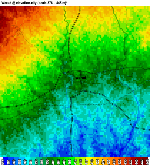
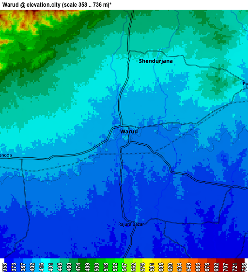
Below is the Elevation map of Warud, which displays elevation range with different colors. Scale of the first map is from 378 to 445 m (1240 to 1460 ft) with average elevation of 404.2 meters (=1326 ft) [note 1]
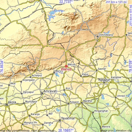
These maps also provides idea of topography and contour of this city, they are displayed at different zoom levels. More info about maps, scale and edge coordinates you can find below images.
| \ | Map #1 | Map #2 | Topo.Map |
| Scale [m] | 378..445 m | 358..736 m | × |
| Scale [ft] | 1240..1460 ft | 1175..2415 ft | × |
| Average | 404.2 m = 1326 ft | 415.8 m = 1364 ft | × |
| Width | 9.09 km = 5.6 mi | 18.19 km = 11.3 mi | 291 km = 180.8 mi |
| Height | 9.09 km = 5.6 mi | 18.19 km = 11.3 mi | 291 km = 180.8 mi |
| ↑Max Latitude | 21.5119° | 21.552778° | 22.7737° |
| Latitude at center | 21.47101° | 21.47101° | 21.47101° |
| ↓Min Latitude | 21.430109° | 21.389196° | 20.15657° |
| ← Min Longitude | 78.225705° | 78.181759° | 76.8634° |
| Longitude center | 78.26965° | 78.26965° | 78.26965° |
| →Max Longitude | 78.313595° | 78.357541° | 79.6759° |
Nearby cities:
Cities around Warud sort by population:
• Pāndhurnā elevation 470 m
29.9 km,  62°
62°
• Kātol 413 m
39.4 km,  123°
123°
• Ārvi 307 m
53 km,  184°
184°
• Morsi 351 m
30.3 km,  241°
241°
• Amla 745 m
52.5 km,  343°
343°
• Sausar 360 m
58.2 km,  69°
69°
• Multai 758 m
33.8 km,  357°
357°
• Chāndūr Bāzār 375 m
60 km, 244°
• Mohgaon 371 m
51.8 km, 68°
• Betūl Bazār 658 m
55.4 km,  320°
320°
• Mowād 407 m
18.8 km,  92°
92°
• Mohpa 361 m
60.7 km,  107°
107°
Multilingual:
 En español:
Warud elevación 402 m.
 En France:
Warud élévation 402 m.


Sources and notes:
- [note 1] Map square and city borders are not equal. Map elevation data is calculated only from area inside that square.
- [src 1] Elevation data from geonames database provided with same terms of usage.
- [src 2] The elevation map of Warud is generated using elevation data from NASA's 3 arcsec (90m) resolution SRTM data.
- [src 3] Base (background) map © OpenStreetMap contributors tiles are generated by Geofabrik and OpenTopoMap.
Copyright & License:
This Warud Elevation Map is licensed under CC BY-SA. You may reuse any part from this page, if you give a proper credit by linking to this URL:
 More info on terms of use page.