Nālāgarh elevation
Nālāgarh (Himachal Pradesh, Solan), India elevation is 400 meters and Nālāgarh elevation in feet is 1312 ft above sea level [src 1]. Nālāgarh is a populated place (feature code) with elevation that is 107 meters (351 ft) bigger than average city elevation in India.
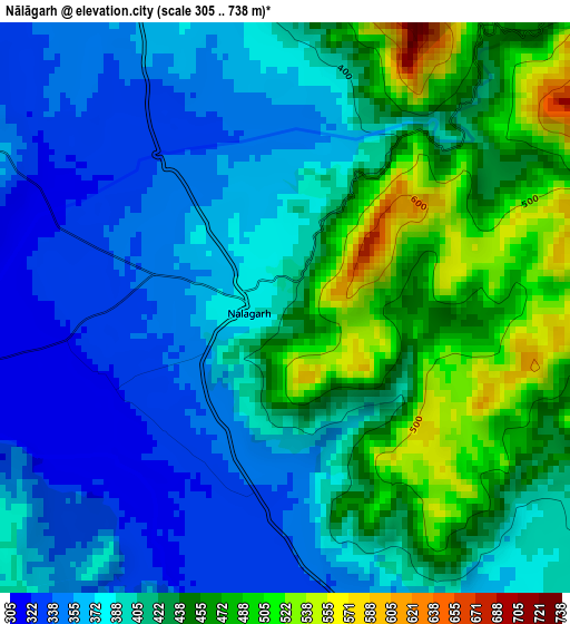
Below is the Elevation map of Nālāgarh, which displays elevation range with different colors. Scale of the first map is from 305 to 738 m (1001 to 2421 ft) with average elevation of 407.8 meters (=1338 ft) [note 1]
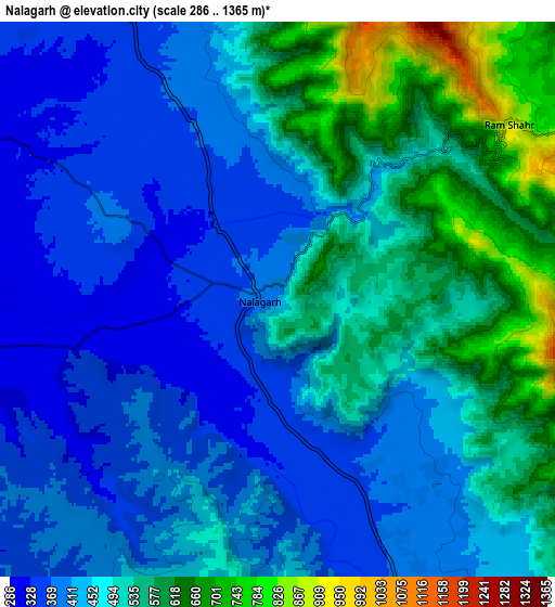
These maps also provides idea of topography and contour of this city, they are displayed at different zoom levels. More info about maps, scale and edge coordinates you can find below images.
| \ | Map #1 | Map #2 | Topo.Map |
| Scale [m] | 305..738 m | 286..1365 m | × |
| Scale [ft] | 1001..2421 ft | 938..4478 ft | × |
| Average | 407.8 m = 1338 ft | 470.6 m = 1544 ft | × |
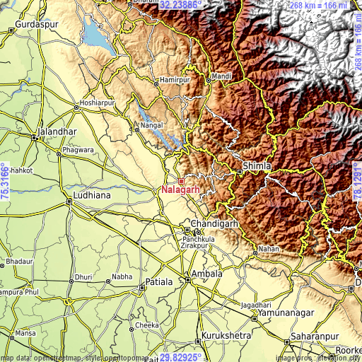
| Width | 8.37 km = 5.2 mi | 16.75 km = 10.4 mi | 267.9 km = 166.5 mi |
| Height | 8.37 km = 5.2 mi | 16.75 km = 10.4 mi | 267.9 km = 166.5 mi |
| ↑Max Latitude | 31.079325° | 31.116954° | 32.23886° |
| Latitude at center | 31.04168° | 31.04168° | 31.04168° |
| ↓Min Latitude | 31.004021° | 30.966346° | 29.82925° |
| ← Min Longitude | 76.678905° | 76.634959° | 75.3166° |
| Longitude center | 76.72285° | 76.72285° | 76.72285° |
| →Max Longitude | 76.766795° | 76.810741° | 78.1291° |
Nearby cities:
Cities around Nālāgarh sort by population:
• Ropar elevation 287 m
20.3 km,  246°
246°
• Kharar 313 m
33.6 km,  192°
192°
• Kālka 703 m
30.6 km,  137°
137°
• Pinjaur 558 m
32.8 km,  145°
145°
• Baddi 426 m
11.4 km, 144°
• Anandpur 309 m
30.4 km,  316°
316°
• Bilaspur 496 m
32.2 km,  5°
5°
• Nūrpur Kalān 299 m
26.7 km,  301°
301°
• Parwanoo 789 m
32.2 km,  134°
134°
• Sabāthu 1235 m
26.6 km,  106°
106°
• Kasauli 1858 m
28.1 km,  124°
124°
• Arki 1126 m
26.3 km,  62°
62°
Multilingual:
 En español:
Nālāgarh elevación 400 m.
 En France:
Nālāgarh élévation 400 m.
 Auf Deutsch:
Nālāgarh höhe über dem Meeresspiegel ist 400 m.

Sources and notes:
- [note 1] Map square and city borders are not equal. Map elevation data is calculated only from area inside that square.
- [src 1] Elevation data from geonames database provided with same terms of usage.
- [src 2] The elevation map of Nālāgarh is generated using elevation data from NASA's 3 arcsec (90m) resolution SRTM data.
- [src 3] Base (background) map © OpenStreetMap contributors tiles are generated by Geofabrik and OpenTopoMap.
Copyright & License:
This Nālāgarh Elevation Map is licensed under CC BY-SA. You may reuse any part from this page, if you give a proper credit by linking to this URL:
 More info on terms of use page.