Nambiyūr elevation
Nambiyūr (Tamil Nadu, Erode), India elevation is 282 meters and Nambiyūr elevation in feet is 925 ft above sea level [src 1]. Nambiyūr is a populated place (feature code) with elevation that is 11 meters (36 ft) smaller than average city elevation in India.
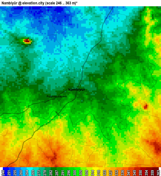
Below is the Elevation map of Nambiyūr, which displays elevation range with different colors. Scale of the first map is from 246 to 363 m (807 to 1191 ft) with average elevation of 292.1 meters (=958 ft) [note 1]
These maps also provides idea of topography and contour of this city, they are displayed at different zoom levels. More info about maps, scale and edge coordinates you can find below images.
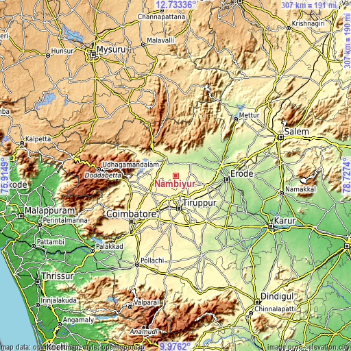
| \ | Map #1 | Map #2 | Topo.Map |
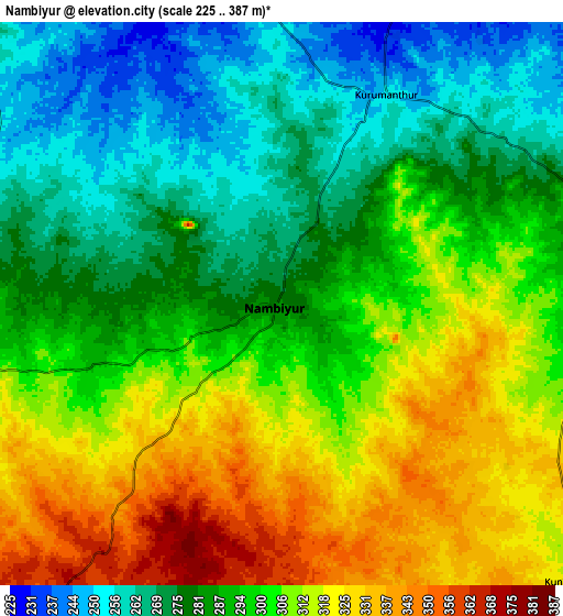
| Scale [m] | 246..363 m | 225..387 m | × |
| Scale [ft] | 807..1191 ft | 738..1270 ft | × |
| Average | 292.1 m = 958 ft | 295.4 m = 969 ft | × |
| Width | 9.58 km = 6 mi | 19.16 km = 11.9 mi | 306.6 km = 190.5 mi |
| Height | 9.58 km = 6 mi | 19.16 km = 11.9 mi | 306.6 km = 190.5 mi |
| ↑Max Latitude | 11.401191° | 11.444266° | 12.73336° |
| Latitude at center | 11.35811° | 11.35811° | 11.35811° |
| ↓Min Latitude | 11.315022° | 11.271928° | 9.9762° |
| ← Min Longitude | 77.277205° | 77.233259° | 75.9149° |
| Longitude center | 77.32115° | 77.32115° | 77.32115° |
| →Max Longitude | 77.365095° | 77.409041° | 78.7274° |
Nearby cities:
Cities around Nambiyūr sort by population:
• Tiruppur elevation 305 m
27.2 km,  172°
172°
• Gobichettipalayam 220 m
17 km,  50°
50°
• Sathyamangalam 239 m
18.7 km,  331°
331°
• Avinashi 330 m
19.2 km,  197°
197°
• Anthiyur 223 m
38 km, 50°
• Sirumugai 288 m
34.7 km,  263°
263°
• Annur 378 m
27.2 km,  240°
240°
• Perundurai 282 m
30.5 km,  107°
107°
• Chennimalai 263 m
37.6 km,  125°
125°
• Punjai Puliyampatti 308 m
16.9 km,  267°
267°
• Ūttukkuli 295 m
25.6 km,  145°
145°
• Vijayapuri 303 m
23.2 km,  122°
122°
Multilingual:
 En español:
Nambiyūr elevación 282 m.
 En France:
Nambiyūr élévation 282 m.
 Auf Deutsch:
Nambiyūr höhe über dem Meeresspiegel ist 282 m.

Sources and notes:
- [note 1] Map square and city borders are not equal. Map elevation data is calculated only from area inside that square.
- [src 1] Elevation data from geonames database provided with same terms of usage.
- [src 2] The elevation map of Nambiyūr is generated using elevation data from NASA's 3 arcsec (90m) resolution SRTM data.
- [src 3] Base (background) map © OpenStreetMap contributors tiles are generated by Geofabrik and OpenTopoMap.
Copyright & License:
This Nambiyūr Elevation Map is licensed under CC BY-SA. You may reuse any part from this page, if you give a proper credit by linking to this URL:
 More info on terms of use page.