Nayāgarh elevation
Nayāgarh (Odisha, Nayagarh District), India elevation is 138 meters and Nayāgarh elevation in feet is 453 ft above sea level [src 1]. Nayāgarh is a populated place (feature code) with elevation that is 155 meters (509 ft) smaller than average city elevation in India.
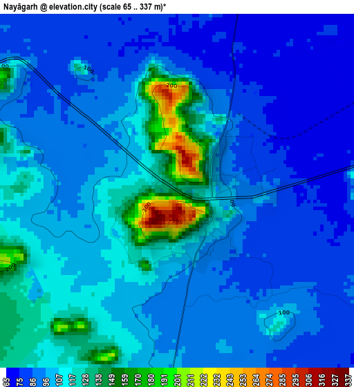
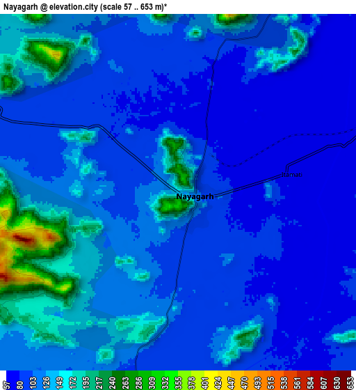
Below is the Elevation map of Nayāgarh, which displays elevation range with different colors. Scale of the first map is from 65 to 337 m (213 to 1106 ft) with average elevation of 101.6 meters (=333 ft) [note 1]
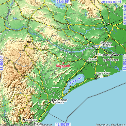
These maps also provides idea of topography and contour of this city, they are displayed at different zoom levels. More info about maps, scale and edge coordinates you can find below images.
| \ | Map #1 | Map #2 | Topo.Map |
| Scale [m] | 65..337 m | 57..653 m | × |
| Scale [ft] | 213..1106 ft | 187..2142 ft | × |
| Average | 101.6 m = 333 ft | 113.6 m = 373 ft | × |
| Width | 9.18 km = 5.7 mi | 18.35 km = 11.4 mi | 293.6 km = 182.4 mi |
| Height | 9.18 km = 5.7 mi | 18.35 km = 11.4 mi | 293.6 km = 182.4 mi |
| ↑Max Latitude | 20.170076° | 20.211321° | 21.4435° |
| Latitude at center | 20.12882° | 20.12882° | 20.12882° |
| ↓Min Latitude | 20.087553° | 20.046276° | 18.80299° |
| ← Min Longitude | 85.052315° | 85.008369° | 83.69001° |
| Longitude center | 85.09626° | 85.09626° | 85.09626° |
| →Max Longitude | 85.140205° | 85.184151° | 86.50251° |
Nearby cities:
Cities around Nayāgarh sort by population:
• Jatani elevation 38 m
63.9 km,  86°
86°
• Khurda 57 m
54.6 km,  83°
83°
• Bhanjanagar 86 m
58.2 km,  247°
247°
• Polasara 84 m
56.7 km,  211°
211°
• Bānapur 23 m
39.7 km,  168°
168°
• Bālugaon 81 m
5.8 km,  17°
17°
• Bānki 42 m
53.1 km,  58°
58°
• Buguda 90 m
47.9 km,  221°
221°
• Kodala 38 m
58.4 km,  196°
196°
• Khallikot 56 m
57.8 km,  181°
181°
• Belaguntha 78 m
55.2 km,  240°
240°
• Kantilo 55 m
27.7 km, 21°
Multilingual:
 En español:
Nayāgarh elevación 138 m.
 En France:
Nayāgarh élévation 138 m.
 Auf Deutsch:
Nayāgarh höhe über dem Meeresspiegel ist 138 m.

Sources and notes:
- [note 1] Map square and city borders are not equal. Map elevation data is calculated only from area inside that square.
- [src 1] Elevation data from geonames database provided with same terms of usage.
- [src 2] The elevation map of Nayāgarh is generated using elevation data from NASA's 3 arcsec (90m) resolution SRTM data.
- [src 3] Base (background) map © OpenStreetMap contributors tiles are generated by Geofabrik and OpenTopoMap.
Copyright & License:
This Nayāgarh Elevation Map is licensed under CC BY-SA. You may reuse any part from this page, if you give a proper credit by linking to this URL:
 More info on terms of use page.