Jatani elevation
Jatani (Odisha, Khordha), India elevation is 38 meters and Jatani elevation in feet is 125 ft above sea level [src 1]. Jatani is a populated place (feature code) with elevation that is 255 meters (837 ft) smaller than average city elevation in India.
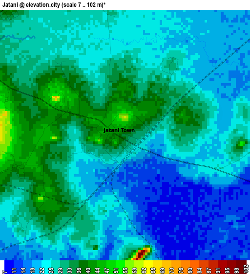
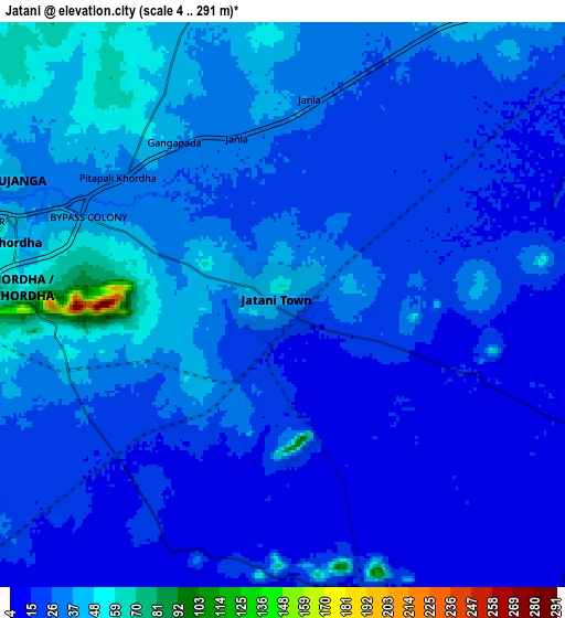
Below is the Elevation map of Jatani, which displays elevation range with different colors. Scale of the first map is from 7 to 102 m (23 to 335 ft) with average elevation of 26.1 meters (=86 ft) [note 1]
These maps also provides idea of topography and contour of this city, they are displayed at different zoom levels. More info about maps, scale and edge coordinates you can find below images.
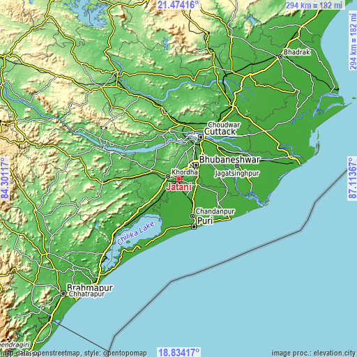
| \ | Map #1 | Map #2 | Topo.Map |
| Scale [m] | 7..102 m | 4..291 m | × |
| Scale [ft] | 23..335 ft | 13..955 ft | × |
| Average | 26.1 m = 86 ft | 27 m = 89 ft | × |
| Width | 9.17 km = 5.7 mi | 18.35 km = 11.4 mi | 293.5 km = 182.4 mi |
| Height | 9.17 km = 5.7 mi | 18.35 km = 11.4 mi | 293.6 km = 182.4 mi |
| ↑Max Latitude | 20.200998° | 20.242234° | 21.47416° |
| Latitude at center | 20.15975° | 20.15975° | 20.15975° |
| ↓Min Latitude | 20.118492° | 20.077222° | 18.83417° |
| ← Min Longitude | 85.663475° | 85.619529° | 84.30117° |
| Longitude center | 85.70742° | 85.70742° | 85.70742° |
| →Max Longitude | 85.751365° | 85.795311° | 87.11367° |
Nearby cities:
Cities around Jatani sort by population:
• Bhubaneshwar elevation 62 m
18.2 km,  46°
46°
• Cuttack 30 m
38.4 km,  27°
27°
• Puri 16 m
42 km,  163°
163°
• Dhenkānāl 77 m
56.5 km,  348°
348°
• Khurda 57 m
9.8 km,  285°
285°
• Jagatsinghapur 15 m
49.5 km,  77°
77°
• Nimāparha 13 m
33 km,  110°
110°
• Konārka 10 m
51.5 km,  124°
124°
• Āthagarh 52 m
40.9 km, 348°
• Bānki 42 m
30.6 km,  322°
322°
• Pipili 15 m
13.9 km, 111°
• Kantilo 55 m
58.2 km, 292°
Multilingual:
 En español:
Jatani elevación 38 m.
 En France:
Jatani élévation 38 m.


Sources and notes:
- [note 1] Map square and city borders are not equal. Map elevation data is calculated only from area inside that square.
- [src 1] Elevation data from geonames database provided with same terms of usage.
- [src 2] The elevation map of Jatani is generated using elevation data from NASA's 3 arcsec (90m) resolution SRTM data.
- [src 3] Base (background) map © OpenStreetMap contributors tiles are generated by Geofabrik and OpenTopoMap.
Copyright & License:
This Jatani Elevation Map is licensed under CC BY-SA. You may reuse any part from this page, if you give a proper credit by linking to this URL:
 More info on terms of use page.