Paliā Kalān elevation
Paliā Kalān (Uttar Pradesh, Kheri), India elevation is 162 meters and Paliā Kalān elevation in feet is 531 ft above sea level [src 1]. Paliā Kalān is a populated place (feature code) with elevation that is 131 meters (430 ft) smaller than average city elevation in India.
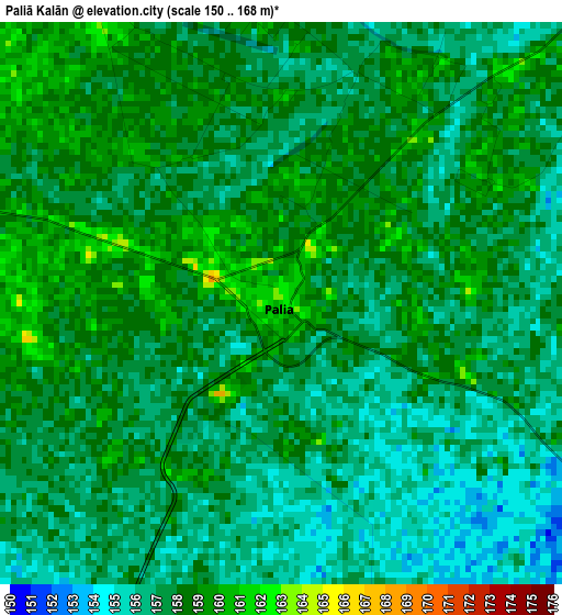
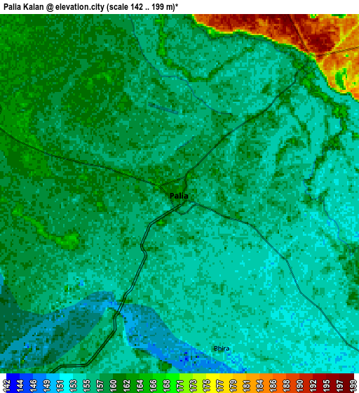
Below is the Elevation map of Paliā Kalān, which displays elevation range with different colors. Scale of the first map is from 150 to 168 m (492 to 551 ft) with average elevation of 157.3 meters (=516 ft) [note 1]
These maps also provides idea of topography and contour of this city, they are displayed at different zoom levels. More info about maps, scale and edge coordinates you can find below images.
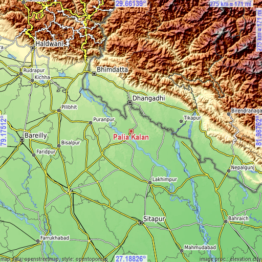
| \ | Map #1 | Map #2 | Topo.Map |
| Scale [m] | 150..168 m | 142..199 m | × |
| Scale [ft] | 492..551 ft | 466..653 ft | × |
| Average | 157.3 m = 516 ft | 158.4 m = 520 ft | × |
| Width | 8.59 km = 5.3 mi | 17.19 km = 10.7 mi | 275 km = 170.9 mi |
| Height | 8.59 km = 5.3 mi | 17.19 km = 10.7 mi | 275 km = 170.9 mi |
| ↑Max Latitude | 28.470688° | 28.509311° | 29.66139° |
| Latitude at center | 28.43205° | 28.43205° | 28.43205° |
| ↓Min Latitude | 28.393398° | 28.354732° | 27.18826° |
| ← Min Longitude | 80.537425° | 80.493479° | 79.17512° |
| Longitude center | 80.58137° | 80.58137° | 80.58137° |
| →Max Longitude | 80.625315° | 80.669261° | 81.98762° |
Nearby cities:
Cities around Paliā Kalān sort by population:
• Lakhīmpur elevation 152 m
57.2 km,  160°
160°
• Gola Gokarannāth 164 m
40.8 km,  195°
195°
• Pūranpur 186 m
43.3 km,  281°
281°
• Kheri 149 m
62.5 km, 160°
• Pawāyan 168 m
62 km,  229°
229°
• Dhaurahra 135 m
69.3 km,  134°
134°
• Khūtār 167 m
39.7 km, 230°
• Bilsanda 171 m
65.1 km,  251°
251°
• Mailāni 169 m
28 km,  235°
235°
• Amethi 133 m
65.1 km,  135°
135°
• Kālīnagar 191 m
53.1 km,  293°
293°
• Mohanpur 171 m
38.5 km, 238°
Multilingual:
 En español:
Paliā Kalān elevación 162 m.
 En France:
Paliā Kalān élévation 162 m.
 Auf Deutsch:
Paliā Kalān höhe über dem Meeresspiegel ist 162 m.

Sources and notes:
- [note 1] Map square and city borders are not equal. Map elevation data is calculated only from area inside that square.
- [src 1] Elevation data from geonames database provided with same terms of usage.
- [src 2] The elevation map of Paliā Kalān is generated using elevation data from NASA's 3 arcsec (90m) resolution SRTM data.
- [src 3] Base (background) map © OpenStreetMap contributors tiles are generated by Geofabrik and OpenTopoMap.
Copyright & License:
This Paliā Kalān Elevation Map is licensed under CC BY-SA. You may reuse any part from this page, if you give a proper credit by linking to this URL:
 More info on terms of use page.