Palani elevation
Palani (Tamil Nadu, Dindigul), India elevation is 328 meters and Palani elevation in feet is 1076 ft above sea level [src 1]. Palani is a populated place (feature code) with elevation that is 35 meters (115 ft) bigger than average city elevation in India.
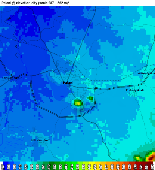
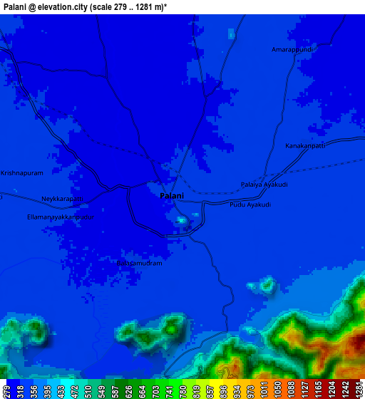
Below is the Elevation map of Palani, which displays elevation range with different colors. Scale of the first map is from 287 to 562 m (942 to 1844 ft) with average elevation of 319.1 meters (=1047 ft) [note 1]
These maps also provides idea of topography and contour of this city, they are displayed at different zoom levels. More info about maps, scale and edge coordinates you can find below images.
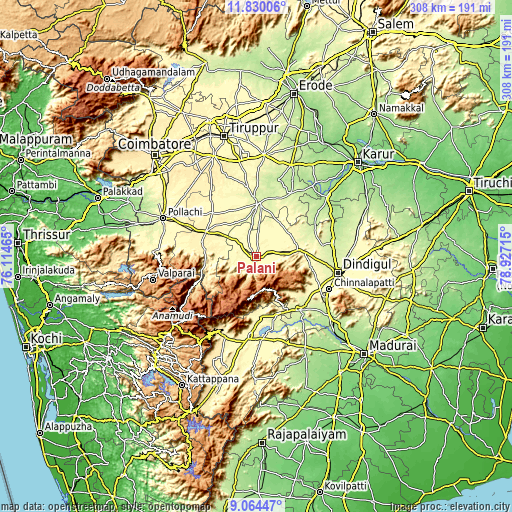
| \ | Map #1 | Map #2 | Topo.Map |
| Scale [m] | 287..562 m | 279..1281 m | × |
| Scale [ft] | 942..1844 ft | 915..4203 ft | × |
| Average | 319.1 m = 1047 ft | 356.9 m = 1171 ft | × |
| Width | 9.61 km = 6 mi | 19.22 km = 11.9 mi | 307.5 km = 191.1 mi |
| Height | 9.61 km = 6 mi | 19.22 km = 11.9 mi | 307.5 km = 191.1 mi |
| ↑Max Latitude | 10.493553° | 10.536761° | 11.83006° |
| Latitude at center | 10.45034° | 10.45034° | 10.45034° |
| ↓Min Latitude | 10.407121° | 10.363895° | 9.06447° |
| ← Min Longitude | 77.476955° | 77.433009° | 76.11465° |
| Longitude center | 77.5209° | 77.5209° | 77.5209° |
| →Max Longitude | 77.564845° | 77.608791° | 78.92715° |
Nearby cities:
Cities around Palani sort by population:
• Dharapuram elevation 250 m
32 km,  2°
2°
• Udumalaippettai 363 m
33.6 km,  297°
297°
• Periyakulam 281 m
36.5 km,  176°
176°
• Kodaikānāl 2098 m
23.7 km,  188°
188°
• Marayur 989 m
43.8 km,  243°
243°
• Ayakudi 336 m
3.4 km,  90°
90°
• Vattalkundu 237 m
41.4 km,  141°
141°
• Devadānappatti 294 m
36.3 km,  158°
158°
• Mūlanūr 223 m
43.5 km,  28°
28°
• Kumaralingam 323 m
19.2 km,  283°
283°
• Dhali 391 m
37 km, 280°
• Kīranūr 280 m
16.1 km,  353°
353°
Multilingual:
 En español:
Palani elevación 328 m.
 En France:
Palani élévation 328 m.


Sources and notes:
- [note 1] Map square and city borders are not equal. Map elevation data is calculated only from area inside that square.
- [src 1] Elevation data from geonames database provided with same terms of usage.
- [src 2] The elevation map of Palani is generated using elevation data from NASA's 3 arcsec (90m) resolution SRTM data.
- [src 3] Base (background) map © OpenStreetMap contributors tiles are generated by Geofabrik and OpenTopoMap.
Copyright & License:
This Palani Elevation Map is licensed under CC BY-SA. You may reuse any part from this page, if you give a proper credit by linking to this URL:
 More info on terms of use page.