Rājāpur elevation
Rājāpur (Maharashtra, Ratnagiri), India elevation is 74 meters and Rājāpur elevation in feet is 243 ft above sea level [src 1]. Rājāpur is a populated place (feature code) with elevation that is 219 meters (719 ft) smaller than average city elevation in India.
Below is the Elevation map of Rājāpur, which displays elevation range with different colors. Scale of the first map is from 3 to 279 m (10 to 915 ft) with average elevation of 138.2 meters (=453 ft) [note 1]
These maps also provides idea of topography and contour of this city, they are displayed at different zoom levels. More info about maps, scale and edge coordinates you can find below images.
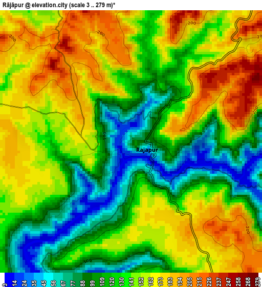
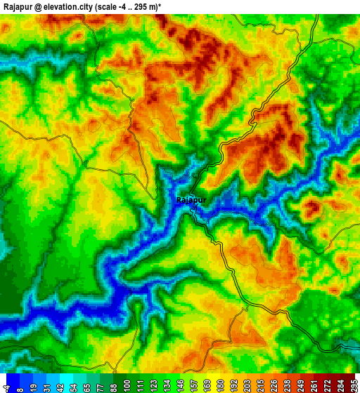
| \ | Map #1 | Map #2 | Topo.Map |
| Scale [m] | 3..279 m | -4..295 m | × |
| Scale [ft] | 10..915 ft | -13..968 ft | × |
| Average | 138.2 m = 453 ft | 142.5 m = 468 ft | × |
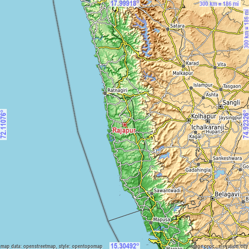
| Width | 9.36 km = 5.8 mi | 18.72 km = 11.6 mi | 299.6 km = 186.2 mi |
| Height | 9.36 km = 5.8 mi | 18.72 km = 11.6 mi | 299.6 km = 186.2 mi |
| ↑Max Latitude | 16.698887° | 16.740974° | 17.99918° |
| Latitude at center | 16.65679° | 16.65679° | 16.65679° |
| ↓Min Latitude | 16.614684° | 16.572569° | 15.30492° |
| ← Min Longitude | 73.473065° | 73.429119° | 72.11076° |
| Longitude center | 73.51701° | 73.51701° | 73.51701° |
| →Max Longitude | 73.560955° | 73.604901° | 74.92326° |
Nearby cities:
Cities around Rājāpur sort by population:
• Kolhāpur elevation 559 m
76.2 km,  86°
86°
• Ratnagiri 66 m
43.2 km,  329°
329°
• Kāgal 565 m
85.5 km,  95°
95°
• Mālvan 14 m
66.6 km,  184°
184°
• Kodoli 566 m
75.8 km,  71°
71°
• Kankauli 54 m
48.2 km,  154°
154°
• Kudāl 28 m
74.1 km,  165°
165°
• Malkāpur 576 m
53.2 km,  56°
56°
• Lānja 139 m
23 km,  8°
8°
• Mākhjan 23 m
68.2 km,  358°
358°
• Murgūd 569 m
77.5 km,  111°
111°
• Panhāla 947 m
65.5 km, 74°
Multilingual:
 En español:
Rājāpur elevación 74 m.
 En France:
Rājāpur élévation 74 m.


Sources and notes:
- [note 1] Map square and city borders are not equal. Map elevation data is calculated only from area inside that square.
- [src 1] Elevation data from geonames database provided with same terms of usage.
- [src 2] The elevation map of Rājāpur is generated using elevation data from NASA's 3 arcsec (90m) resolution SRTM data.
- [src 3] Base (background) map © OpenStreetMap contributors tiles are generated by Geofabrik and OpenTopoMap.
Copyright & License:
This Rājāpur Elevation Map is licensed under CC BY-SA. You may reuse any part from this page, if you give a proper credit by linking to this URL:
 More info on terms of use page.