Sagauli elevation
Sagauli (Bihar, Pūrba Champāran), India elevation is 75 meters and Sagauli elevation in feet is 246 ft above sea level [src 1]. Sagauli is a populated place (feature code) with elevation that is 218 meters (715 ft) smaller than average city elevation in India.
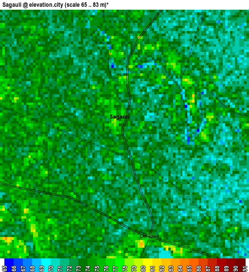
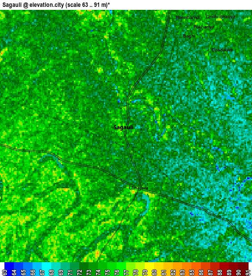
Below is the Elevation map of Sagauli, which displays elevation range with different colors. Scale of the first map is from 65 to 83 m (213 to 272 ft) with average elevation of 72.7 meters (=239 ft) [note 1]
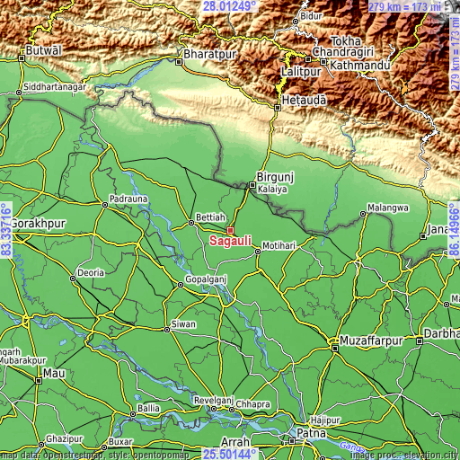
These maps also provides idea of topography and contour of this city, they are displayed at different zoom levels. More info about maps, scale and edge coordinates you can find below images.
| \ | Map #1 | Map #2 | Topo.Map |
| Scale [m] | 65..83 m | 63..91 m | × |
| Scale [ft] | 213..272 ft | 207..299 ft | × |
| Average | 72.7 m = 239 ft | 72.8 m = 239 ft | × |
| Width | 8.73 km = 5.4 mi | 17.45 km = 10.8 mi | 279.2 km = 173.5 mi |
| Height | 8.73 km = 5.4 mi | 17.45 km = 10.8 mi | 279.2 km = 173.5 mi |
| ↑Max Latitude | 26.803131° | 26.842348° | 28.01249° |
| Latitude at center | 26.7639° | 26.7639° | 26.7639° |
| ↓Min Latitude | 26.724656° | 26.685398° | 25.50144° |
| ← Min Longitude | 84.699465° | 84.655519° | 83.33716° |
| Longitude center | 84.74341° | 84.74341° | 84.74341° |
| →Max Longitude | 84.787355° | 84.831301° | 86.14966° |
Nearby cities:
Cities around Sagauli sort by population:
• Bettiah elevation 84 m
24.2 km,  280°
280°
• Siwān 71 m
71.6 km,  212°
212°
• Mothīhāri 74 m
21.4 km,  126°
126°
• Gopālganj 74 m
44.7 km,  222°
222°
• Raxaul 86 m
26.3 km,  23°
23°
• Rāmnagar 100 m
60.9 km,  316°
316°
• Bairāgnia 81 m
52.7 km,  92°
92°
• Barauli 73 m
45.3 km,  200°
200°
• Dhāka 72 m
43.2 km,  103°
103°
• Sheohar 71 m
61.3 km,  116°
116°
• Belsand 67 m
74.4 km, 118°
• Chākia 67 m
49 km,  142°
142°
Multilingual:
 En español:
Sagauli elevación 75 m.
 En France:
Sagauli élévation 75 m.


Sources and notes:
- [note 1] Map square and city borders are not equal. Map elevation data is calculated only from area inside that square.
- [src 1] Elevation data from geonames database provided with same terms of usage.
- [src 2] The elevation map of Sagauli is generated using elevation data from NASA's 3 arcsec (90m) resolution SRTM data.
- [src 3] Base (background) map © OpenStreetMap contributors tiles are generated by Geofabrik and OpenTopoMap.
Copyright & License:
This Sagauli Elevation Map is licensed under CC BY-SA. You may reuse any part from this page, if you give a proper credit by linking to this URL:
 More info on terms of use page.