Seoni elevation
Seoni (Madhya Pradesh, Seonī), India elevation is 628 meters and Seoni elevation in feet is 2060 ft above sea level [src 1]. Seoni is a populated place (feature code) with elevation that is 335 meters (1099 ft) bigger than average city elevation in India.
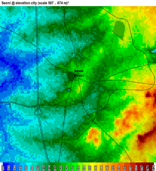
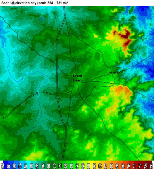
Below is the Elevation map of Seoni, which displays elevation range with different colors. Scale of the first map is from 587 to 674 m (1926 to 2211 ft) with average elevation of 617.6 meters (=2026 ft) [note 1]
These maps also provides idea of topography and contour of this city, they are displayed at different zoom levels. More info about maps, scale and edge coordinates you can find below images.
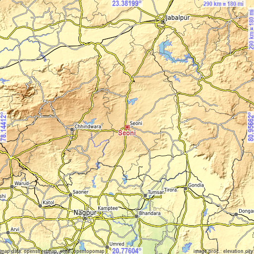
| \ | Map #1 | Map #2 | Topo.Map |
| Scale [m] | 587..674 m | 554..731 m | × |
| Scale [ft] | 1926..2211 ft | 1818..2398 ft | × |
| Average | 617.6 m = 2026 ft | 613.5 m = 2013 ft | × |
| Width | 9.06 km = 5.6 mi | 18.11 km = 11.3 mi | 289.8 km = 180.1 mi |
| Height | 9.06 km = 5.6 mi | 18.11 km = 11.3 mi | 289.8 km = 180.1 mi |
| ↑Max Latitude | 22.125745° | 22.166448° | 23.38199° |
| Latitude at center | 22.08503° | 22.08503° | 22.08503° |
| ↓Min Latitude | 22.044303° | 22.003565° | 20.77604° |
| ← Min Longitude | 79.506425° | 79.462479° | 78.14412° |
| Longitude center | 79.55037° | 79.55037° | 79.55037° |
| →Max Longitude | 79.594315° | 79.638261° | 80.95662° |
Nearby cities:
Cities around Seoni sort by population:
• Chhindwāra elevation 688 m
63 km,  267°
267°
• Bālāghāt 319 m
72.3 km,  114°
114°
• Wārāseonī 307 m
62.2 km,  125°
125°
• Nainpur 448 m
68.8 km,  56°
56°
• Chicholi 291 m
70.2 km,  167°
167°
• Lakhnādon 617 m
57.5 km,  5°
5°
• Katangi 351 m
43.5 km,  142°
142°
• Amarwāra 807 m
45.8 km,  301°
301°
• Barghāt 538 m
19.7 km, 107°
• Harrai 598 m
67.8 km,  330°
330°
• Tirodi 332 m
47.7 km,  158°
158°
• Hīrāpur Hamesha 299 m
63.7 km, 157°
Multilingual:
 En español:
Seoni elevación 628 m.
 En France:
Seoni élévation 628 m.


Sources and notes:
- [note 1] Map square and city borders are not equal. Map elevation data is calculated only from area inside that square.
- [src 1] Elevation data from geonames database provided with same terms of usage.
- [src 2] The elevation map of Seoni is generated using elevation data from NASA's 3 arcsec (90m) resolution SRTM data.
- [src 3] Base (background) map © OpenStreetMap contributors tiles are generated by Geofabrik and OpenTopoMap.
Copyright & License:
This Seoni Elevation Map is licensed under CC BY-SA. You may reuse any part from this page, if you give a proper credit by linking to this URL:
 More info on terms of use page.