Nazareth elevation
Nazareth (Northern District), Israel elevation is 504 meters and Nazareth elevation in feet is 1654 ft above sea level [src 1]. Nazareth is a seat of a first-order administrative division (feature code) with elevation that is 293 meters (961 ft) bigger than average city elevation in Israel.
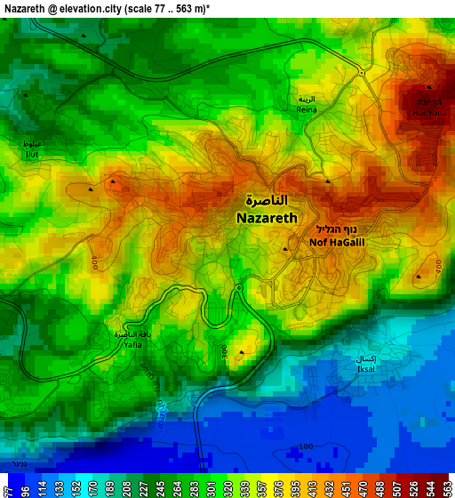
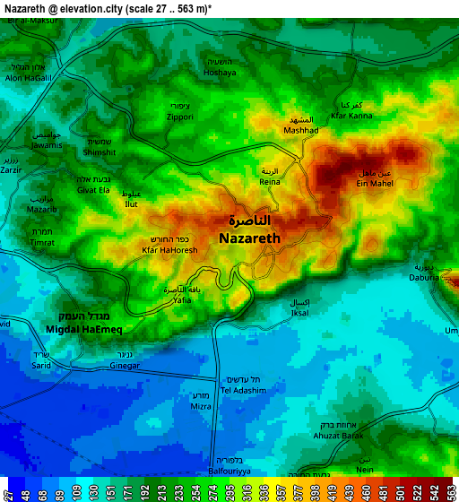
Below is the Elevation map of Nazareth, which displays elevation range with different colors. Scale of the first map is from 77 to 563 m (253 to 1847 ft) with average elevation of 294 meters (=965 ft) [note 1]
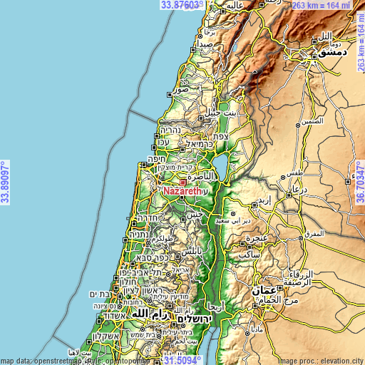
These maps also provides idea of topography and contour of this city, they are displayed at different zoom levels. More info about maps, scale and edge coordinates you can find below images.
| \ | Map #1 | Map #2 | Topo.Map |
| Scale [m] | 77..563 m | 27..563 m | × |
| Scale [ft] | 253..1847 ft | 89..1847 ft | × |
| Average | 294 m = 965 ft | 209.2 m = 686 ft | × |
| Width | 8.22 km = 5.1 mi | 16.45 km = 10.2 mi | 263.1 km = 163.5 mi |
| Height | 8.22 km = 5.1 mi | 16.45 km = 10.2 mi | 263.1 km = 163.5 mi |
| ↑Max Latitude | 32.737533° | 32.77449° | 33.87603° |
| Latitude at center | 32.70056° | 32.70056° | 32.70056° |
| ↓Min Latitude | 32.663572° | 32.626569° | 31.5094° |
| ← Min Longitude | 35.253275° | 35.209329° | 33.89097° |
| Longitude center | 35.29722° | 35.29722° | 35.29722° |
| →Max Longitude | 35.341165° | 35.385111° | 36.70347° |
Nearby cities:
Cities around Nazareth sort by population:
• Afula elevation 62 m
10.2 km,  184°
184°
• Migdal Ha‘Emeq 227 m
6 km,  243°
243°
• Kafr Kannā 278 m
6.6 km,  39°
39°
• Er Reina 343 m
3.1 km, 35°
• Iksāl 160 m
3.2 km,  130°
130°
• Dabbūrīya 180 m
7 km,  97°
97°
• Shibli 234 m
8.9 km,  94°
94°
• ‘Uzeir 166 m
10.6 km,  16°
16°
• Sūlam 120 m
11.1 km,  161°
161°
• Timrat 233 m
6.9 km,  272°
272°
• Nein 234 m
9.2 km,  148°
148°
• Rumat Heib 221 m
8.6 km,  5°
5°
Multilingual:
 En español:
Nazaret elevación 504 m.
 En France:
Nazareth élévation 504 m.


Sources and notes:
- [note 1] Map square and city borders are not equal. Map elevation data is calculated only from area inside that square.
- [src 1] Elevation data from geonames database provided with same terms of usage.
- [src 2] The elevation map of Nazareth is generated using elevation data from NASA's 3 arcsec (90m) resolution SRTM data.
- [src 3] Base (background) map © OpenStreetMap contributors tiles are generated by Geofabrik and OpenTopoMap.
Copyright & License:
This Nazareth Elevation Map is licensed under CC BY-SA. You may reuse any part from this page, if you give a proper credit by linking to this URL:
 More info on terms of use page.