Nesher elevation
Nesher (Haifa), Israel elevation is 125 meters and Nesher elevation in feet is 410 ft above sea level [src 1]. Nesher is a populated place (feature code) with elevation that is 86 meters (282 ft) smaller than average city elevation in Israel.
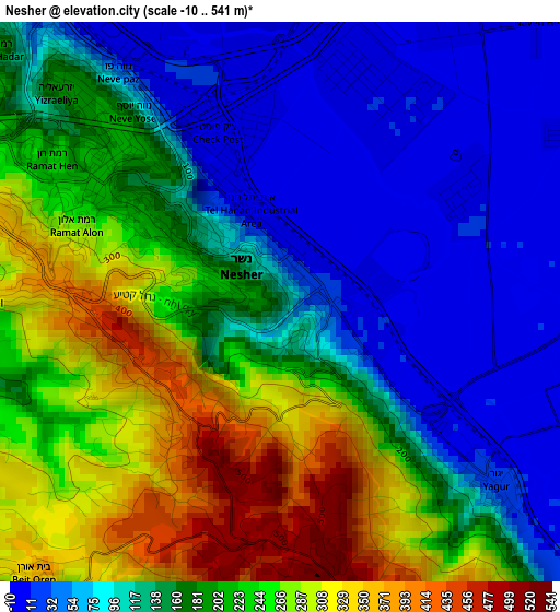
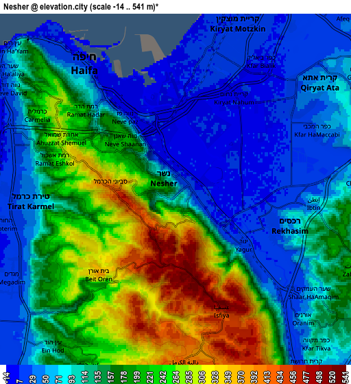
Below is the Elevation map of Nesher, which displays elevation range with different colors. Scale of the first map is from -10 to 541 m (-33 to 1775 ft) with average elevation of 170.1 meters (=558 ft) [note 1]
These maps also provides idea of topography and contour of this city, they are displayed at different zoom levels. More info about maps, scale and edge coordinates you can find below images.
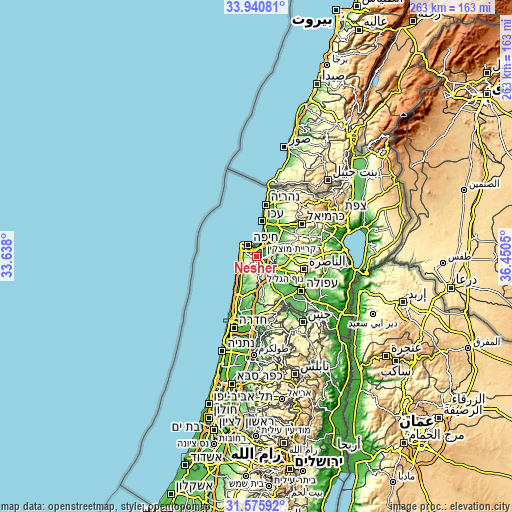
| \ | Map #1 | Map #2 | Topo.Map |
| Scale [m] | -10..541 m | -14..541 m | × |
| Scale [ft] | -33..1775 ft | -46..1775 ft | × |
| Average | 170.1 m = 558 ft | 142.9 m = 469 ft | × |
| Width | 8.22 km = 5.1 mi | 16.44 km = 10.2 mi | 263 km = 163.4 mi |
| Height | 8.22 km = 5.1 mi | 16.44 km = 10.2 mi | 263 km = 163.4 mi |
| ↑Max Latitude | 32.803165° | 32.840095° | 33.94081° |
| Latitude at center | 32.76622° | 32.76622° | 32.76622° |
| ↓Min Latitude | 32.729259° | 32.692283° | 31.57592° |
| ← Min Longitude | 35.000305° | 34.956359° | 33.638° |
| Longitude center | 35.04425° | 35.04425° | 35.04425° |
| →Max Longitude | 35.088195° | 35.132141° | 36.4505° |
Nearby cities:
Cities around Nesher sort by population:
• Haifa elevation 40 m
7.8 km,  318°
318°
• Qiryat Ata 46 m
8.2 km,  52°
52°
• Qiryat Moẕqin 10 m
8.5 km,  21°
21°
• Qiryat Yam 9 m
9.6 km,  14°
14°
• Qiryat Bialik 12 m
7.8 km,  29°
29°
• Daliyat al Karmel 414 m
8.1 km,  178°
178°
• Tirat Karmel 47 m
6.8 km,  264°
264°
• Rekhasim 43 m
5.5 km,  110°
110°
• Basmat Ṭab‘ūn 194 m
11 km, 106°
• Ramat Yishay 98 m
13.7 km,  120°
120°
• Atlit 22 m
12.8 km,  227°
227°
• Ibṭīn 93 m
6.5 km,  94°
94°
Multilingual:
 En español:
Nesher elevación 125 m.
 En France:
Nesher élévation 125 m.


Sources and notes:
- [note 1] Map square and city borders are not equal. Map elevation data is calculated only from area inside that square.
- [src 1] Elevation data from geonames database provided with same terms of usage.
- [src 2] The elevation map of Nesher is generated using elevation data from NASA's 3 arcsec (90m) resolution SRTM data.
- [src 3] Base (background) map © OpenStreetMap contributors tiles are generated by Geofabrik and OpenTopoMap.
Copyright & License:
This Nesher Elevation Map is licensed under CC BY-SA. You may reuse any part from this page, if you give a proper credit by linking to this URL:
 More info on terms of use page.