Qiryat Ata elevation
Qiryat Ata (Haifa), Israel elevation is 46 meters and Qiryat Ata elevation in feet is 151 ft above sea level [src 1]. Qiryat Ata is a populated place (feature code) with elevation that is 165 meters (541 ft) smaller than average city elevation in Israel.
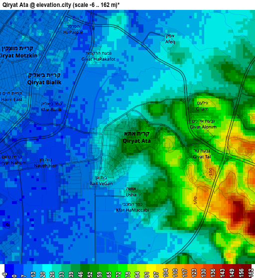
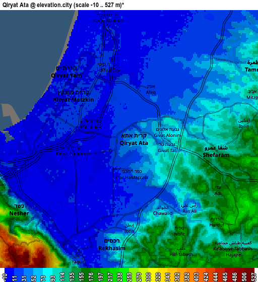
Below is the Elevation map of Qiryat Ata, which displays elevation range with different colors. Scale of the first map is from -6 to 162 m (-20 to 531 ft) with average elevation of 30.3 meters (=99 ft) [note 1]
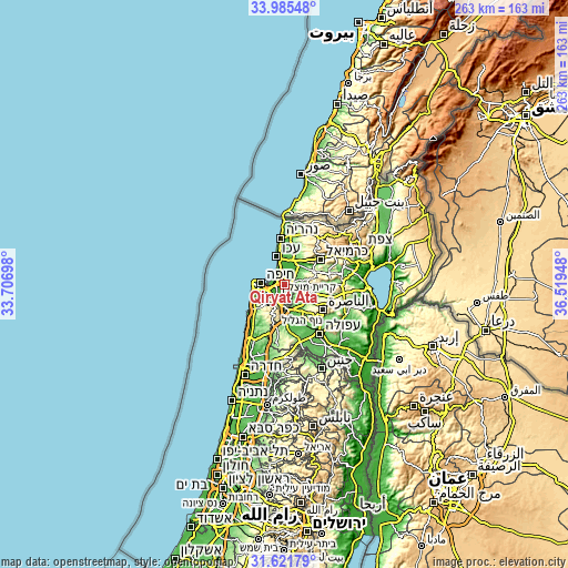
These maps also provides idea of topography and contour of this city, they are displayed at different zoom levels. More info about maps, scale and edge coordinates you can find below images.
| \ | Map #1 | Map #2 | Topo.Map |
| Scale [m] | -6..162 m | -10..527 m | × |
| Scale [ft] | -20..531 ft | -33..1729 ft | × |
| Average | 30.3 m = 99 ft | 67.8 m = 222 ft | × |
| Width | 8.21 km = 5.1 mi | 16.43 km = 10.2 mi | 262.8 km = 163.3 mi |
| Height | 8.21 km = 5.1 mi | 16.43 km = 10.2 mi | 262.8 km = 163.3 mi |
| ↑Max Latitude | 32.848417° | 32.885328° | 33.98548° |
| Latitude at center | 32.81149° | 32.81149° | 32.81149° |
| ↓Min Latitude | 32.774548° | 32.737591° | 31.62179° |
| ← Min Longitude | 35.069285° | 35.025339° | 33.70698° |
| Longitude center | 35.11323° | 35.11323° | 35.11323° |
| →Max Longitude | 35.157175° | 35.201121° | 36.51948° |
Nearby cities:
Cities around Qiryat Ata sort by population:
• Haifa elevation 40 m
11.7 km,  273°
273°
• Qiryat Moẕqin 10 m
4.4 km,  310°
310°
• Qiryat Yam 9 m
5.9 km,  316°
316°
• Qiryat Bialik 12 m
3.1 km,  304°
304°
• Tamra 92 m
9.2 km,  59°
59°
• Nesher 125 m
8.2 km,  232°
232°
• Rekhasim 43 m
7.1 km,  190°
190°
• Kābūl 92 m
11.2 km, 55°
• Bīr el Maksūr 255 m
10.7 km,  110°
110°
• Basmat Ṭab‘ūn 194 m
9 km,  153°
153°
• Kaukab Abū el Hījā 408 m
12.8 km,  79°
79°
• Ibṭīn 93 m
5.6 km,  179°
179°
Multilingual:
 En español:
Qiryat Ata elevación 46 m.
 En France:
Qiryat Ata élévation 46 m.
 Auf Deutsch:
Qiryat Ata höhe über dem Meeresspiegel ist 46 m.

Sources and notes:
- [note 1] Map square and city borders are not equal. Map elevation data is calculated only from area inside that square.
- [src 1] Elevation data from geonames database provided with same terms of usage.
- [src 2] The elevation map of Qiryat Ata is generated using elevation data from NASA's 3 arcsec (90m) resolution SRTM data.
- [src 3] Base (background) map © OpenStreetMap contributors tiles are generated by Geofabrik and OpenTopoMap.
Copyright & License:
This Qiryat Ata Elevation Map is licensed under CC BY-SA. You may reuse any part from this page, if you give a proper credit by linking to this URL:
 More info on terms of use page.