Oldbawn elevation
Oldbawn (Leinster, South Dublin), Ireland elevation is 104 meters and Oldbawn elevation in feet is 341 ft above sea level [src 1]. Oldbawn is a populated place (feature code) with elevation that is 53 meters (174 ft) bigger than average city elevation in Ireland.
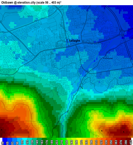
Below is the Elevation map of Oldbawn, which displays elevation range with different colors. Scale of the first map is from 56 to 403 m (184 to 1322 ft) with average elevation of 146.8 meters (=482 ft) [note 1]
These maps also provides idea of topography and contour of this city, they are displayed at different zoom levels. More info about maps, scale and edge coordinates you can find below images.
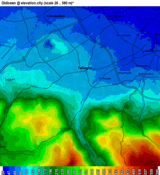
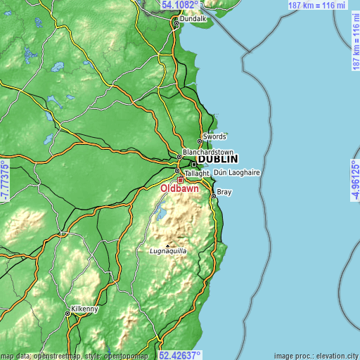
| \ | Map #1 | Map #2 | Topo.Map |
| Scale [m] | 56..403 m | 26..580 m | × |
| Scale [ft] | 184..1322 ft | 85..1903 ft | × |
| Average | 146.8 m = 482 ft | 172.2 m = 565 ft | × |
| Width | 5.84 km = 3.6 mi | 11.69 km = 7.3 mi | 187 km = 116.2 mi |
| Height | 5.84 km = 3.6 mi | 11.69 km = 7.3 mi | 187 km = 116.2 mi |
| ↑Max Latitude | 53.30183° | 53.328083° | 54.1082° |
| Latitude at center | 53.27556° | 53.27556° | 53.27556° |
| ↓Min Latitude | 53.249274° | 53.222972° | 52.42637° |
| ← Min Longitude | -6.411445° | -6.455391° | -7.77375° |
| Longitude center | -6.3675° | -6.3675° | -6.3675° |
| →Max Longitude | -6.323555° | -6.279609° | -4.96125° |
Nearby cities:
Cities around Oldbawn sort by population:
• Tallaght elevation 103 m
1.2 km,  341°
341°
• Knocklyon 87 m
2.5 km,  77°
77°
• Clondalkin 60 m
5.8 km, 340°
• Crumlin 49 m
6.2 km,  34°
34°
• Jobstown 116 m
2.7 km,  277°
277°
• Ballyboden 89 m
3.4 km, 80°
• Cherry Orchard 54 m
6.8 km,  354°
354°
• Terenure 44 m
6.7 km,  55°
55°
• Templeogue 57 m
4.5 km, 60°
• Firhouse 84 m
2 km,  70°
70°
• Rathcoole 114 m
7 km, 276°
• Saggart 129 m
5.1 km, 275°
Multilingual:
 En español:
Oldbawn elevación 104 m.
 En France:
Oldbawn élévation 104 m.


Sources and notes:
- [note 1] Map square and city borders are not equal. Map elevation data is calculated only from area inside that square.
- [src 1] Elevation data from geonames database provided with same terms of usage.
- [src 2] The elevation map of Oldbawn is generated using elevation data from NASA's 3 arcsec (90m) resolution SRTM data.
- [src 3] Base (background) map © OpenStreetMap contributors tiles are generated by Geofabrik and OpenTopoMap.
Copyright & License:
This Oldbawn Elevation Map is licensed under CC BY-SA. You may reuse any part from this page, if you give a proper credit by linking to this URL:
 More info on terms of use page.