Ballyboden elevation
Ballyboden (Leinster, South Dublin), Ireland elevation is 89 meters and Ballyboden elevation in feet is 292 ft above sea level [src 1]. Ballyboden is a populated place (feature code) with elevation that is 38 meters (125 ft) bigger than average city elevation in Ireland.
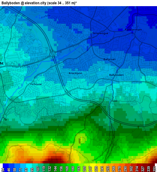
Below is the Elevation map of Ballyboden, which displays elevation range with different colors. Scale of the first map is from 34 to 351 m (112 to 1152 ft) with average elevation of 106 meters (=348 ft) [note 1]
These maps also provides idea of topography and contour of this city, they are displayed at different zoom levels. More info about maps, scale and edge coordinates you can find below images.
| \ | Map #1 | Map #2 | Topo.Map |
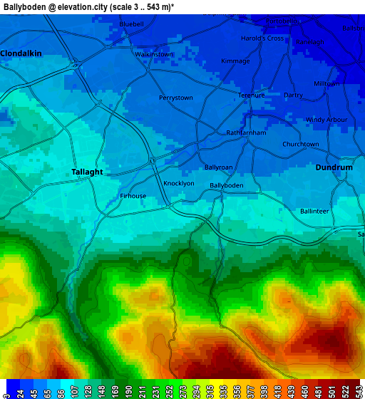
| Scale [m] | 34..351 m | 3..543 m | × |
| Scale [ft] | 112..1152 ft | 10..1781 ft | × |
| Average | 106 m = 348 ft | 152.7 m = 501 ft | × |
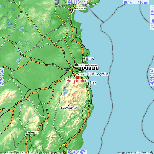
| Width | 5.84 km = 3.6 mi | 11.69 km = 7.3 mi | 187 km = 116.2 mi |
| Height | 5.84 km = 3.6 mi | 11.69 km = 7.3 mi | 187 km = 116.2 mi |
| ↑Max Latitude | 53.306827° | 53.333077° | 54.11311° |
| Latitude at center | 53.28056° | 53.28056° | 53.28056° |
| ↓Min Latitude | 53.254277° | 53.227978° | 52.43147° |
| ← Min Longitude | -6.360335° | -6.404281° | -7.72264° |
| Longitude center | -6.31639° | -6.31639° | -6.31639° |
| →Max Longitude | -6.272445° | -6.228499° | -4.91014° |
Nearby cities:
Cities around Ballyboden sort by population:
• Tallaght elevation 103 m
3.8 km,  278°
278°
• Knocklyon 87 m
1 km,  268°
268°
• Dundrum 60 m
4.1 km,  74°
74°
• Crumlin 49 m
4.6 km,  1°
1°
• Rathmines 27 m
5.7 km,  38°
38°
• Oldbawn 104 m
3.4 km,  260°
260°
• Balally 96 m
5.4 km,  96°
96°
• Ballinteer 98 m
4.2 km, 99°
• Rathgar 39 m
4.7 km, 36°
• Terenure 44 m
3.8 km,  32°
32°
• Templeogue 57 m
1.7 km,  16°
16°
• Firhouse 84 m
1.5 km, 274°
Multilingual:
 En español:
Ballyboden elevación 89 m.
 En France:
Ballyboden élévation 89 m.
 Auf Deutsch:
Ballyboden höhe über dem Meeresspiegel ist 89 m.

Sources and notes:
- [note 1] Map square and city borders are not equal. Map elevation data is calculated only from area inside that square.
- [src 1] Elevation data from geonames database provided with same terms of usage.
- [src 2] The elevation map of Ballyboden is generated using elevation data from NASA's 3 arcsec (90m) resolution SRTM data.
- [src 3] Base (background) map © OpenStreetMap contributors tiles are generated by Geofabrik and OpenTopoMap.
Copyright & License:
This Ballyboden Elevation Map is licensed under CC BY-SA. You may reuse any part from this page, if you give a proper credit by linking to this URL:
 More info on terms of use page.