Cepu elevation
Cepu (Central Java), Indonesia elevation is 36 meters and Cepu elevation in feet is 118 ft above sea level [src 1]. Cepu is a seat of a third-order administrative division (feature code) with elevation that is 155 meters (509 ft) smaller than average city elevation in Indonesia.
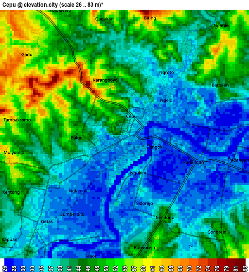
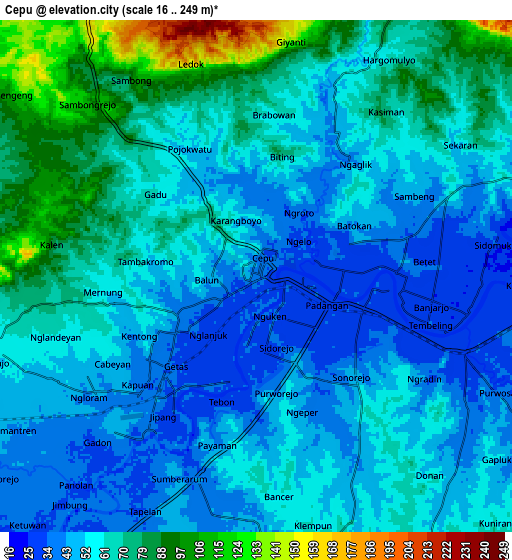
Below is the Elevation map of Cepu, which displays elevation range with different colors. Scale of the first map is from 26 to 83 m (85 to 272 ft) with average elevation of 42 meters (=138 ft) [note 1]
These maps also provides idea of topography and contour of this city, they are displayed at different zoom levels. More info about maps, scale and edge coordinates you can find below images.
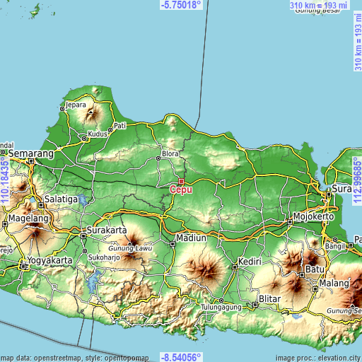
| \ | Map #1 | Map #2 | Topo.Map |
| Scale [m] | 26..83 m | 16..249 m | × |
| Scale [ft] | 85..272 ft | 52..817 ft | × |
| Average | 42 m = 138 ft | 59.3 m = 195 ft | × |
| Width | 9.7 km = 6 mi | 19.39 km = 12 mi | 310.3 km = 192.8 mi |
| Height | 9.7 km = 6 mi | 19.39 km = 12 mi | 310.3 km = 192.8 mi |
| ↑Max Latitude | -7.103894° | -7.060284° | -5.75018° |
| Latitude at center | -7.1475° | -7.1475° | -7.1475° |
| ↓Min Latitude | -7.191102° | -7.234699° | -8.54056° |
| ← Min Longitude | 111.546655° | 111.502709° | 110.18435° |
| Longitude center | 111.5906° | 111.5906° | 111.5906° |
| →Max Longitude | 111.634545° | 111.678491° | 112.99685° |
Nearby cities:
Cities around Cepu sort by population:
• Blora elevation 89 m
27.4 km,  316°
316°
• Jojogan 59 m
29.3 km,  47°
47°
• Jetis 79 m
26.5 km,  8°
8°
• Bangkle 91 m
26.4 km, 318°
• Bogorejo 129 m
24.4 km,  340°
340°
• Bangilan 54 m
24 km,  34°
34°
• Jepon 108 m
23 km,  327°
327°
• Senori 55 m
20.8 km, 45°
• Menden 49 m
18.6 km,  233°
233°
• Watulumbung 122 m
18 km, 331°
• Ngraho 55 m
10.6 km,  255°
255°
• Pengkok 33 m
3 km,  135°
135°
Multilingual:
 En español:
Cepu elevación 36 m.
 En France:
Cepu élévation 36 m.


Sources and notes:
- [note 1] Map square and city borders are not equal. Map elevation data is calculated only from area inside that square.
- [src 1] Elevation data from geonames database provided with same terms of usage.
- [src 2] The elevation map of Cepu is generated using elevation data from NASA's 3 arcsec (90m) resolution SRTM data.
- [src 3] Base (background) map © OpenStreetMap contributors tiles are generated by Geofabrik and OpenTopoMap.
Copyright & License:
This Cepu Elevation Map is licensed under CC BY-SA. You may reuse any part from this page, if you give a proper credit by linking to this URL:
 More info on terms of use page.