Kutoarjo elevation
Kutoarjo (Central Java), Indonesia elevation is 20 meters and Kutoarjo elevation in feet is 66 ft above sea level [src 1]. Kutoarjo is a populated place (feature code) with elevation that is 171 meters (561 ft) smaller than average city elevation in Indonesia.
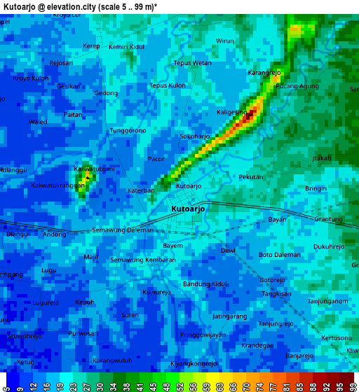
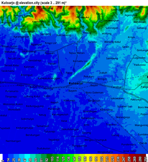
Below is the Elevation map of Kutoarjo, which displays elevation range with different colors. Scale of the first map is from 5 to 99 m (16 to 325 ft) with average elevation of 19.7 meters (=65 ft) [note 1]
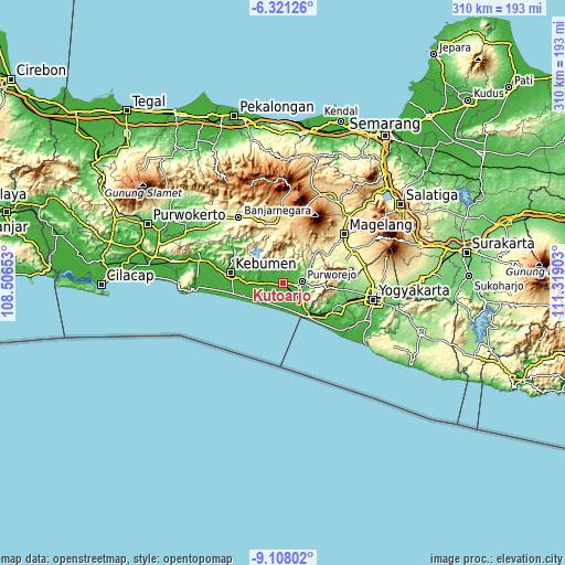
These maps also provides idea of topography and contour of this city, they are displayed at different zoom levels. More info about maps, scale and edge coordinates you can find below images.
| \ | Map #1 | Map #2 | Topo.Map |
| Scale [m] | 5..99 m | 3..291 m | × |
| Scale [ft] | 16..325 ft | 10..955 ft | × |
| Average | 19.7 m = 65 ft | 36.4 m = 119 ft | × |
| Width | 9.68 km = 6 mi | 19.37 km = 12 mi | 309.9 km = 192.6 mi |
| Height | 9.68 km = 6 mi | 19.37 km = 12 mi | 309.9 km = 192.6 mi |
| ↑Max Latitude | -7.67339° | -7.629836° | -6.32126° |
| Latitude at center | -7.71694° | -7.71694° | -7.71694° |
| ↓Min Latitude | -7.760485° | -7.804026° | -9.10802° |
| ← Min Longitude | 109.868835° | 109.824889° | 108.50653° |
| Longitude center | 109.91278° | 109.91278° | 109.91278° |
| →Max Longitude | 109.956725° | 110.000671° | 111.31903° |
Nearby cities:
Cities around Kutoarjo sort by population:
• Magelang elevation 379 m
43.4 km,  50°
50°
• Wonosobo 794 m
39.8 km,  358°
358°
• Mertoyudan 351 m
40.9 km,  57°
57°
• Godean 121 m
42.4 km,  97°
97°
• Muntilan 377 m
44.5 km,  70°
70°
• Gombong 26 m
45.6 km,  285°
285°
• Srandakan 23 m
44.6 km,  123°
123°
• Banjarnegara 300 m
42.9 km,  326°
326°
• Mungkid 250 m
36.5 km, 67°
• Wates 23 m
31.1 km, 120°
• Kebumen 29 m
29.1 km,  280°
280°
• Purworejo 71 m
10.8 km,  86°
86°
Multilingual:
 En español:
Kutoarjo elevación 20 m.
 En France:
Kutoarjo élévation 20 m.


Sources and notes:
- [note 1] Map square and city borders are not equal. Map elevation data is calculated only from area inside that square.
- [src 1] Elevation data from geonames database provided with same terms of usage.
- [src 2] The elevation map of Kutoarjo is generated using elevation data from NASA's 3 arcsec (90m) resolution SRTM data.
- [src 3] Base (background) map © OpenStreetMap contributors tiles are generated by Geofabrik and OpenTopoMap.
Copyright & License:
This Kutoarjo Elevation Map is licensed under CC BY-SA. You may reuse any part from this page, if you give a proper credit by linking to this URL:
 More info on terms of use page.