Labuan Lombok elevation
Labuan Lombok (West Nusa Tenggara), Indonesia elevation is 5 meters and Labuan Lombok elevation in feet is 16 ft above sea level [src 1]. Labuan Lombok is a populated place (feature code) with elevation that is 186 meters (610 ft) smaller than average city elevation in Indonesia.
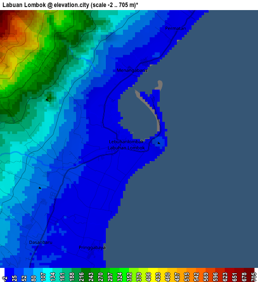
Below is the Elevation map of Labuan Lombok, which displays elevation range with different colors. Scale of the first map is from -2 to 705 m (-7 to 2313 ft) with average elevation of 110.9 meters (=364 ft) [note 1]
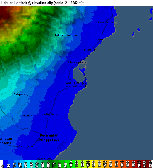
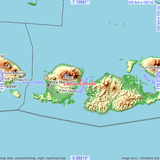
These maps also provides idea of topography and contour of this city, they are displayed at different zoom levels. More info about maps, scale and edge coordinates you can find below images.
| \ | Map #1 | Map #2 | Topo.Map |
| Scale [m] | -2..705 m | -2..2242 m | × |
| Scale [ft] | -7..2313 ft | -7..7356 ft | × |
| Average | 110.9 m = 364 ft | 348.5 m = 1143 ft | × |
| Width | 9.67 km = 6 mi | 19.33 km = 12 mi | 309.3 km = 192.2 mi |
| Height | 9.67 km = 6 mi | 19.33 km = 12 mi | 309.3 km = 192.2 mi |
| ↑Max Latitude | -8.456535° | -8.413065° | -7.10681° |
| Latitude at center | -8.5° | -8.5° | -8.5° |
| ↓Min Latitude | -8.54346° | -8.586915° | -9.88815° |
| ← Min Longitude | 116.622725° | 116.578779° | 115.26042° |
| Longitude center | 116.66667° | 116.66667° | 116.66667° |
| →Max Longitude | 116.710615° | 116.754561° | 118.07292° |
Nearby cities:
Cities around Labuan Lombok sort by population:
• Taliwang elevation 14 m
34.1 km,  143°
143°
• Terara 325 m
32.2 km,  240°
240°
• Sakra 227 m
30.3 km,  227°
227°
• Sikur 305 m
28.4 km, 238°
• Seteluk 32 m
26 km,  122°
122°
• Masbagik 276 m
24.9 km, 236°
• Senayan 45 m
23.8 km, 121°
• Selong 156 m
22.3 km,  221°
221°
• Sukamulia 206 m
22.2 km, 229°
• Aikmel 272 m
16.8 km, 243°
• Sambelia 149 m
13.6 km,  9°
9°
• Pringgabaya 27 m
7.4 km,  211°
211°
Multilingual:
 En español:
Labuan Lombok elevación 5 m.
 En France:
Labuan Lombok élévation 5 m.
 Auf Deutsch:
Labuan Lombok höhe über dem Meeresspiegel ist 5 m.

Sources and notes:
- [note 1] Map square and city borders are not equal. Map elevation data is calculated only from area inside that square.
- [src 1] Elevation data from geonames database provided with same terms of usage.
- [src 2] The elevation map of Labuan Lombok is generated using elevation data from NASA's 3 arcsec (90m) resolution SRTM data.
- [src 3] Base (background) map © OpenStreetMap contributors tiles are generated by Geofabrik and OpenTopoMap.
Copyright & License:
This Labuan Lombok Elevation Map is licensed under CC BY-SA. You may reuse any part from this page, if you give a proper credit by linking to this URL:
 More info on terms of use page.