Rantepao elevation
Rantepao (South Sulawesi), Indonesia elevation is 784 meters and Rantepao elevation in feet is 2572 ft above sea level [src 1]. Rantepao is a seat of a second-order administrative division (feature code) with elevation that is 593 meters (1946 ft) bigger than average city elevation in Indonesia.
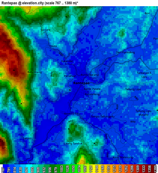
Below is the Elevation map of Rantepao, which displays elevation range with different colors. Scale of the first map is from 767 to 1380 m (2516 to 4528 ft) with average elevation of 871.2 meters (=2858 ft) [note 1]
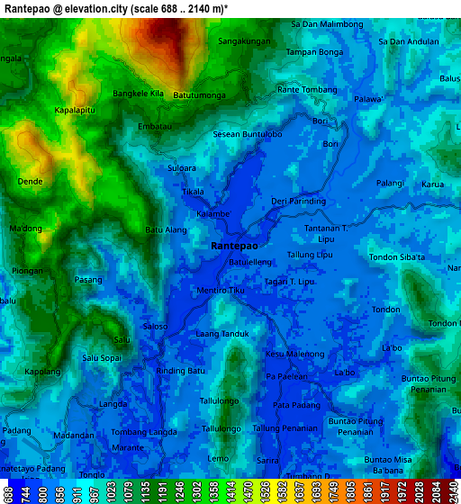
These maps also provides idea of topography and contour of this city, they are displayed at different zoom levels. More info about maps, scale and edge coordinates you can find below images.
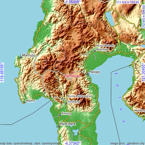
| \ | Map #1 | Map #2 | Topo.Map |
| Scale [m] | 767..1380 m | 688..2140 m | × |
| Scale [ft] | 2516..4528 ft | 2257..7021 ft | × |
| Average | 871.2 m = 2858 ft | 988.6 m = 3243 ft | × |
| Width | 9.76 km = 6.1 mi | 19.52 km = 12.1 mi | 312.3 km = 194.1 mi |
| Height | 9.76 km = 6.1 mi | 19.52 km = 12.1 mi | 312.3 km = 194.1 mi |
| ↑Max Latitude | -2.926213° | -2.882324° | -1.56499° |
| Latitude at center | -2.9701° | -2.9701° | -2.9701° |
| ↓Min Latitude | -3.013985° | -3.057869° | -4.37343° |
| ← Min Longitude | 119.853855° | 119.809909° | 118.49155° |
| Longitude center | 119.8978° | 119.8978° | 119.8978° |
| →Max Longitude | 119.941745° | 119.985691° | 121.30405° |
Nearby cities:
Cities around Rantepao sort by population:
• Palopo elevation 8 m
33.3 km,  94°
94°
• Beringinjaya 9 m
34.4 km,  96°
96°
• Buakayu 378 m
32 km,  217°
217°
• Beuma 341 m
31.9 km,  147°
147°
• Batuputih 32 m
31.5 km, 87°
• Walenrang 76 m
28.7 km,  60°
60°
• Getengan 1040 m
23.5 km,  183°
183°
• Tangratte 848 m
17.3 km,  239°
239°
• Makale 762 m
15.4 km,  198°
198°
• Rindingallo 1200 m
12.3 km,  310°
310°
• Totumbang 788 m
12.3 km,  167°
167°
• Rantepang 829 m
6.9 km,  44°
44°
Multilingual:
 En español:
Rantepao elevación 784 m.
 En France:
Rantepao élévation 784 m.
 Auf Deutsch:
Rantepao höhe über dem Meeresspiegel ist 784 m.

Sources and notes:
- [note 1] Map square and city borders are not equal. Map elevation data is calculated only from area inside that square.
- [src 1] Elevation data from geonames database provided with same terms of usage.
- [src 2] The elevation map of Rantepao is generated using elevation data from NASA's 3 arcsec (90m) resolution SRTM data.
- [src 3] Base (background) map © OpenStreetMap contributors tiles are generated by Geofabrik and OpenTopoMap.
Copyright & License:
This Rantepao Elevation Map is licensed under CC BY-SA. You may reuse any part from this page, if you give a proper credit by linking to this URL:
 More info on terms of use page.