Sijunjung elevation
Sijunjung (West Sumatra), Indonesia elevation is 167 meters and Sijunjung elevation in feet is 548 ft above sea level [src 1]. Sijunjung is a seat of a third-order administrative division (feature code) with elevation that is 24 meters (79 ft) smaller than average city elevation in Indonesia.
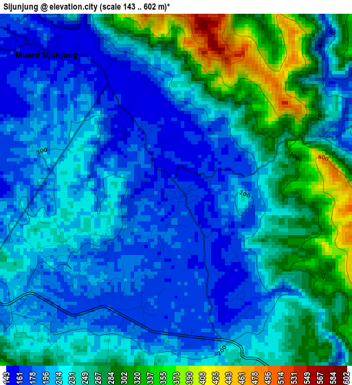
Below is the Elevation map of Sijunjung, which displays elevation range with different colors. Scale of the first map is from 143 to 602 m (469 to 1975 ft) with average elevation of 231.6 meters (=760 ft) [note 1]
These maps also provides idea of topography and contour of this city, they are displayed at different zoom levels. More info about maps, scale and edge coordinates you can find below images.
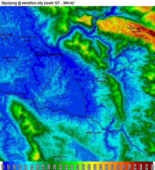
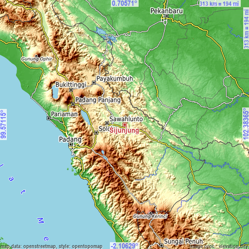
| \ | Map #1 | Map #2 | Topo.Map |
| Scale [m] | 143..602 m | 127..904 m | × |
| Scale [ft] | 469..1975 ft | 417..2966 ft | × |
| Average | 231.6 m = 760 ft | 285.7 m = 937 ft | × |
| Width | 9.77 km = 6.1 mi | 19.54 km = 12.1 mi | 312.7 km = 194.3 mi |
| Height | 9.77 km = 6.1 mi | 19.54 km = 12.1 mi | 312.7 km = 194.3 mi |
| ↑Max Latitude | -0.656558° | -0.612615° | 0.70571° |
| Latitude at center | -0.7005° | -0.7005° | -0.7005° |
| ↓Min Latitude | -0.744442° | -0.788383° | -2.10629° |
| ← Min Longitude | 100.933455° | 100.889509° | 99.57115° |
| Longitude center | 100.9774° | 100.9774° | 100.9774° |
| →Max Longitude | 101.021345° | 101.065291° | 102.38365° |
Nearby cities:
Cities around Sijunjung sort by population:
• Solok elevation 392 m
37.3 km,  252°
252°
• Sulitair 492 m
37.9 km,  284°
284°
• Tanjung Mas 255 m
32.1 km,  314°
314°
• Sirukam 776 m
31.9 km,  229°
229°
• Sumpur Kudus 336 m
29.8 km,  345°
345°
• Talawi 219 m
28.8 km,  293°
293°
• Tanjunggadang 330 m
26 km,  109°
109°
• Kumanis 208 m
23.4 km,  315°
315°
• Tanjungampalu 270 m
19 km,  297°
297°
• Tanjungampalu 285 m
18 km, 292°
• Kototujuh 202 m
12.2 km, 306°
• Muaro 171 m
4.6 km,  332°
332°
Multilingual:
 En español:
Sijunjung elevación 167 m.
 En France:
Sijunjung élévation 167 m.
 Auf Deutsch:
Sijunjung höhe über dem Meeresspiegel ist 167 m.

Sources and notes:
- [note 1] Map square and city borders are not equal. Map elevation data is calculated only from area inside that square.
- [src 1] Elevation data from geonames database provided with same terms of usage.
- [src 2] The elevation map of Sijunjung is generated using elevation data from NASA's 3 arcsec (90m) resolution SRTM data.
- [src 3] Base (background) map © OpenStreetMap contributors tiles are generated by Geofabrik and OpenTopoMap.
Copyright & License:
This Sijunjung Elevation Map is licensed under CC BY-SA. You may reuse any part from this page, if you give a proper credit by linking to this URL:
 More info on terms of use page.