Sumedang elevation
Sumedang (West Java, Kabupaten Sumedang), Indonesia elevation is 460 meters and Sumedang elevation in feet is 1509 ft above sea level [src 1]. Sumedang is a seat of a second-order administrative division (feature code) with elevation that is 269 meters (883 ft) bigger than average city elevation in Indonesia.
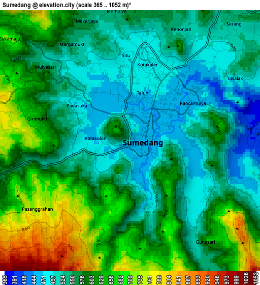
Below is the Elevation map of Sumedang, which displays elevation range with different colors. Scale of the first map is from 365 to 1052 m (1198 to 3451 ft) with average elevation of 583.4 meters (=1914 ft) [note 1]
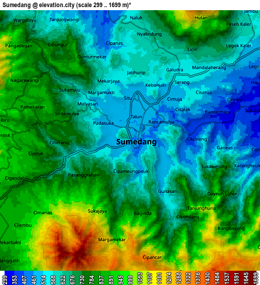
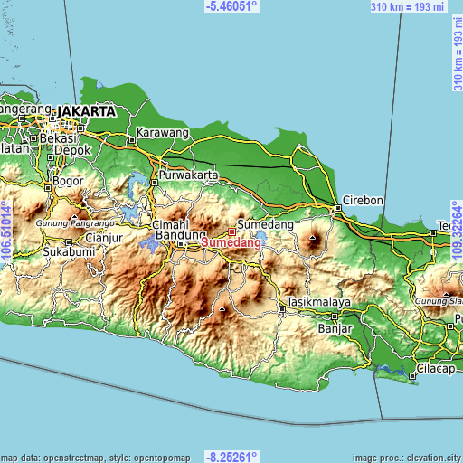
These maps also provides idea of topography and contour of this city, they are displayed at different zoom levels. More info about maps, scale and edge coordinates you can find below images.
| \ | Map #1 | Map #2 | Topo.Map |
| Scale [m] | 365..1052 m | 299..1699 m | × |
| Scale [ft] | 1198..3451 ft | 981..5574 ft | × |
| Average | 583.4 m = 1914 ft | 745.1 m = 2445 ft | × |
| Width | 9.7 km = 6 mi | 19.41 km = 12.1 mi | 310.5 km = 192.9 mi |
| Height | 9.7 km = 6 mi | 19.41 km = 12.1 mi | 310.5 km = 192.9 mi |
| ↑Max Latitude | -6.814977° | -6.77134° | -5.46051° |
| Latitude at center | -6.85861° | -6.85861° | -6.85861° |
| ↓Min Latitude | -6.902239° | -6.945864° | -8.25261° |
| ← Min Longitude | 107.872445° | 107.828499° | 106.51014° |
| Longitude center | 107.91639° | 107.91639° | 107.91639° |
| →Max Longitude | 107.960335° | 108.004281° | 109.32264° |
Nearby cities:
Cities around Sumedang sort by population:
• Paseh elevation 918 m
31.9 km,  211°
211°
• Cileunyi 703 m
20.1 km,  243°
243°
• Sumedang Utara 467 m
1 km,  1°
1°
• Lemahputih 967 m
32.6 km,  121°
121°
• Malangbong 614 m
29.3 km,  139°
139°
• Leles 717 m
28 km,  184°
184°
• Gununglimbangan 626 m
28 km,  164°
164°
• Pasirluhur 620 m
27.6 km,  171°
171°
• Sukasari 710 m
24.3 km,  185°
185°
• Bunisari 594 m
24.3 km, 168°
• Baluburlimbangan 551 m
21 km, 159°
• Pulosari 556 m
20.1 km,  146°
146°
Multilingual:
 En español:
Sumedang elevación 460 m.
 En France:
Sumedang élévation 460 m.
 Auf Deutsch:
Sumedang höhe über dem Meeresspiegel ist 460 m.

Sources and notes:
- [note 1] Map square and city borders are not equal. Map elevation data is calculated only from area inside that square.
- [src 1] Elevation data from geonames database provided with same terms of usage.
- [src 2] The elevation map of Sumedang is generated using elevation data from NASA's 3 arcsec (90m) resolution SRTM data.
- [src 3] Base (background) map © OpenStreetMap contributors tiles are generated by Geofabrik and OpenTopoMap.
Copyright & License:
This Sumedang Elevation Map is licensed under CC BY-SA. You may reuse any part from this page, if you give a proper credit by linking to this URL:
 More info on terms of use page.