Weleri elevation
Weleri (Central Java), Indonesia elevation is 17 meters and Weleri elevation in feet is 56 ft above sea level [src 1]. Weleri is a populated place (feature code) with elevation that is 174 meters (571 ft) smaller than average city elevation in Indonesia.
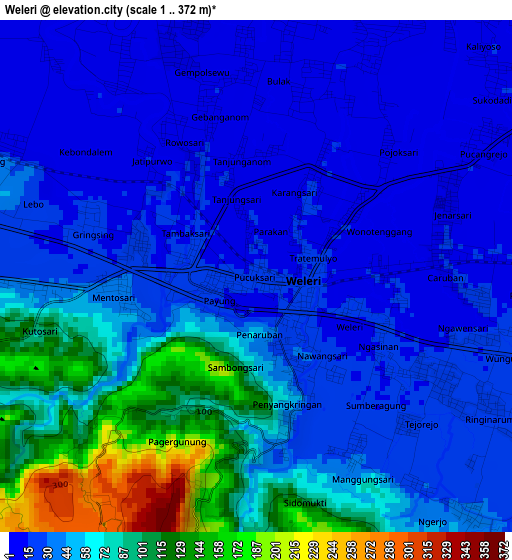
Below is the Elevation map of Weleri, which displays elevation range with different colors. Scale of the first map is from 1 to 372 m (3 to 1220 ft) with average elevation of 49.5 meters (=162 ft) [note 1]
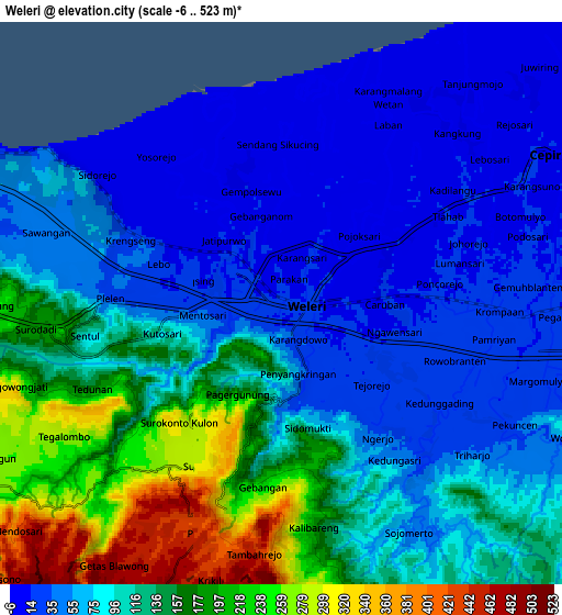
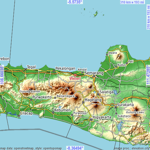
These maps also provides idea of topography and contour of this city, they are displayed at different zoom levels. More info about maps, scale and edge coordinates you can find below images.
| \ | Map #1 | Map #2 | Topo.Map |
| Scale [m] | 1..372 m | -6..523 m | × |
| Scale [ft] | 3..1220 ft | -20..1716 ft | × |
| Average | 49.5 m = 162 ft | 100.4 m = 329 ft | × |
| Width | 9.7 km = 6 mi | 19.4 km = 12.1 mi | 310.4 km = 192.9 mi |
| Height | 9.7 km = 6 mi | 19.4 km = 12.1 mi | 310.4 km = 192.9 mi |
| ↑Max Latitude | -6.927678° | -6.884051° | -5.5735° |
| Latitude at center | -6.9713° | -6.9713° | -6.9713° |
| ↓Min Latitude | -7.014918° | -7.058533° | -8.36494° |
| ← Min Longitude | 110.022655° | 109.978709° | 108.66035° |
| Longitude center | 110.0666° | 110.0666° | 110.0666° |
| →Max Longitude | 110.110545° | 110.154491° | 111.47285° |
Nearby cities:
Cities around Weleri sort by population:
• Semarang elevation 18 m
39.2 km,  93°
93°
• Pekalongan 10 m
44.2 km,  282°
282°
• Ungaran 351 m
41.8 km,  116°
116°
• Kedungwuni 17 m
46.2 km,  270°
270°
• Wonosobo 794 m
46.7 km,  202°
202°
• Ambarawa 481 m
48.9 km,  131°
131°
• Wiradesa 10 m
50.2 km, 280°
• Wonopringgo 45 m
49.7 km, 268°
• Mranggen 20 m
50 km,  97°
97°
• Temanggung 556 m
41.1 km,  160°
160°
• Batang 10 m
37.8 km, 280°
• Kendal 6 m
16 km,  69°
69°
Multilingual:
 En español:
Weleri elevación 17 m.
 En France:
Weleri élévation 17 m.


Sources and notes:
- [note 1] Map square and city borders are not equal. Map elevation data is calculated only from area inside that square.
- [src 1] Elevation data from geonames database provided with same terms of usage.
- [src 2] The elevation map of Weleri is generated using elevation data from NASA's 3 arcsec (90m) resolution SRTM data.
- [src 3] Base (background) map © OpenStreetMap contributors tiles are generated by Geofabrik and OpenTopoMap.
Copyright & License:
This Weleri Elevation Map is licensed under CC BY-SA. You may reuse any part from this page, if you give a proper credit by linking to this URL:
 More info on terms of use page.