Subagan elevation
Subagan (Bali), Indonesia elevation is 107 meters and Subagan elevation in feet is 351 ft above sea level [src 1]. Subagan is a seat of a third-order administrative division (feature code) with elevation that is 84 meters (276 ft) smaller than average city elevation in Indonesia.
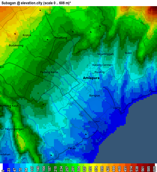
Below is the Elevation map of Subagan, which displays elevation range with different colors. Scale of the first map is from 0 to 608 m (0 to 1995 ft) with average elevation of 176.9 meters (=580 ft) [note 1]
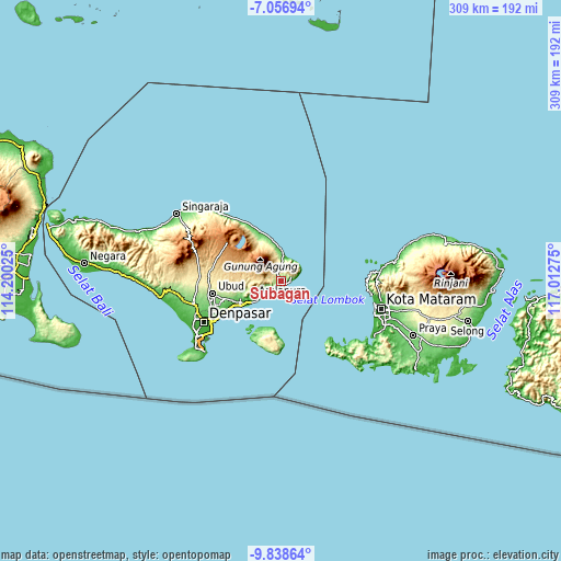
These maps also provides idea of topography and contour of this city, they are displayed at different zoom levels. More info about maps, scale and edge coordinates you can find below images.
| \ | Map #1 | Topo.Map |
| Scale [m] | 0..608 m | × |
| Scale [ft] | 0..1995 ft | × |
| Average | 176.9 m = 580 ft | × |
| Width | 9.67 km = 6 mi | 309.3 km = 192.2 mi |
| Height | 9.67 km = 6 mi | 309.3 km = 192.2 mi |
| ↑Max Latitude | -8.406829° | -7.05694° |
| Latitude at center | -8.4503° | -8.4503° |
| ↓Min Latitude | -8.493766° | -9.83864° |
| ← Min Longitude | 115.562555° | 114.20025° |
| Longitude center | 115.6065° | 115.6065° |
| →Max Longitude | 115.650445° | 117.01275° |
Nearby cities:
Cities around Subagan sort by population:
• Amlapura elevation 86 m
1.1 km,  88°
88°
• Amlapura city 152 m
0.2 km,  349°
349°
• Bedugul 155 m
1.5 km,  269°
269°
• Banjar Wangsian 212 m
20.7 km,  256°
256°
• Tembuku 454 m
24.4 km, 269°
• Semarapura 97 m
24.3 km,  247°
247°
• Kubu 55 m
22.4 km, 348°
• Sidemen 280 m
18.1 km, 258°
• Duda 519 m
13.1 km, 273°
• Ulakan 32 m
11.6 km,  242°
242°
• Abang 335 m
7.1 km,  355°
355°
• Bebandem 342 m
5.2 km,  283°
283°
Multilingual:
 En español:
Subagan elevación 107 m.
 En France:
Subagan élévation 107 m.


Sources and notes:
- [note 1] Map square and city borders are not equal. Map elevation data is calculated only from area inside that square.
- [src 1] Elevation data from geonames database provided with same terms of usage.
- [src 2] The elevation map of Subagan is generated using elevation data from NASA's 3 arcsec (90m) resolution SRTM data.
- [src 3] Base (background) map © OpenStreetMap contributors tiles are generated by Geofabrik and OpenTopoMap.
Copyright & License:
This Subagan Elevation Map is licensed under CC BY-SA. You may reuse any part from this page, if you give a proper credit by linking to this URL:
 More info on terms of use page.