Eger elevation
Eger (Heves), Hungary elevation is 168 meters and Eger elevation in feet is 551 ft above sea level [src 1]. Eger is a seat of a first-order administrative division (feature code) with elevation that is 39 meters (128 ft) bigger than average city elevation in Hungary.
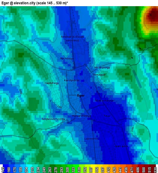
Below is the Elevation map of Eger, which displays elevation range with different colors. Scale of the first map is from 145 to 530 m (476 to 1739 ft) with average elevation of 211.1 meters (=693 ft) [note 1]
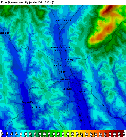
These maps also provides idea of topography and contour of this city, they are displayed at different zoom levels. More info about maps, scale and edge coordinates you can find below images.
| \ | Map #1 | Map #2 | Topo.Map |
| Scale [m] | 145..530 m | 134..658 m | × |
| Scale [ft] | 476..1739 ft | 440..2159 ft | × |
| Average | 211.1 m = 693 ft | 226.2 m = 742 ft | × |
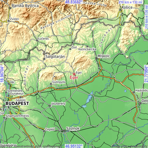
| Width | 6.55 km = 4.1 mi | 13.1 km = 8.1 mi | 209.6 km = 130.2 mi |
| Height | 6.55 km = 4.1 mi | 13.1 km = 8.1 mi | 209.6 km = 130.2 mi |
| ↑Max Latitude | 47.932102° | 47.961538° | 48.83682° |
| Latitude at center | 47.90265° | 47.90265° | 47.90265° |
| ↓Min Latitude | 47.873181° | 47.843695° | 46.95132° |
| ← Min Longitude | 20.329345° | 20.285399° | 18.96704° |
| Longitude center | 20.37329° | 20.37329° | 20.37329° |
| →Max Longitude | 20.417235° | 20.461181° | 21.77954° |
Nearby cities:
Cities around Eger sort by population:
• Füzesabony elevation 112 m
17.3 km,  169°
169°
• Verpelét 150 m
12 km,  240°
240°
• Bélapátfalva 398 m
16.4 km,  358°
358°
• Felsőtárkány 256 m
7.8 km,  24°
24°
• Andornaktálya 172 m
6.7 km,  151°
151°
• Ostoros 158 m
6 km,  131°
131°
• Maklár 120 m
11.9 km,  164°
164°
• Kerecsend 142 m
11.5 km,  188°
188°
• Szihalom 106 m
17.2 km, 151°
• Bogács 165 m
11.9 km,  91°
91°
• Sirok 173 m
13.4 km,  284°
284°
• Egerszalók 193 m
5 km,  216°
216°
Multilingual:
 En español:
Eger elevación 168 m.
 En France:
Eger élévation 168 m.
 Auf Deutsch:
Erlau, Eger höhe über dem Meeresspiegel ist 168 m.

Sources and notes:
- [note 1] Map square and city borders are not equal. Map elevation data is calculated only from area inside that square.
- [src 1] Elevation data from geonames database provided with same terms of usage.
- [src 2] The elevation map of Eger is generated using elevation data from NASA's 3 arcsec (90m) resolution SRTM data.
- [src 3] Base (background) map © OpenStreetMap contributors tiles are generated by Geofabrik and OpenTopoMap.
Copyright & License:
This Eger Elevation Map is licensed under CC BY-SA. You may reuse any part from this page, if you give a proper credit by linking to this URL:
 More info on terms of use page.