Emőd elevation
Emőd (Borsod-Abaúj-Zemplén), Hungary elevation is 108 meters and Emőd elevation in feet is 354 ft above sea level [src 1]. Emőd is a populated place (feature code) with elevation that is 21 meters (69 ft) smaller than average city elevation in Hungary.
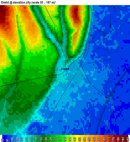
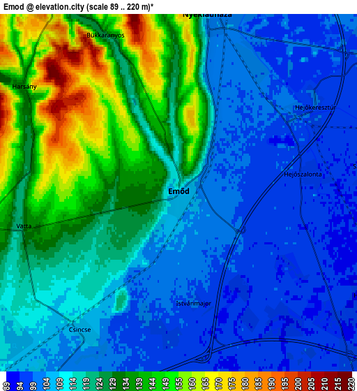
Below is the Elevation map of Emőd, which displays elevation range with different colors. Scale of the first map is from 93 to 187 m (305 to 614 ft) with average elevation of 117.5 meters (=385 ft) [note 1]
These maps also provides idea of topography and contour of this city, they are displayed at different zoom levels. More info about maps, scale and edge coordinates you can find below images.
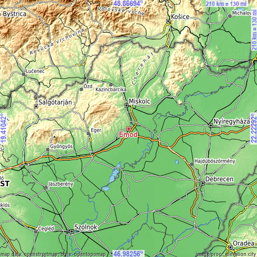
| \ | Map #1 | Map #2 | Topo.Map |
| Scale [m] | 93..187 m | 89..220 m | × |
| Scale [ft] | 305..614 ft | 292..722 ft | × |
| Average | 117.5 m = 385 ft | 119 m = 390 ft | × |
| Width | 6.55 km = 4.1 mi | 13.1 km = 8.1 mi | 209.5 km = 130.2 mi |
| Height | 6.55 km = 4.1 mi | 13.1 km = 8.1 mi | 209.5 km = 130.2 mi |
| ↑Max Latitude | 47.962765° | 47.992183° | 48.86694° |
| Latitude at center | 47.93333° | 47.93333° | 47.93333° |
| ↓Min Latitude | 47.903878° | 47.87441° | 46.98256° |
| ← Min Longitude | 20.772725° | 20.728779° | 19.41042° |
| Longitude center | 20.81667° | 20.81667° | 20.81667° |
| →Max Longitude | 20.860615° | 20.904561° | 22.22292° |
Nearby cities:
Cities around Emőd sort by population:
• Mezőcsát elevation 91 m
15 km,  150°
150°
• Alsózsolca 113 m
15.9 km,  17°
17°
• Nyékládháza 103 m
5.7 km,  12°
12°
• Mályi 104 m
9.3 km, 7°
• Mezőkeresztes 104 m
14.1 km,  218°
218°
• Sajólád 104 m
14.4 km,  25°
25°
• Ónod 102 m
10.5 km,  45°
45°
• Sajószöged 93 m
13.8 km,  82°
82°
• Sály 188 m
11.3 km,  279°
279°
• Harsány 158 m
6.2 km,  306°
306°
• Hejőbába 93 m
10.6 km,  110°
110°
• Sajóörös 93 m
16.2 km, 83°
Multilingual:
 En español:
Emőd elevación 108 m.
 En France:
Emőd élévation 108 m.


Sources and notes:
- [note 1] Map square and city borders are not equal. Map elevation data is calculated only from area inside that square.
- [src 1] Elevation data from geonames database provided with same terms of usage.
- [src 2] The elevation map of Emőd is generated using elevation data from NASA's 3 arcsec (90m) resolution SRTM data.
- [src 3] Base (background) map © OpenStreetMap contributors tiles are generated by Geofabrik and OpenTopoMap.
Copyright & License:
This Emőd Elevation Map is licensed under CC BY-SA. You may reuse any part from this page, if you give a proper credit by linking to this URL:
 More info on terms of use page.