Mándok elevation
Mándok (Szabolcs-Szatmár-Bereg), Hungary elevation is 111 meters and Mándok elevation in feet is 364 ft above sea level [src 1]. Mándok is a populated place (feature code) with elevation that is 18 meters (59 ft) smaller than average city elevation in Hungary.
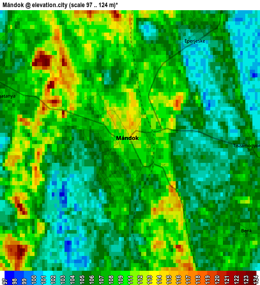
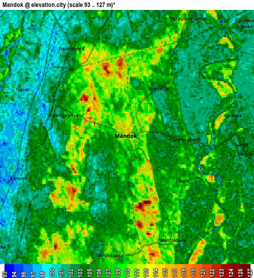
Below is the Elevation map of Mándok, which displays elevation range with different colors. Scale of the first map is from 97 to 124 m (318 to 407 ft) with average elevation of 107.5 meters (=353 ft) [note 1]
These maps also provides idea of topography and contour of this city, they are displayed at different zoom levels. More info about maps, scale and edge coordinates you can find below images.
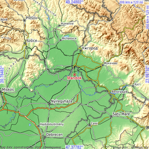
| \ | Map #1 | Map #2 | Topo.Map |
| Scale [m] | 97..124 m | 93..127 m | × |
| Scale [ft] | 318..407 ft | 305..417 ft | × |
| Average | 107.5 m = 353 ft | 105.3 m = 345 ft | × |
| Width | 6.5 km = 4 mi | 13 km = 8.1 mi | 207.9 km = 129.2 mi |
| Height | 6.5 km = 4 mi | 13 km = 8.1 mi | 207.9 km = 129.2 mi |
| ↑Max Latitude | 48.350703° | 48.379899° | 49.24802° |
| Latitude at center | 48.32149° | 48.32149° | 48.32149° |
| ↓Min Latitude | 48.29226° | 48.263014° | 47.37782° |
| ← Min Longitude | 22.147125° | 22.103179° | 20.78482° |
| Longitude center | 22.19107° | 22.19107° | 22.19107° |
| →Max Longitude | 22.235015° | 22.278961° | 23.59732° |
Nearby cities:
Cities around Mándok sort by population:
• Kisvárda elevation 106 m
14.1 km,  214°
214°
• Záhony 103 m
9.8 km,  353°
353°
• Dombrád 96 m
21.4 km,  242°
242°
• Ajak 101 m
18.7 km, 210°
• Tuzsér 101 m
6 km,  294°
294°
• Tornyospálca 107 m
6.1 km,  185°
185°
• Fényeslitke 104 m
8.7 km,  230°
230°
• Döge 96 m
11.5 km, 235°
• Aranyosapáti 108 m
13.8 km,  158°
158°
• Tiszabezdéd 102 m
5.9 km,  328°
328°
• Anarcs 106 m
17.2 km,  200°
200°
• Ricse 102 m
16.3 km,  271°
271°
Multilingual:
 En español:
Mándok elevación 111 m.
 En France:
Mándok élévation 111 m.


Sources and notes:
- [note 1] Map square and city borders are not equal. Map elevation data is calculated only from area inside that square.
- [src 1] Elevation data from geonames database provided with same terms of usage.
- [src 2] The elevation map of Mándok is generated using elevation data from NASA's 3 arcsec (90m) resolution SRTM data.
- [src 3] Base (background) map © OpenStreetMap contributors tiles are generated by Geofabrik and OpenTopoMap.
Copyright & License:
This Mándok Elevation Map is licensed under CC BY-SA. You may reuse any part from this page, if you give a proper credit by linking to this URL:
 More info on terms of use page.