Sárospatak elevation
Sárospatak (Borsod-Abaúj-Zemplén), Hungary elevation is 106 meters and Sárospatak elevation in feet is 348 ft above sea level [src 1]. Sárospatak is a seat of a second-order administrative division (feature code) with elevation that is 23 meters (75 ft) smaller than average city elevation in Hungary.
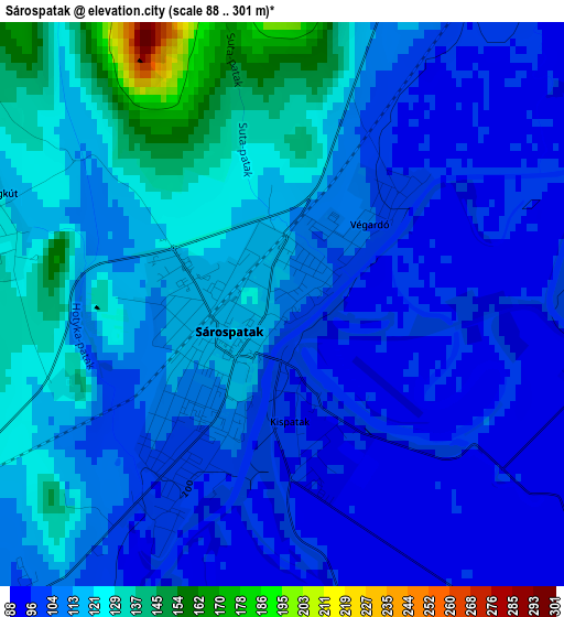
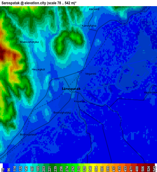
Below is the Elevation map of Sárospatak, which displays elevation range with different colors. Scale of the first map is from 88 to 301 m (289 to 988 ft) with average elevation of 112.3 meters (=368 ft) [note 1]
These maps also provides idea of topography and contour of this city, they are displayed at different zoom levels. More info about maps, scale and edge coordinates you can find below images.
| \ | Map #1 | Map #2 | Topo.Map |
| Scale [m] | 88..301 m | 78..542 m | × |
| Scale [ft] | 289..988 ft | 256..1778 ft | × |
| Average | 112.3 m = 368 ft | 136.1 m = 447 ft | × |
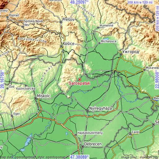
| Width | 6.5 km = 4 mi | 13 km = 8.1 mi | 207.9 km = 129.2 mi |
| Height | 6.5 km = 4 mi | 13 km = 8.1 mi | 207.9 km = 129.2 mi |
| ↑Max Latitude | 48.353711° | 48.382906° | 49.25097° |
| Latitude at center | 48.3245° | 48.3245° | 48.3245° |
| ↓Min Latitude | 48.295272° | 48.266027° | 47.38089° |
| ← Min Longitude | 21.529885° | 21.485939° | 20.16758° |
| Longitude center | 21.57383° | 21.57383° | 21.57383° |
| →Max Longitude | 21.617775° | 21.661721° | 22.98008° |
Nearby cities:
Cities around Sárospatak sort by population:
• Sátoraljaújhely elevation 108 m
10 km,  38°
38°
• Ibrány 100 m
24.5 km,  155°
155°
• Nagyhalász 97 m
25.4 km,  146°
146°
• Rakamaz 102 m
23.8 km,  199°
199°
• Cigánd 96 m
24.7 km,  108°
108°
• Tiszakarád 97 m
17.4 km,  142°
142°
• Buj 98 m
25.6 km,  167°
167°
• Tiszabercel 100 m
20.2 km, 163°
• Tiszanagyfalu 96 m
25.8 km, 195°
• Karcsa 100 m
17.2 km,  94°
94°
• Tolcsva 113 m
10.2 km,  243°
243°
• Olaszliszka 114 m
13.3 km,  231°
231°
Multilingual:
 En español:
Sárospatak elevación 106 m.
 En France:
Sárospatak élévation 106 m.
 Auf Deutsch:
Patak am Bodrog höhe über dem Meeresspiegel ist 106 m.

Sources and notes:
- [note 1] Map square and city borders are not equal. Map elevation data is calculated only from area inside that square.
- [src 1] Elevation data from geonames database provided with same terms of usage.
- [src 2] The elevation map of Sárospatak is generated using elevation data from NASA's 3 arcsec (90m) resolution SRTM data.
- [src 3] Base (background) map © OpenStreetMap contributors tiles are generated by Geofabrik and OpenTopoMap.
Copyright & License:
This Sárospatak Elevation Map is licensed under CC BY-SA. You may reuse any part from this page, if you give a proper credit by linking to this URL:
 More info on terms of use page.