Vámospércs elevation
Vámospércs (Hajdú-Bihar), Hungary elevation is 130 meters and Vámospércs elevation in feet is 427 ft above sea level [src 1]. Vámospércs is a populated place (feature code) with elevation that is 1 meters (3 ft) bigger than average city elevation in Hungary.
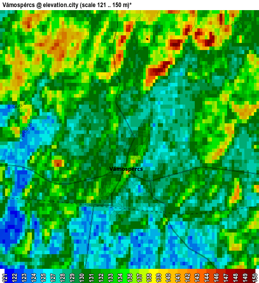
Below is the Elevation map of Vámospércs, which displays elevation range with different colors. Scale of the first map is from 121 to 150 m (397 to 492 ft) with average elevation of 131.3 meters (=431 ft) [note 1]
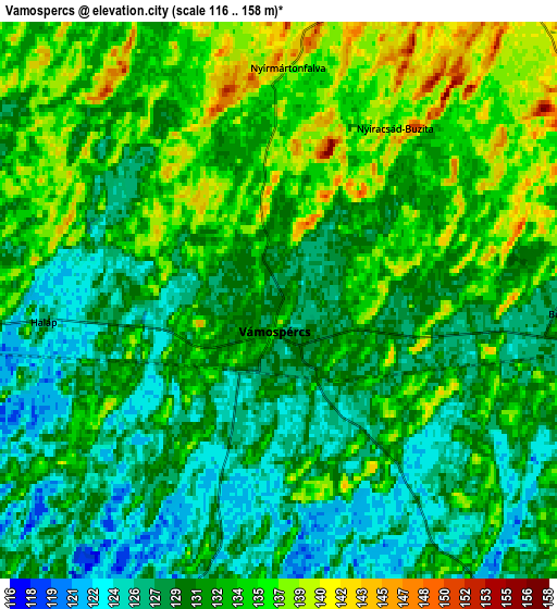
These maps also provides idea of topography and contour of this city, they are displayed at different zoom levels. More info about maps, scale and edge coordinates you can find below images.
| \ | Map #1 | Map #2 | Topo.Map |
| Scale [m] | 121..150 m | 116..158 m | × |
| Scale [ft] | 397..492 ft | 381..518 ft | × |
| Average | 131.3 m = 431 ft | 131.5 m = 431 ft | × |
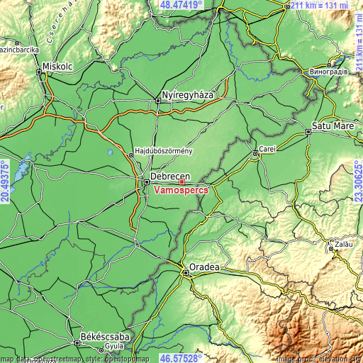
| Width | 6.6 km = 4.1 mi | 13.2 km = 8.2 mi | 211.1 km = 131.2 mi |
| Height | 6.6 km = 4.1 mi | 13.2 km = 8.2 mi | 211.1 km = 131.2 mi |
| ↑Max Latitude | 47.562992° | 47.592637° | 48.47419° |
| Latitude at center | 47.53333° | 47.53333° | 47.53333° |
| ↓Min Latitude | 47.503651° | 47.473956° | 46.57528° |
| ← Min Longitude | 21.856055° | 21.812109° | 20.49375° |
| Longitude center | 21.9° | 21.9° | 21.9° |
| →Max Longitude | 21.943945° | 21.987891° | 23.30625° |
Nearby cities:
Cities around Vámospércs sort by population:
• Debrecen elevation 123 m
20 km,  270°
270°
• Hajdúsámson 133 m
12.5 km,  306°
306°
• Nyíradony 152 m
18.3 km,  4°
4°
• Létavértes 113 m
16.7 km,  180°
180°
• Hosszúpályi 107 m
20 km,  218°
218°
• Nyíracsád 146 m
9.5 km,  34°
34°
• Nyírábrány 136 m
9.6 km,  76°
76°
• Mikepércs 104 m
22.1 km,  245°
245°
• Nyírlugos 158 m
20.8 km, 31°
• Bagamér 129 m
11.5 km,  144°
144°
• Monostorpályi 108 m
17.2 km,  210°
210°
• Nyírmártonfalva 144 m
5.6 km, 0°
Multilingual:
 En español:
Vámospércs elevación 130 m.
 En France:
Vámospércs élévation 130 m.
 Auf Deutsch:
Vámospércs höhe über dem Meeresspiegel ist 130 m.

Sources and notes:
- [note 1] Map square and city borders are not equal. Map elevation data is calculated only from area inside that square.
- [src 1] Elevation data from geonames database provided with same terms of usage.
- [src 2] The elevation map of Vámospércs is generated using elevation data from NASA's 3 arcsec (90m) resolution SRTM data.
- [src 3] Base (background) map © OpenStreetMap contributors tiles are generated by Geofabrik and OpenTopoMap.
Copyright & License:
This Vámospércs Elevation Map is licensed under CC BY-SA. You may reuse any part from this page, if you give a proper credit by linking to this URL:
 More info on terms of use page.