Nyíradony elevation
Nyíradony (Hajdú-Bihar), Hungary elevation is 152 meters and Nyíradony elevation in feet is 499 ft above sea level [src 1]. Nyíradony is a seat of a second-order administrative division (feature code) with elevation that is 23 meters (75 ft) bigger than average city elevation in Hungary.
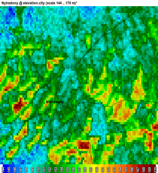
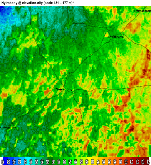
Below is the Elevation map of Nyíradony, which displays elevation range with different colors. Scale of the first map is from 144 to 170 m (472 to 558 ft) with average elevation of 152.5 meters (=500 ft) [note 1]
These maps also provides idea of topography and contour of this city, they are displayed at different zoom levels. More info about maps, scale and edge coordinates you can find below images.
| \ | Map #1 | Map #2 | Topo.Map |
| Scale [m] | 144..170 m | 131..177 m | × |
| Scale [ft] | 472..558 ft | 430..581 ft | × |
| Average | 152.5 m = 500 ft | 152.2 m = 499 ft | × |
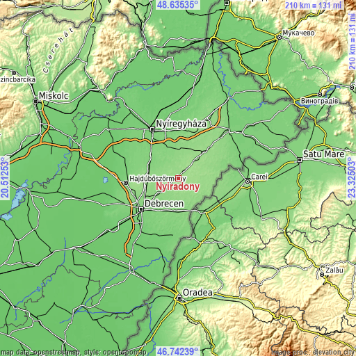
| Width | 6.58 km = 4.1 mi | 13.15 km = 8.2 mi | 210.5 km = 130.8 mi |
| Height | 6.58 km = 4.1 mi | 13.15 km = 8.2 mi | 210.5 km = 130.8 mi |
| ↑Max Latitude | 47.727029° | 47.756581° | 48.63535° |
| Latitude at center | 47.69746° | 47.69746° | 47.69746° |
| ↓Min Latitude | 47.667874° | 47.638272° | 46.74239° |
| ← Min Longitude | 21.874835° | 21.830889° | 20.51253° |
| Longitude center | 21.91878° | 21.91878° | 21.91878° |
| →Max Longitude | 21.962725° | 22.006671° | 23.32503° |
Nearby cities:
Cities around Nyíradony sort by population:
• Hajdúsámson elevation 133 m
15.7 km,  226°
226°
• Balkány 138 m
9.1 km,  332°
332°
• Nyíracsád 146 m
11.2 km,  159°
159°
• Nyírbogát 154 m
16.1 km,  42°
42°
• Bököny 134 m
13.2 km,  287°
287°
• Nyírbéltek 148 m
16.1 km,  88°
88°
• Nyírlugos 158 m
9.4 km, 92°
• Szakoly 144 m
7.7 km,  358°
358°
• Nyírmártonfalva 144 m
12.8 km,  186°
186°
• Encsencs 153 m
15.3 km,  74°
74°
• Nyírmihálydi 151 m
5.8 km, 35°
• Kisléta 142 m
17.3 km,  21°
21°
Multilingual:
 En español:
Nyíradony elevación 152 m.
 En France:
Nyíradony élévation 152 m.
 Auf Deutsch:
Nyíradony höhe über dem Meeresspiegel ist 152 m.

Sources and notes:
- [note 1] Map square and city borders are not equal. Map elevation data is calculated only from area inside that square.
- [src 1] Elevation data from geonames database provided with same terms of usage.
- [src 2] The elevation map of Nyíradony is generated using elevation data from NASA's 3 arcsec (90m) resolution SRTM data.
- [src 3] Base (background) map © OpenStreetMap contributors tiles are generated by Geofabrik and OpenTopoMap.
Copyright & License:
This Nyíradony Elevation Map is licensed under CC BY-SA. You may reuse any part from this page, if you give a proper credit by linking to this URL:
 More info on terms of use page.