Adony elevation
Adony (Fejér), Hungary elevation is 101 meters and Adony elevation in feet is 331 ft above sea level [src 1]. Adony is a populated place (feature code) with elevation that is 28 meters (92 ft) smaller than average city elevation in Hungary.
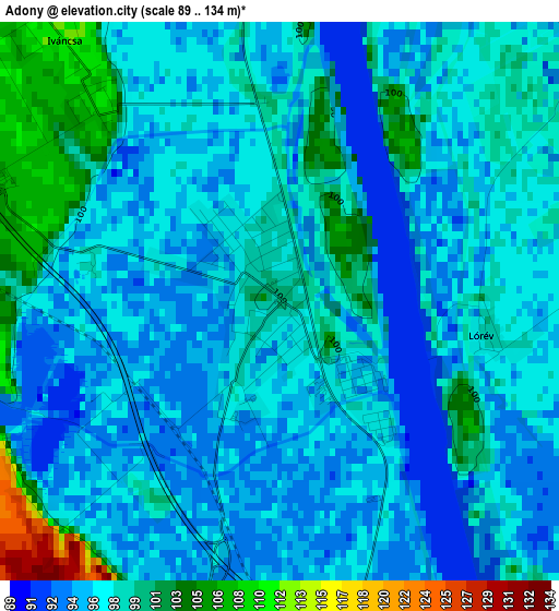
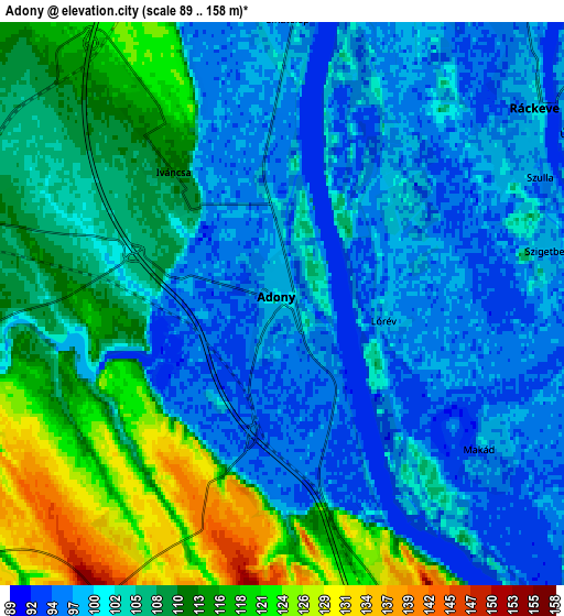
Below is the Elevation map of Adony, which displays elevation range with different colors. Scale of the first map is from 89 to 134 m (292 to 440 ft) with average elevation of 97.3 meters (=319 ft) [note 1]
These maps also provides idea of topography and contour of this city, they are displayed at different zoom levels. More info about maps, scale and edge coordinates you can find below images.
| \ | Map #1 | Map #2 | Topo.Map |
| Scale [m] | 89..134 m | 89..158 m | × |
| Scale [ft] | 292..440 ft | 292..518 ft | × |
| Average | 97.3 m = 319 ft | 104.7 m = 344 ft | × |
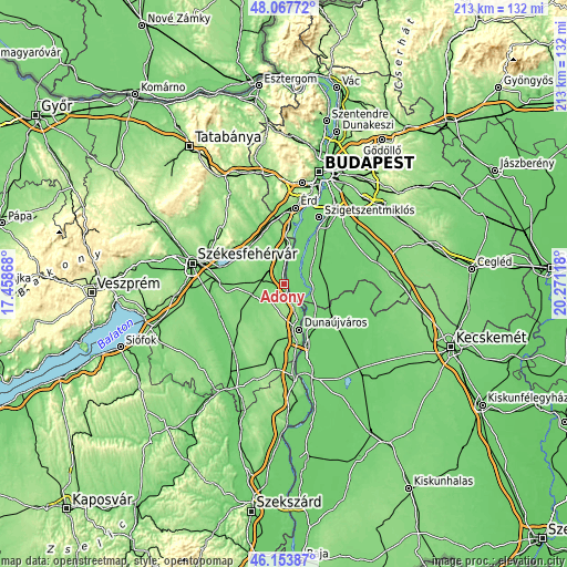
| Width | 6.65 km = 4.1 mi | 13.3 km = 8.3 mi | 212.8 km = 132.2 mi |
| Height | 6.65 km = 4.1 mi | 13.3 km = 8.3 mi | 212.8 km = 132.2 mi |
| ↑Max Latitude | 47.149295° | 47.179174° | 48.06772° |
| Latitude at center | 47.1194° | 47.1194° | 47.1194° |
| ↓Min Latitude | 47.089488° | 47.059559° | 46.15387° |
| ← Min Longitude | 18.820985° | 18.777039° | 17.45868° |
| Longitude center | 18.86493° | 18.86493° | 18.86493° |
| →Max Longitude | 18.908875° | 18.952821° | 20.27118° |
Nearby cities:
Cities around Adony sort by population:
• Ráckeve elevation 100 m
7.6 km,  52°
52°
• Kiskunlacháza 97 m
13.3 km, 54°
• Ercsi 123 m
14.9 km,  9°
9°
• Pusztaszabolcs 111 m
7.7 km,  284°
284°
• Dömsöd 97 m
11.5 km,  106°
106°
• Perkáta 128 m
10 km,  216°
216°
• Rácalmás 140 m
12.2 km,  151°
151°
• dunaújváros 143 m
17.7 km,  163°
163°
• Ráckeresztúr 112 m
17.3 km,  352°
352°
• Tass 97 m
16.6 km,  131°
131°
• Iváncsa 114 m
5.3 km,  320°
320°
• Szigetújfalu 99 m
13.6 km,  20°
20°
Multilingual:
 En español:
Adony elevación 101 m.
 En France:
Adony élévation 101 m.


Sources and notes:
- [note 1] Map square and city borders are not equal. Map elevation data is calculated only from area inside that square.
- [src 1] Elevation data from geonames database provided with same terms of usage.
- [src 2] The elevation map of Adony is generated using elevation data from NASA's 3 arcsec (90m) resolution SRTM data.
- [src 3] Base (background) map © OpenStreetMap contributors tiles are generated by Geofabrik and OpenTopoMap.
Copyright & License:
This Adony Elevation Map is licensed under CC BY-SA. You may reuse any part from this page, if you give a proper credit by linking to this URL:
 More info on terms of use page.