dunaújváros elevation
dunaújváros (Fejér), Hungary elevation is 143 meters and dunaújváros elevation in feet is 469 ft above sea level [src 1]. dunaújváros is a populated locality (feature code) with elevation that is 14 meters (46 ft) bigger than average city elevation in Hungary.
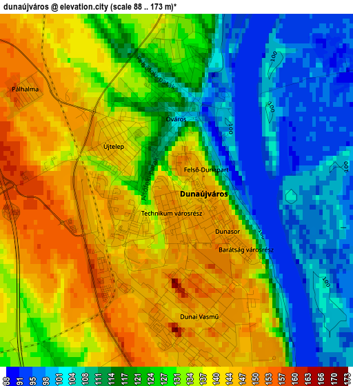
Below is the Elevation map of dunaújváros, which displays elevation range with different colors. Scale of the first map is from 88 to 173 m (289 to 568 ft) with average elevation of 126.9 meters (=416 ft) [note 1]
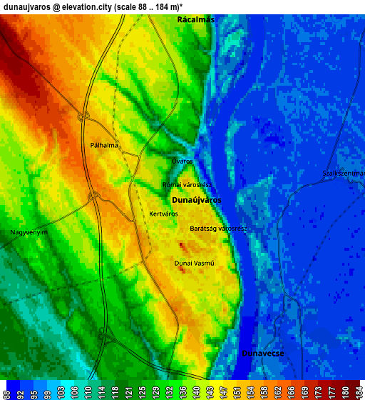
These maps also provides idea of topography and contour of this city, they are displayed at different zoom levels. More info about maps, scale and edge coordinates you can find below images.
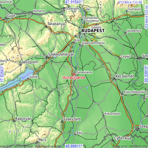
| \ | Map #1 | Map #2 | Topo.Map |
| Scale [m] | 88..173 m | 88..184 m | × |
| Scale [ft] | 289..568 ft | 289..604 ft | × |
| Average | 126.9 m = 416 ft | 121.3 m = 398 ft | × |
| Width | 6.67 km = 4.1 mi | 13.34 km = 8.3 mi | 213.4 km = 132.6 mi |
| Height | 6.67 km = 4.1 mi | 13.34 km = 8.3 mi | 213.4 km = 132.6 mi |
| ↑Max Latitude | 46.997351° | 47.027314° | 47.91841° |
| Latitude at center | 46.96737° | 46.96737° | 46.96737° |
| ↓Min Latitude | 46.937373° | 46.907359° | 45.99911° |
| ← Min Longitude | 18.888935° | 18.844989° | 17.52663° |
| Longitude center | 18.93288° | 18.93288° | 18.93288° |
| →Max Longitude | 18.976825° | 19.020771° | 20.33913° |
Nearby cities:
Cities around dunaújváros sort by population:
• Dunaújváros elevation 146 m
0.6 km,  118°
118°
• Kunszentmiklós 95 m
16.1 km,  65°
65°
• Dömsöd 97 m
14.9 km,  23°
23°
• Mezőfalva 144 m
12.9 km,  252°
252°
• Dunavecse 119 m
6.5 km,  153°
153°
• Perkáta 128 m
14.1 km,  308°
308°
• Rácalmás 140 m
6.2 km,  5°
5°
• Baracs 102 m
9.7 km,  191°
191°
• Szalkszentmárton 99 m
6.1 km,  81°
81°
• Tass 97 m
9.5 km,  50°
50°
• Előszállás 107 m
16.9 km,  206°
206°
• Apostag 97 m
9.7 km,  166°
166°
Multilingual:
 En español:
dunaújváros elevación 143 m.
 En France:
dunaújváros élévation 143 m.
 Auf Deutsch:
dunaújváros höhe über dem Meeresspiegel ist 143 m.

Sources and notes:
- [note 1] Map square and city borders are not equal. Map elevation data is calculated only from area inside that square.
- [src 1] Elevation data from geonames database provided with same terms of usage.
- [src 2] The elevation map of dunaújváros is generated using elevation data from NASA's 3 arcsec (90m) resolution SRTM data.
- [src 3] Base (background) map © OpenStreetMap contributors tiles are generated by Geofabrik and OpenTopoMap.
Copyright & License:
This dunaújváros Elevation Map is licensed under CC BY-SA. You may reuse any part from this page, if you give a proper credit by linking to this URL:
 More info on terms of use page.