Bodajk elevation
Bodajk (Fejér), Hungary elevation is 152 meters and Bodajk elevation in feet is 499 ft above sea level [src 1]. Bodajk is a populated place (feature code) with elevation that is 23 meters (75 ft) bigger than average city elevation in Hungary.
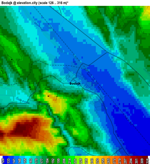
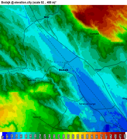
Below is the Elevation map of Bodajk, which displays elevation range with different colors. Scale of the first map is from 126 to 316 m (413 to 1037 ft) with average elevation of 176.4 meters (=579 ft) [note 1]
These maps also provides idea of topography and contour of this city, they are displayed at different zoom levels. More info about maps, scale and edge coordinates you can find below images.
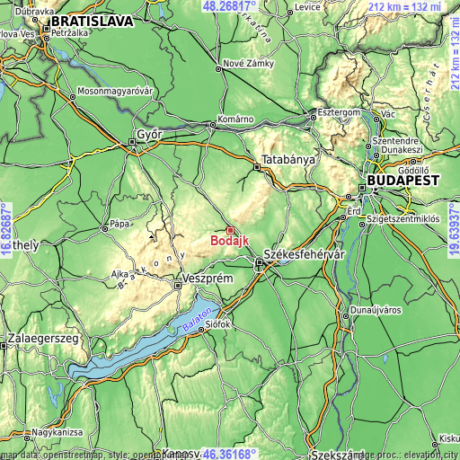
| \ | Map #1 | Map #2 | Topo.Map |
| Scale [m] | 126..316 m | 92..488 m | × |
| Scale [ft] | 413..1037 ft | 302..1601 ft | × |
| Average | 176.4 m = 579 ft | 215.6 m = 707 ft | × |
| Width | 6.62 km = 4.1 mi | 13.25 km = 8.2 mi | 212 km = 131.7 mi |
| Height | 6.62 km = 4.1 mi | 13.25 km = 8.2 mi | 212 km = 131.7 mi |
| ↑Max Latitude | 47.3533° | 47.383064° | 48.26817° |
| Latitude at center | 47.32352° | 47.32352° | 47.32352° |
| ↓Min Latitude | 47.293723° | 47.263909° | 46.36168° |
| ← Min Longitude | 18.189175° | 18.145229° | 16.82687° |
| Longitude center | 18.23312° | 18.23312° | 18.23312° |
| →Max Longitude | 18.277065° | 18.321011° | 19.63937° |
Nearby cities:
Cities around Bodajk sort by population:
• Várpalota elevation 158 m
15.5 km,  207°
207°
• Oroszlány 182 m
19.1 km,  18°
18°
• Mór 177 m
6.4 km,  339°
339°
• Csákvár 143 m
19 km,  66°
66°
• Pétfürdő 138 m
19.5 km, 206°
• Bakonycsernye 210 m
11.9 km,  270°
270°
• Pusztavám 207 m
11.8 km,  357°
357°
• Bokod 201 m
18.7 km,  3°
3°
• Zámoly 146 m
13.2 km,  93°
93°
• Csetény 290 m
18.2 km, 268°
• Fehérvárcsurgó 133 m
4.1 km,  144°
144°
• Kincsesbánya 139 m
7.4 km,  152°
152°
Multilingual:
 En español:
Bodajk elevación 152 m.
 En France:
Bodajk élévation 152 m.


Sources and notes:
- [note 1] Map square and city borders are not equal. Map elevation data is calculated only from area inside that square.
- [src 1] Elevation data from geonames database provided with same terms of usage.
- [src 2] The elevation map of Bodajk is generated using elevation data from NASA's 3 arcsec (90m) resolution SRTM data.
- [src 3] Base (background) map © OpenStreetMap contributors tiles are generated by Geofabrik and OpenTopoMap.
Copyright & License:
This Bodajk Elevation Map is licensed under CC BY-SA. You may reuse any part from this page, if you give a proper credit by linking to this URL:
 More info on terms of use page.