Bóly elevation
Bóly (Baranya), Hungary elevation is 136 meters and Bóly elevation in feet is 446 ft above sea level [src 1]. Bóly is a seat of a second-order administrative division (feature code) with elevation that is 7 meters (23 ft) bigger than average city elevation in Hungary.
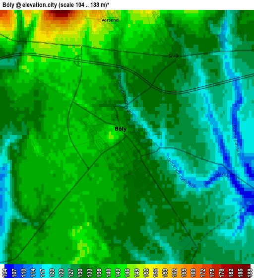
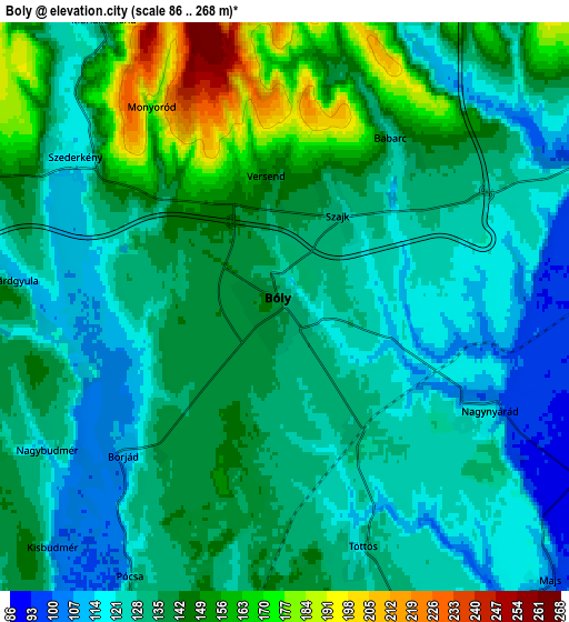
Below is the Elevation map of Bóly, which displays elevation range with different colors. Scale of the first map is from 104 to 188 m (341 to 617 ft) with average elevation of 132.7 meters (=435 ft) [note 1]
These maps also provides idea of topography and contour of this city, they are displayed at different zoom levels. More info about maps, scale and edge coordinates you can find below images.
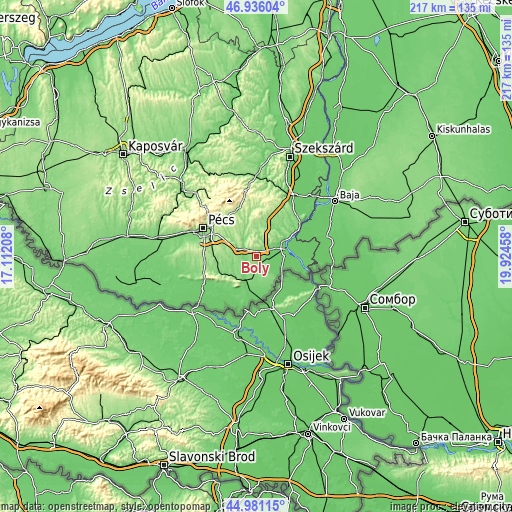
| \ | Map #1 | Map #2 | Topo.Map |
| Scale [m] | 104..188 m | 86..268 m | × |
| Scale [ft] | 341..617 ft | 282..879 ft | × |
| Average | 132.7 m = 435 ft | 135 m = 443 ft | × |
| Width | 6.79 km = 4.2 mi | 13.59 km = 8.4 mi | 217.4 km = 135.1 mi |
| Height | 6.79 km = 4.2 mi | 13.59 km = 8.4 mi | 217.4 km = 135.1 mi |
| ↑Max Latitude | 45.997757° | 46.028276° | 46.93604° |
| Latitude at center | 45.96722° | 45.96722° | 45.96722° |
| ↓Min Latitude | 45.936667° | 45.906096° | 44.98115° |
| ← Min Longitude | 18.474385° | 18.430439° | 17.11208° |
| Longitude center | 18.51833° | 18.51833° | 18.51833° |
| →Max Longitude | 18.562275° | 18.606221° | 19.92458° |
Nearby cities:
Cities around Bóly sort by population:
• Pécs elevation 193 m
25.5 km,  300°
300°
• Mohács 82 m
13.2 km,  78°
78°
• Siklós 104 m
21.2 km,  233°
233°
• Kozármisleny 161 m
18.8 km,  291°
291°
• Pécsvárad 216 m
22.7 km,  341°
341°
• Harkány 95 m
25.4 km,  239°
239°
• Hosszúhetény 273 m
25.4 km,  329°
329°
• Beremend 99 m
20.7 km,  198°
198°
• Villány 101 m
12 km, 204°
• Lánycsók 99 m
9.3 km,  62°
62°
• Dunaszekcső 99 m
22.9 km,  54°
54°
• Báta 85 m
26.5 km, 47°
Multilingual:
 En español:
Bóly elevación 136 m.
 En France:
Bóly élévation 136 m.


Sources and notes:
- [note 1] Map square and city borders are not equal. Map elevation data is calculated only from area inside that square.
- [src 1] Elevation data from geonames database provided with same terms of usage.
- [src 2] The elevation map of Bóly is generated using elevation data from NASA's 3 arcsec (90m) resolution SRTM data.
- [src 3] Base (background) map © OpenStreetMap contributors tiles are generated by Geofabrik and OpenTopoMap.
Copyright & License:
This Bóly Elevation Map is licensed under CC BY-SA. You may reuse any part from this page, if you give a proper credit by linking to this URL:
 More info on terms of use page.