Etyek elevation
Etyek (Fejér), Hungary elevation is 169 meters and Etyek elevation in feet is 554 ft above sea level [src 1]. Etyek is a populated place (feature code) with elevation that is 40 meters (131 ft) bigger than average city elevation in Hungary.
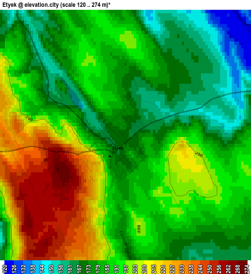
Below is the Elevation map of Etyek, which displays elevation range with different colors. Scale of the first map is from 120 to 274 m (394 to 899 ft) with average elevation of 189.5 meters (=622 ft) [note 1]
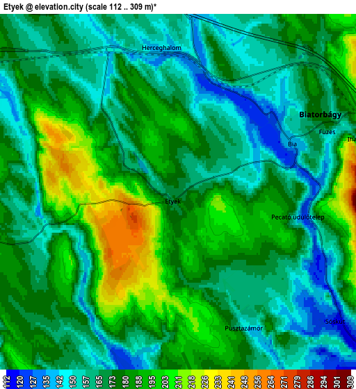
These maps also provides idea of topography and contour of this city, they are displayed at different zoom levels. More info about maps, scale and edge coordinates you can find below images.
| \ | Map #1 | Map #2 | Topo.Map |
| Scale [m] | 120..274 m | 112..309 m | × |
| Scale [ft] | 394..899 ft | 367..1014 ft | × |
| Average | 189.5 m = 622 ft | 174.9 m = 574 ft | × |
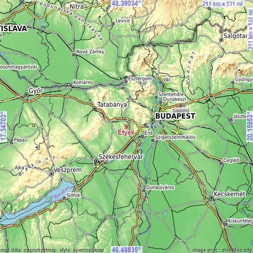
| Width | 6.61 km = 4.1 mi | 13.22 km = 8.2 mi | 211.5 km = 131.4 mi |
| Height | 6.61 km = 4.1 mi | 13.22 km = 8.2 mi | 211.5 km = 131.4 mi |
| ↑Max Latitude | 47.47765° | 47.507343° | 48.39034° |
| Latitude at center | 47.44794° | 47.44794° | 47.44794° |
| ↓Min Latitude | 47.418213° | 47.38847° | 46.48835° |
| ← Min Longitude | 18.709335° | 18.665389° | 17.34703° |
| Longitude center | 18.75328° | 18.75328° | 18.75328° |
| →Max Longitude | 18.797225° | 18.841171° | 20.15953° |
Nearby cities:
Cities around Etyek sort by population:
• Érd elevation 150 m
13.4 km,  116°
116°
• Budakeszi 234 m
14.8 km,  61°
61°
• Törökbálint 174 m
12.2 km,  99°
99°
• Bicske 164 m
9.1 km,  296°
296°
• Biatorbágy 167 m
5.5 km, 62°
• Tárnok 113 m
10.8 km,  140°
140°
• Páty 195 m
9.5 km,  36°
36°
• Zsámbék 168 m
11.4 km,  347°
347°
• Sóskút 123 m
6.9 km,  131°
131°
• Vál 114 m
11 km,  210°
210°
• Mány 184 m
12 km,  322°
322°
• Telki 240 m
12.5 km,  26°
26°
Multilingual:
 En español:
Etyek elevación 169 m.
 En France:
Etyek élévation 169 m.


Sources and notes:
- [note 1] Map square and city borders are not equal. Map elevation data is calculated only from area inside that square.
- [src 1] Elevation data from geonames database provided with same terms of usage.
- [src 2] The elevation map of Etyek is generated using elevation data from NASA's 3 arcsec (90m) resolution SRTM data.
- [src 3] Base (background) map © OpenStreetMap contributors tiles are generated by Geofabrik and OpenTopoMap.
Copyright & License:
This Etyek Elevation Map is licensed under CC BY-SA. You may reuse any part from this page, if you give a proper credit by linking to this URL:
 More info on terms of use page.