Zsámbék elevation
Zsámbék (Pest), Hungary elevation is 168 meters and Zsámbék elevation in feet is 551 ft above sea level [src 1]. Zsámbék is a populated place (feature code) with elevation that is 39 meters (128 ft) bigger than average city elevation in Hungary.
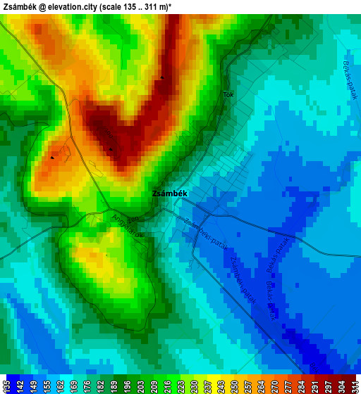
Below is the Elevation map of Zsámbék, which displays elevation range with different colors. Scale of the first map is from 135 to 311 m (443 to 1020 ft) with average elevation of 191.6 meters (=629 ft) [note 1]
These maps also provides idea of topography and contour of this city, they are displayed at different zoom levels. More info about maps, scale and edge coordinates you can find below images.
| \ | Map #1 | Map #2 | Topo.Map |
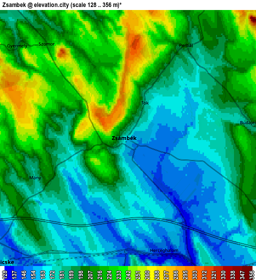
| Scale [m] | 135..311 m | 128..356 m | × |
| Scale [ft] | 443..1020 ft | 420..1168 ft | × |
| Average | 191.6 m = 629 ft | 196.3 m = 644 ft | × |
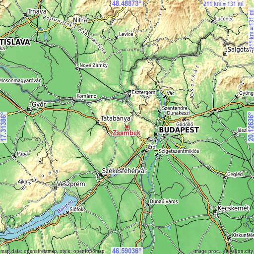
| Width | 6.6 km = 4.1 mi | 13.19 km = 8.2 mi | 211.1 km = 131.2 mi |
| Height | 6.6 km = 4.1 mi | 13.19 km = 8.2 mi | 211.1 km = 131.2 mi |
| ↑Max Latitude | 47.577793° | 47.60743° | 48.48873° |
| Latitude at center | 47.54814° | 47.54814° | 47.54814° |
| ↓Min Latitude | 47.51847° | 47.488783° | 46.59036° |
| ← Min Longitude | 18.676165° | 18.632219° | 17.31386° |
| Longitude center | 18.72011° | 18.72011° | 18.72011° |
| →Max Longitude | 18.764055° | 18.808001° | 20.12636° |
Nearby cities:
Cities around Zsámbék sort by population:
• Pilisvörösvár elevation 178 m
15.9 km,  62°
62°
• Bicske 164 m
9.1 km,  218°
218°
• Biatorbágy 167 m
11.4 km,  139°
139°
• Piliscsaba 211 m
12.6 km,  40°
40°
• Páty 195 m
8.8 km,  112°
112°
• Pilisszentiván 209 m
15.1 km, 63°
• Etyek 169 m
11.4 km,  167°
167°
• Sárisáp 130 m
14.7 km,  347°
347°
• Mány 184 m
5.1 km,  251°
251°
• Perbál 197 m
5.5 km,  33°
33°
• Telki 240 m
8.1 km,  90°
90°
• Bajna 199 m
14.9 km,  321°
321°
Multilingual:
 En español:
Zsámbék elevación 168 m.
 En France:
Zsámbék élévation 168 m.


Sources and notes:
- [note 1] Map square and city borders are not equal. Map elevation data is calculated only from area inside that square.
- [src 1] Elevation data from geonames database provided with same terms of usage.
- [src 2] The elevation map of Zsámbék is generated using elevation data from NASA's 3 arcsec (90m) resolution SRTM data.
- [src 3] Base (background) map © OpenStreetMap contributors tiles are generated by Geofabrik and OpenTopoMap.
Copyright & License:
This Zsámbék Elevation Map is licensed under CC BY-SA. You may reuse any part from this page, if you give a proper credit by linking to this URL:
 More info on terms of use page.