Halásztelek elevation
Halásztelek (Pest), Hungary elevation is 99 meters and Halásztelek elevation in feet is 325 ft above sea level [src 1]. Halásztelek is a populated place (feature code) with elevation that is 30 meters (98 ft) smaller than average city elevation in Hungary.
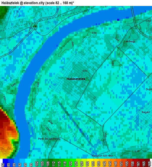
Below is the Elevation map of Halásztelek, which displays elevation range with different colors. Scale of the first map is from 82 to 168 m (269 to 551 ft) with average elevation of 98.8 meters (=324 ft) [note 1]
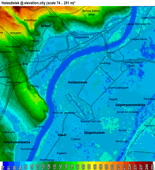
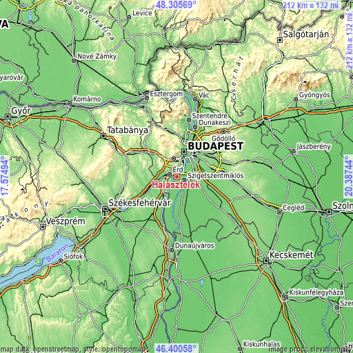
These maps also provides idea of topography and contour of this city, they are displayed at different zoom levels. More info about maps, scale and edge coordinates you can find below images.
| \ | Map #1 | Map #2 | Topo.Map |
| Scale [m] | 82..168 m | 74..251 m | × |
| Scale [ft] | 269..551 ft | 243..823 ft | × |
| Average | 98.8 m = 324 ft | 111.4 m = 365 ft | × |
| Width | 6.62 km = 4.1 mi | 13.24 km = 8.2 mi | 211.8 km = 131.6 mi |
| Height | 6.62 km = 4.1 mi | 13.24 km = 8.2 mi | 211.8 km = 131.6 mi |
| ↑Max Latitude | 47.391489° | 47.421231° | 48.30569° |
| Latitude at center | 47.36173° | 47.36173° | 47.36173° |
| ↓Min Latitude | 47.331954° | 47.302162° | 46.40058° |
| ← Min Longitude | 18.937245° | 18.893299° | 17.57494° |
| Longitude center | 18.98119° | 18.98119° | 18.98119° |
| →Max Longitude | 19.025135° | 19.069081° | 20.38744° |
Nearby cities:
Cities around Halásztelek sort by population:
• Budapest XXI. kerület elevation 105 m
10.2 km,  41°
41°
• Érd 150 m
6.3 km,  305°
305°
• Budapest XXII. kerület 104 m
8.5 km,  31°
31°
• Szigetszentmiklós 99 m
5.1 km,  113°
113°
• Százhalombatta 71 m
4.8 km,  221°
221°
• Dunaharaszti 100 m
8.9 km,  95°
95°
• Szigethalom 99 m
4.7 km,  159°
159°
• Törökbálint 174 m
9.1 km,  325°
325°
• Tököl 100 m
4.7 km,  197°
197°
• Tárnok 113 m
10.3 km,  277°
277°
• Diósd 133 m
5.8 km,  335°
335°
• Taksony 105 m
7.4 km,  118°
118°
Multilingual:
 En español:
Halásztelek elevación 99 m.
 En France:
Halásztelek élévation 99 m.
 Auf Deutsch:
Halásztelek höhe über dem Meeresspiegel ist 99 m.

Sources and notes:
- [note 1] Map square and city borders are not equal. Map elevation data is calculated only from area inside that square.
- [src 1] Elevation data from geonames database provided with same terms of usage.
- [src 2] The elevation map of Halásztelek is generated using elevation data from NASA's 3 arcsec (90m) resolution SRTM data.
- [src 3] Base (background) map © OpenStreetMap contributors tiles are generated by Geofabrik and OpenTopoMap.
Copyright & License:
This Halásztelek Elevation Map is licensed under CC BY-SA. You may reuse any part from this page, if you give a proper credit by linking to this URL:
 More info on terms of use page.