Tököl elevation
Tököl (Pest), Hungary elevation is 100 meters and Tököl elevation in feet is 328 ft above sea level [src 1]. Tököl is a populated place (feature code) with elevation that is 29 meters (95 ft) smaller than average city elevation in Hungary.
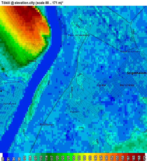
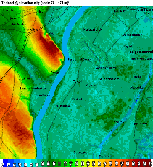
Below is the Elevation map of Tököl, which displays elevation range with different colors. Scale of the first map is from 88 to 171 m (289 to 561 ft) with average elevation of 102.6 meters (=337 ft) [note 1]
These maps also provides idea of topography and contour of this city, they are displayed at different zoom levels. More info about maps, scale and edge coordinates you can find below images.
| \ | Map #1 | Map #2 | Topo.Map |
| Scale [m] | 88..171 m | 74..171 m | × |
| Scale [ft] | 289..561 ft | 243..561 ft | × |
| Average | 102.6 m = 337 ft | 106.8 m = 350 ft | × |
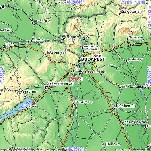
| Width | 6.62 km = 4.1 mi | 13.25 km = 8.2 mi | 212 km = 131.7 mi |
| Height | 6.62 km = 4.1 mi | 13.25 km = 8.2 mi | 212 km = 131.7 mi |
| ↑Max Latitude | 47.351561° | 47.381326° | 48.26646° |
| Latitude at center | 47.32178° | 47.32178° | 47.32178° |
| ↓Min Latitude | 47.291982° | 47.262167° | 46.3599° |
| ← Min Longitude | 18.918545° | 18.874599° | 17.55624° |
| Longitude center | 18.96249° | 18.96249° | 18.96249° |
| →Max Longitude | 19.006435° | 19.050381° | 20.36874° |
Nearby cities:
Cities around Tököl sort by population:
• Érd elevation 150 m
8.9 km,  335°
335°
• Szigetszentmiklós 99 m
6.6 km,  68°
68°
• Százhalombatta 71 m
2 km,  295°
295°
• Szigethalom 99 m
3 km,  88°
88°
• Ercsi 123 m
9.2 km,  212°
212°
• Tárnok 113 m
10.5 km, 303°
• Halásztelek 99 m
4.7 km,  17°
17°
• Diósd 133 m
9.8 km,  354°
354°
• Taksony 105 m
7.9 km,  83°
83°
• Dunavarsány 97 m
9.2 km,  121°
121°
• Szigetcsép 100 m
6.4 km,  174°
174°
• Szigetújfalu 99 m
10.1 km,  195°
195°
Multilingual:
 En español:
Tököl elevación 100 m.
 En France:
Tököl élévation 100 m.


Sources and notes:
- [note 1] Map square and city borders are not equal. Map elevation data is calculated only from area inside that square.
- [src 1] Elevation data from geonames database provided with same terms of usage.
- [src 2] The elevation map of Tököl is generated using elevation data from NASA's 3 arcsec (90m) resolution SRTM data.
- [src 3] Base (background) map © OpenStreetMap contributors tiles are generated by Geofabrik and OpenTopoMap.
Copyright & License:
This Tököl Elevation Map is licensed under CC BY-SA. You may reuse any part from this page, if you give a proper credit by linking to this URL:
 More info on terms of use page.