Jászberény elevation
Jászberény (Jász-Nagykun-Szolnok), Hungary elevation is 96 meters and Jászberény elevation in feet is 315 ft above sea level [src 1]. Jászberény is a seat of a second-order administrative division (feature code) with elevation that is 33 meters (108 ft) smaller than average city elevation in Hungary.
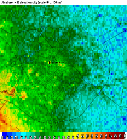
Below is the Elevation map of Jászberény, which displays elevation range with different colors. Scale of the first map is from 84 to 106 m (276 to 348 ft) with average elevation of 91.7 meters (=301 ft) [note 1]
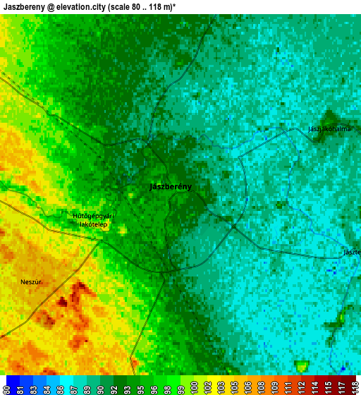
These maps also provides idea of topography and contour of this city, they are displayed at different zoom levels. More info about maps, scale and edge coordinates you can find below images.
| \ | Map #1 | Map #2 | Topo.Map |
| Scale [m] | 84..106 m | 80..118 m | × |
| Scale [ft] | 276..348 ft | 262..387 ft | × |
| Average | 91.7 m = 301 ft | 93.5 m = 307 ft | × |
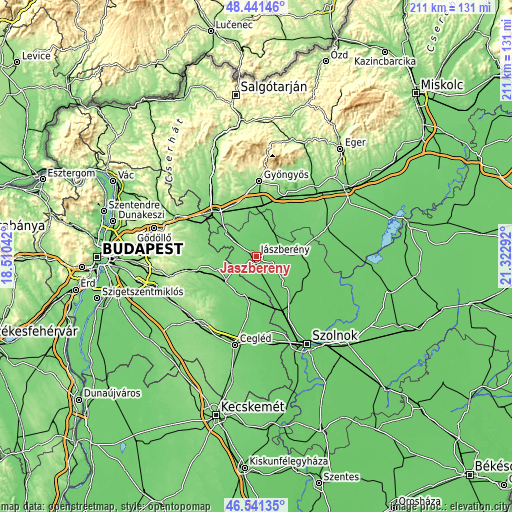
| Width | 6.6 km = 4.1 mi | 13.2 km = 8.2 mi | 211.3 km = 131.3 mi |
| Height | 6.6 km = 4.1 mi | 13.2 km = 8.2 mi | 211.3 km = 131.3 mi |
| ↑Max Latitude | 47.529681° | 47.559344° | 48.44146° |
| Latitude at center | 47.5° | 47.5° | 47.5° |
| ↓Min Latitude | 47.470303° | 47.440588° | 46.54135° |
| ← Min Longitude | 19.872725° | 19.828779° | 18.51042° |
| Longitude center | 19.91667° | 19.91667° | 19.91667° |
| →Max Longitude | 19.960615° | 20.004561° | 21.32292° |
Nearby cities:
Cities around Jászberény sort by population:
• Nagykáta elevation 112 m
16 km,  233°
233°
• Jászapáti 95 m
17.6 km,  83°
83°
• Jászárokszállás 101 m
16.5 km,  16°
16°
• Szentmártonkáta 117 m
17 km,  252°
252°
• Farmos 99 m
16.4 km,  198°
198°
• Jászjákóhalma 92 m
6 km,  67°
67°
• Jánoshida 86 m
17.2 km,  138°
138°
• Csány 115 m
17.7 km,  338°
338°
• Jászdózsa 95 m
10.4 km,  45°
45°
• Szentlőrinckáta 106 m
12.5 km,  279°
279°
• Alattyán 89 m
12.4 km,  130°
130°
• Tarnaörs 94 m
14.7 km,  43°
43°
Multilingual:
 En español:
Jászberény elevación 96 m.
 En France:
Jászberény élévation 96 m.
 Auf Deutsch:
Jászberény höhe über dem Meeresspiegel ist 96 m.

Sources and notes:
- [note 1] Map square and city borders are not equal. Map elevation data is calculated only from area inside that square.
- [src 1] Elevation data from geonames database provided with same terms of usage.
- [src 2] The elevation map of Jászberény is generated using elevation data from NASA's 3 arcsec (90m) resolution SRTM data.
- [src 3] Base (background) map © OpenStreetMap contributors tiles are generated by Geofabrik and OpenTopoMap.
Copyright & License:
This Jászberény Elevation Map is licensed under CC BY-SA. You may reuse any part from this page, if you give a proper credit by linking to this URL:
 More info on terms of use page.