Kóka elevation
Kóka (Pest), Hungary elevation is 145 meters and Kóka elevation in feet is 476 ft above sea level [src 1]. Kóka is a populated place (feature code) with elevation that is 16 meters (52 ft) bigger than average city elevation in Hungary.
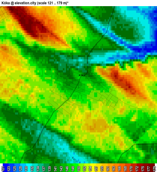
Below is the Elevation map of Kóka, which displays elevation range with different colors. Scale of the first map is from 121 to 179 m (397 to 587 ft) with average elevation of 148 meters (=486 ft) [note 1]
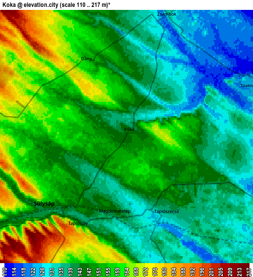
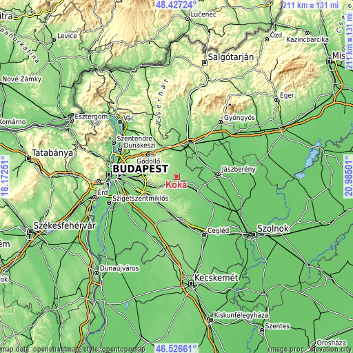
These maps also provides idea of topography and contour of this city, they are displayed at different zoom levels. More info about maps, scale and edge coordinates you can find below images.
| \ | Map #1 | Map #2 | Topo.Map |
| Scale [m] | 121..179 m | 110..217 m | × |
| Scale [ft] | 397..587 ft | 361..712 ft | × |
| Average | 148 m = 486 ft | 147.8 m = 485 ft | × |
| Width | 6.6 km = 4.1 mi | 13.21 km = 8.2 mi | 211.3 km = 131.3 mi |
| Height | 6.6 km = 4.1 mi | 13.21 km = 8.2 mi | 211.3 km = 131.3 mi |
| ↑Max Latitude | 47.515209° | 47.544881° | 48.42724° |
| Latitude at center | 47.48552° | 47.48552° | 47.48552° |
| ↓Min Latitude | 47.455814° | 47.426092° | 46.52661° |
| ← Min Longitude | 19.534815° | 19.490869° | 18.17251° |
| Longitude center | 19.57876° | 19.57876° | 19.57876° |
| →Max Longitude | 19.622705° | 19.666651° | 20.98501° |
Nearby cities:
Cities around Kóka sort by population:
• Sülysáp elevation 142 m
5 km,  222°
222°
• Tápiószecső 137 m
4.6 km,  149°
149°
• Szentmártonkáta 117 m
9.9 km,  110°
110°
• Dány 163 m
4.6 km,  325°
325°
• Mende 159 m
11 km,  236°
236°
• Tóalmás 126 m
7 km,  69°
69°
• Tápióság 133 m
10.1 km,  157°
157°
• Úri 155 m
8.8 km,  205°
205°
• Zsámbok 130 m
6.9 km,  20°
20°
• Forrópuszta 132 m
7 km,  119°
119°
• Valkó 155 m
10 km, 330°
• Vácszentlászló 165 m
10.3 km,  342°
342°
Multilingual:
 En español:
Kóka elevación 145 m.
 En France:
Kóka élévation 145 m.


Sources and notes:
- [note 1] Map square and city borders are not equal. Map elevation data is calculated only from area inside that square.
- [src 1] Elevation data from geonames database provided with same terms of usage.
- [src 2] The elevation map of Kóka is generated using elevation data from NASA's 3 arcsec (90m) resolution SRTM data.
- [src 3] Base (background) map © OpenStreetMap contributors tiles are generated by Geofabrik and OpenTopoMap.
Copyright & License:
This Kóka Elevation Map is licensed under CC BY-SA. You may reuse any part from this page, if you give a proper credit by linking to this URL:
 More info on terms of use page.