Körmend elevation
Körmend (Vas), Hungary elevation is 192 meters and Körmend elevation in feet is 630 ft above sea level [src 1]. Körmend is a populated place (feature code) with elevation that is 63 meters (207 ft) bigger than average city elevation in Hungary.
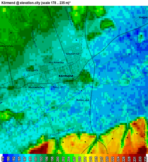
Below is the Elevation map of Körmend, which displays elevation range with different colors. Scale of the first map is from 178 to 235 m (584 to 771 ft) with average elevation of 193 meters (=633 ft) [note 1]
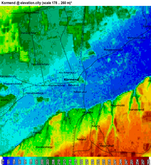
These maps also provides idea of topography and contour of this city, they are displayed at different zoom levels. More info about maps, scale and edge coordinates you can find below images.
| \ | Map #1 | Map #2 | Topo.Map |
| Scale [m] | 178..235 m | 178..260 m | × |
| Scale [ft] | 584..771 ft | 584..853 ft | × |
| Average | 193 m = 633 ft | 204.5 m = 671 ft | × |
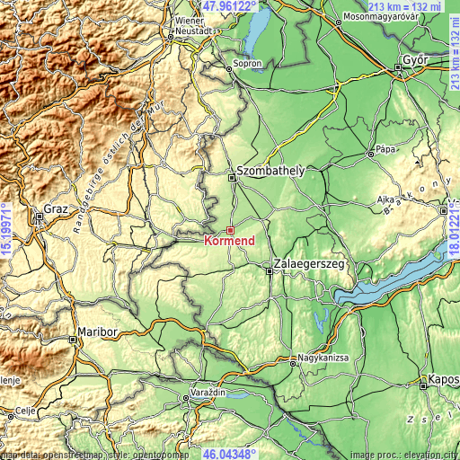
| Width | 6.66 km = 4.1 mi | 13.33 km = 8.3 mi | 213.2 km = 132.5 mi |
| Height | 6.66 km = 4.1 mi | 13.33 km = 8.3 mi | 213.2 km = 132.5 mi |
| ↑Max Latitude | 47.040916° | 47.070855° | 47.96122° |
| Latitude at center | 47.01096° | 47.01096° | 47.01096° |
| ↓Min Latitude | 46.980987° | 46.950997° | 46.04348° |
| ← Min Longitude | 16.562015° | 16.518069° | 15.19971° |
| Longitude center | 16.60596° | 16.60596° | 16.60596° |
| →Max Longitude | 16.649905° | 16.693851° | 18.01221° |
Nearby cities:
Cities around Körmend sort by population:
• Szombathely elevation 215 m
24.5 km,  2°
2°
• Zalaegerszeg 152 m
26.2 km,  136°
136°
• Sárvár 158 m
36.7 km,  42°
42°
• Szentgotthárd 229 m
26 km,  255°
255°
• Zalaszentgrót 124 m
36.7 km,  101°
101°
• Vasvár 202 m
15.3 km,  73°
73°
• Vép 191 m
25.9 km,  19°
19°
• Zalalövő 199 m
18.2 km,  184°
184°
• Gencsapáti 228 m
30.5 km,  358°
358°
• Táplánszentkereszt 193 m
21.6 km, 18°
• Ják 206 m
14.7 km,  352°
352°
• Türje 141 m
38.1 km,  94°
94°
Multilingual:
 En español:
Körmend elevación 192 m.
 En France:
Körmend élévation 192 m.


Sources and notes:
- [note 1] Map square and city borders are not equal. Map elevation data is calculated only from area inside that square.
- [src 1] Elevation data from geonames database provided with same terms of usage.
- [src 2] The elevation map of Körmend is generated using elevation data from NASA's 3 arcsec (90m) resolution SRTM data.
- [src 3] Base (background) map © OpenStreetMap contributors tiles are generated by Geofabrik and OpenTopoMap.
Copyright & License:
This Körmend Elevation Map is licensed under CC BY-SA. You may reuse any part from this page, if you give a proper credit by linking to this URL:
 More info on terms of use page.