Örkény elevation
Örkény (Pest), Hungary elevation is 123 meters and Örkény elevation in feet is 404 ft above sea level [src 1]. Örkény is a populated place (feature code) with elevation that is 6 meters (20 ft) smaller than average city elevation in Hungary.
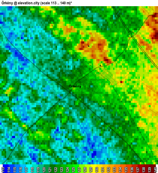
Below is the Elevation map of Örkény, which displays elevation range with different colors. Scale of the first map is from 113 to 140 m (371 to 459 ft) with average elevation of 122.8 meters (=403 ft) [note 1]
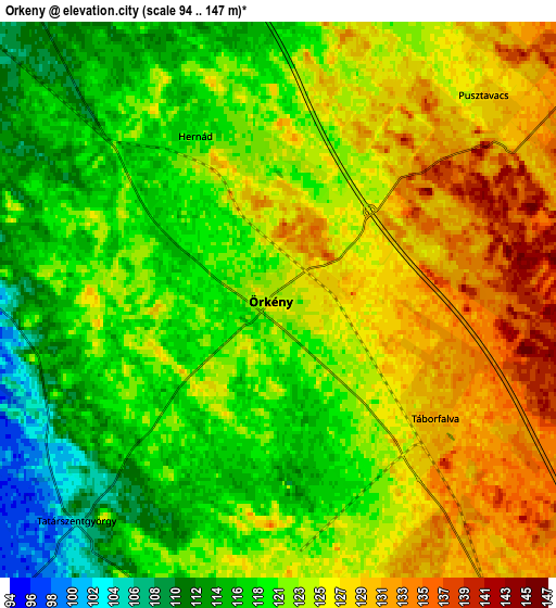
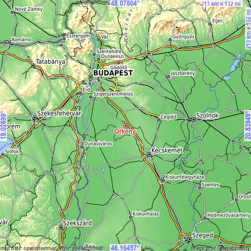
These maps also provides idea of topography and contour of this city, they are displayed at different zoom levels. More info about maps, scale and edge coordinates you can find below images.
| \ | Map #1 | Map #2 | Topo.Map |
| Scale [m] | 113..140 m | 94..147 m | × |
| Scale [ft] | 371..459 ft | 308..482 ft | × |
| Average | 122.8 m = 403 ft | 122.3 m = 401 ft | × |
| Width | 6.65 km = 4.1 mi | 13.3 km = 8.3 mi | 212.8 km = 132.2 mi |
| Height | 6.65 km = 4.1 mi | 13.3 km = 8.3 mi | 212.7 km = 132.2 mi |
| ↑Max Latitude | 47.159799° | 47.189672° | 48.07804° |
| Latitude at center | 47.12991° | 47.12991° | 47.12991° |
| ↓Min Latitude | 47.100004° | 47.070081° | 46.16457° |
| ← Min Longitude | 19.389295° | 19.345349° | 18.02699° |
| Longitude center | 19.43324° | 19.43324° | 19.43324° |
| →Max Longitude | 19.477185° | 19.521131° | 20.83949° |
Nearby cities:
Cities around Örkény sort by population:
• Dabas elevation 99 m
11.2 km,  303°
303°
• Albertirsa 125 m
18.7 km,  47°
47°
• Pilis 139 m
19.7 km,  26°
26°
• Lajosmizse 132 m
15.5 km,  141°
141°
• Csemő 130 m
19.5 km,  93°
93°
• Inárcs 114 m
16.7 km,  331°
331°
• Nyáregyháza 137 m
15.5 km,  19°
19°
• Hernád 123 m
3.6 km,  359°
359°
• Táborfalva 129 m
4.8 km,  134°
134°
• Újhartyán 113 m
10.6 km,  340°
340°
• Dánszentmiklós 136 m
12.8 km,  42°
42°
• Kakucs 114 m
13.5 km, 337°
Multilingual:
 En español:
Örkény elevación 123 m.
 En France:
Örkény élévation 123 m.


Sources and notes:
- [note 1] Map square and city borders are not equal. Map elevation data is calculated only from area inside that square.
- [src 1] Elevation data from geonames database provided with same terms of usage.
- [src 2] The elevation map of Örkény is generated using elevation data from NASA's 3 arcsec (90m) resolution SRTM data.
- [src 3] Base (background) map © OpenStreetMap contributors tiles are generated by Geofabrik and OpenTopoMap.
Copyright & License:
This Örkény Elevation Map is licensed under CC BY-SA. You may reuse any part from this page, if you give a proper credit by linking to this URL:
 More info on terms of use page.