Albertirsa elevation
Albertirsa (Pest), Hungary elevation is 125 meters and Albertirsa elevation in feet is 410 ft above sea level [src 1]. Albertirsa is a populated place (feature code) with elevation that is 4 meters (13 ft) smaller than average city elevation in Hungary.
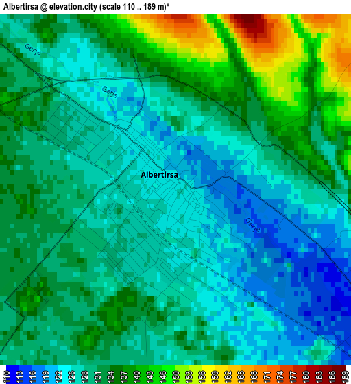
Below is the Elevation map of Albertirsa, which displays elevation range with different colors. Scale of the first map is from 110 to 189 m (361 to 620 ft) with average elevation of 131.2 meters (=430 ft) [note 1]
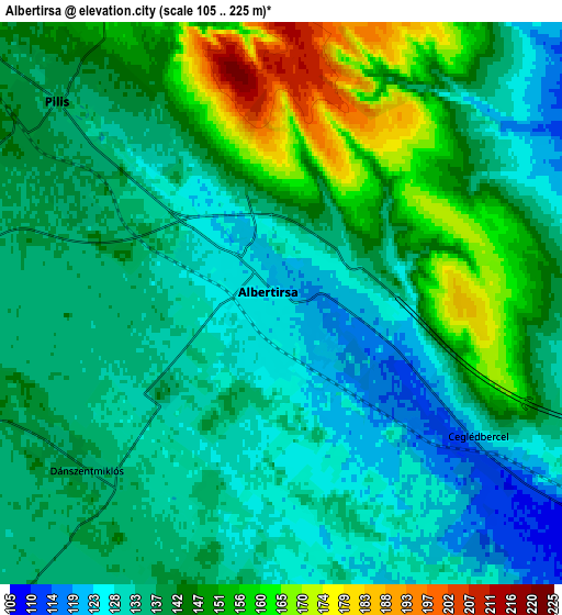
These maps also provides idea of topography and contour of this city, they are displayed at different zoom levels. More info about maps, scale and edge coordinates you can find below images.
| \ | Map #1 | Map #2 | Topo.Map |
| Scale [m] | 110..189 m | 105..225 m | × |
| Scale [ft] | 361..620 ft | 344..738 ft | × |
| Average | 131.2 m = 430 ft | 139.8 m = 459 ft | × |
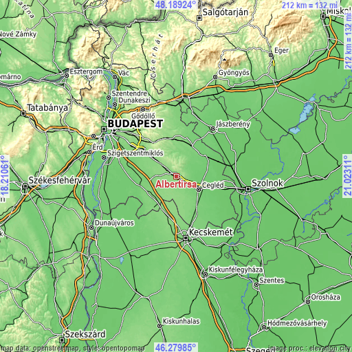
| Width | 6.63 km = 4.1 mi | 13.27 km = 8.2 mi | 212.3 km = 131.9 mi |
| Height | 6.63 km = 4.1 mi | 13.27 km = 8.2 mi | 212.3 km = 131.9 mi |
| ↑Max Latitude | 47.272976° | 47.302784° | 48.18924° |
| Latitude at center | 47.24315° | 47.24315° | 47.24315° |
| ↓Min Latitude | 47.213308° | 47.183448° | 46.27985° |
| ← Min Longitude | 19.572915° | 19.528969° | 18.21061° |
| Longitude center | 19.61686° | 19.61686° | 19.61686° |
| →Max Longitude | 19.660805° | 19.704751° | 21.02311° |
Nearby cities:
Cities around Albertirsa sort by population:
• Cegléd elevation 106 m
15.9 km,  119°
119°
• Pilis 139 m
7.3 km,  314°
314°
• Tápiószentmárton 108 m
14.5 km,  42°
42°
• Ceglédbercel 124 m
4.4 km, 119°
• Csemő 130 m
15 km,  158°
158°
• Nyáregyháza 137 m
9 km,  283°
283°
• Hernád 123 m
16.5 km,  237°
237°
• Tápióbicske 113 m
14.1 km,  21°
21°
• Gomba 156 m
15.6 km,  335°
335°
• Újhartyán 113 m
17.6 km,  261°
261°
• Dánszentmiklós 136 m
6.1 km, 239°
• Pánd 134 m
12.3 km,  6°
6°
Multilingual:
 En español:
Albertirsa elevación 125 m.
 En France:
Albertirsa élévation 125 m.
 Auf Deutsch:
Albertirsa höhe über dem Meeresspiegel ist 125 m.

Sources and notes:
- [note 1] Map square and city borders are not equal. Map elevation data is calculated only from area inside that square.
- [src 1] Elevation data from geonames database provided with same terms of usage.
- [src 2] The elevation map of Albertirsa is generated using elevation data from NASA's 3 arcsec (90m) resolution SRTM data.
- [src 3] Base (background) map © OpenStreetMap contributors tiles are generated by Geofabrik and OpenTopoMap.
Copyright & License:
This Albertirsa Elevation Map is licensed under CC BY-SA. You may reuse any part from this page, if you give a proper credit by linking to this URL:
 More info on terms of use page.