Sükösd elevation
Sükösd (Bács-Kiskun), Hungary elevation is 105 meters and Sükösd elevation in feet is 344 ft above sea level [src 1]. Sükösd is a populated place (feature code) with elevation that is 24 meters (79 ft) smaller than average city elevation in Hungary.
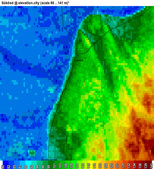
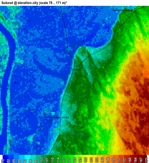
Below is the Elevation map of Sükösd, which displays elevation range with different colors. Scale of the first map is from 80 to 141 m (262 to 463 ft) with average elevation of 99.2 meters (=325 ft) [note 1]
These maps also provides idea of topography and contour of this city, they are displayed at different zoom levels. More info about maps, scale and edge coordinates you can find below images.
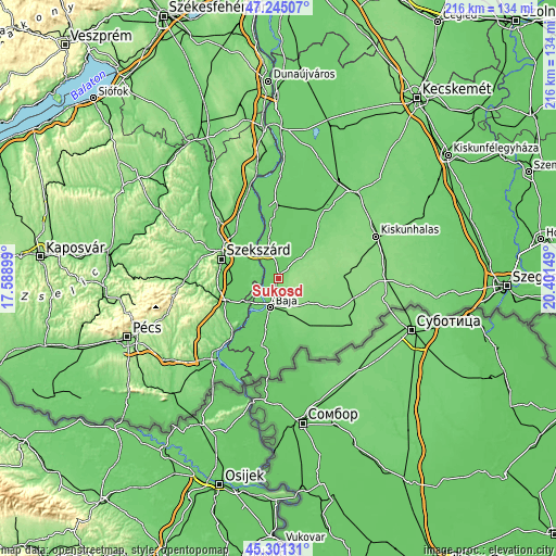
| \ | Map #1 | Map #2 | Topo.Map |
| Scale [m] | 80..141 m | 78..171 m | × |
| Scale [ft] | 262..463 ft | 256..561 ft | × |
| Average | 99.2 m = 325 ft | 104.7 m = 344 ft | × |
| Width | 6.75 km = 4.2 mi | 13.51 km = 8.4 mi | 216.1 km = 134.3 mi |
| Height | 6.75 km = 4.2 mi | 13.51 km = 8.4 mi | 216.1 km = 134.3 mi |
| ↑Max Latitude | 46.312173° | 46.342519° | 47.24507° |
| Latitude at center | 46.28181° | 46.28181° | 46.28181° |
| ↓Min Latitude | 46.25143° | 46.221034° | 45.30131° |
| ← Min Longitude | 18.951295° | 18.907349° | 17.58899° |
| Longitude center | 18.99524° | 18.99524° | 18.99524° |
| →Max Longitude | 19.039185° | 19.083131° | 20.40149° |
Nearby cities:
Cities around Sükösd sort by population:
• Baja elevation 99 m
11.5 km,  196°
196°
• Decs 88 m
18.1 km,  270°
270°
• Vaskút 101 m
19.4 km,  182°
182°
• Hajós 89 m
16.2 km,  36°
36°
• Dusnok 91 m
12.4 km,  348°
348°
• Érsekcsanád 96 m
3.3 km,  194°
194°
• Császártöltés 109 m
21.3 km, 42°
• Őcsény 90 m
18.6 km,  280°
280°
• Bogyiszló 89 m
17.2 km,  312°
312°
• Csávoly 130 m
15.5 km,  131°
131°
• Nemesnádudvar 91 m
7.8 km,  33°
33°
• Felsőszentiván 127 m
17.5 km,  122°
122°
Multilingual:
 En español:
Sükösd elevación 105 m.
 En France:
Sükösd élévation 105 m.


Sources and notes:
- [note 1] Map square and city borders are not equal. Map elevation data is calculated only from area inside that square.
- [src 1] Elevation data from geonames database provided with same terms of usage.
- [src 2] The elevation map of Sükösd is generated using elevation data from NASA's 3 arcsec (90m) resolution SRTM data.
- [src 3] Base (background) map © OpenStreetMap contributors tiles are generated by Geofabrik and OpenTopoMap.
Copyright & License:
This Sükösd Elevation Map is licensed under CC BY-SA. You may reuse any part from this page, if you give a proper credit by linking to this URL:
 More info on terms of use page.