Székesfehérvár elevation
Székesfehérvár (Fejér), Hungary elevation is 117 meters and Székesfehérvár elevation in feet is 384 ft above sea level [src 1]. Székesfehérvár is a seat of a first-order administrative division (feature code) with elevation that is 12 meters (39 ft) smaller than average city elevation in Hungary.
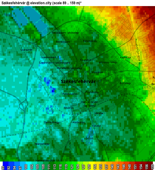
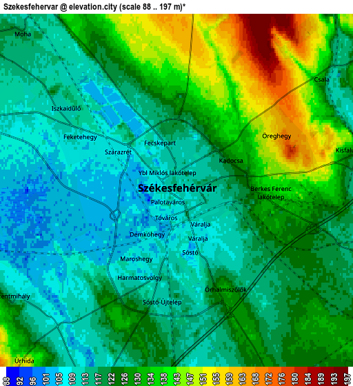
Below is the Elevation map of Székesfehérvár, which displays elevation range with different colors. Scale of the first map is from 89 to 159 m (292 to 522 ft) with average elevation of 113.1 meters (=371 ft) [note 1]
These maps also provides idea of topography and contour of this city, they are displayed at different zoom levels. More info about maps, scale and edge coordinates you can find below images.
| \ | Map #1 | Map #2 | Topo.Map |
| Scale [m] | 89..159 m | 88..197 m | × |
| Scale [ft] | 292..522 ft | 289..646 ft | × |
| Average | 113.1 m = 371 ft | 123 m = 404 ft | × |
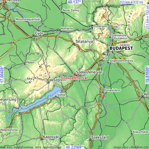
| Width | 6.64 km = 4.1 mi | 13.28 km = 8.3 mi | 212.5 km = 132 mi |
| Height | 6.64 km = 4.1 mi | 13.28 km = 8.3 mi | 212.5 km = 132 mi |
| ↑Max Latitude | 47.219806° | 47.249644° | 48.137° |
| Latitude at center | 47.18995° | 47.18995° | 47.18995° |
| ↓Min Latitude | 47.160078° | 47.130189° | 46.22569° |
| ← Min Longitude | 18.366395° | 18.322449° | 17.00409° |
| Longitude center | 18.41034° | 18.41034° | 18.41034° |
| →Max Longitude | 18.454285° | 18.498231° | 19.81659° |
Nearby cities:
Cities around Székesfehérvár sort by population:
• Gárdony elevation 110 m
17.2 km,  82°
82°
• Polgárdi 151 m
16.5 km,  209°
209°
• Velence 110 m
19.2 km,  73°
73°
• Seregélyes 121 m
14.7 km,  127°
127°
• Szabadbattyán 110 m
8.5 km,  201°
201°
• Sárszentmihály 108 m
6.8 km,  232°
232°
• Pákozd 115 m
9.6 km, 74°
• Lovasberény 157 m
17.1 km,  38°
38°
• Zámoly 146 m
14.1 km,  359°
359°
• Ősi 110 m
17.4 km,  254°
254°
• Fehérvárcsurgó 133 m
15.9 km,  316°
316°
• Kincsesbánya 139 m
13 km,  309°
309°
Multilingual:
 En español:
Székesfehérvár elevación 117 m.
 En France:
Székesfehérvár élévation 117 m.
 Auf Deutsch:
Székesfehérvár, Stuhlweißenburg höhe über dem Meeresspiegel ist 117 m.

Sources and notes:
- [note 1] Map square and city borders are not equal. Map elevation data is calculated only from area inside that square.
- [src 1] Elevation data from geonames database provided with same terms of usage.
- [src 2] The elevation map of Székesfehérvár is generated using elevation data from NASA's 3 arcsec (90m) resolution SRTM data.
- [src 3] Base (background) map © OpenStreetMap contributors tiles are generated by Geofabrik and OpenTopoMap.
Copyright & License:
This Székesfehérvár Elevation Map is licensed under CC BY-SA. You may reuse any part from this page, if you give a proper credit by linking to this URL:
 More info on terms of use page.