Veszprém elevation
Veszprém, Hungary elevation is 265 meters and Veszprém elevation in feet is 869 ft above sea level [src 1]. Veszprém is a seat of a first-order administrative division (feature code) with elevation that is 136 meters (446 ft) bigger than average city elevation in Hungary.
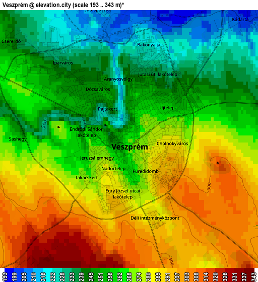
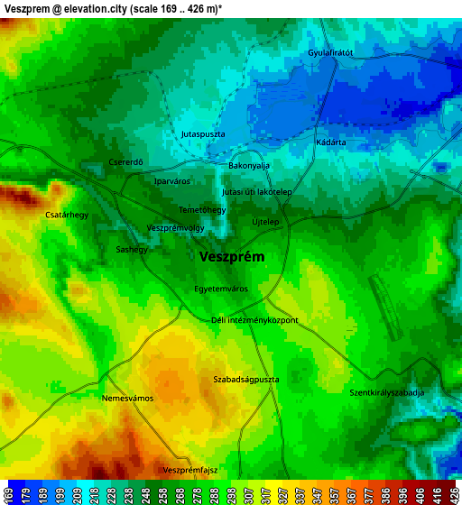
Below is the Elevation map of Veszprém, which displays elevation range with different colors. Scale of the first map is from 193 to 343 m (633 to 1125 ft) with average elevation of 266.9 meters (=876 ft) [note 1]
These maps also provides idea of topography and contour of this city, they are displayed at different zoom levels. More info about maps, scale and edge coordinates you can find below images.
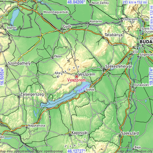
| \ | Map #1 | Map #2 | Topo.Map |
| Scale [m] | 193..343 m | 169..426 m | × |
| Scale [ft] | 633..1125 ft | 554..1398 ft | × |
| Average | 266.9 m = 876 ft | 269 m = 883 ft | × |
| Width | 6.65 km = 4.1 mi | 13.31 km = 8.3 mi | 212.9 km = 132.3 mi |
| Height | 6.65 km = 4.1 mi | 13.31 km = 8.3 mi | 212.9 km = 132.3 mi |
| ↑Max Latitude | 47.12318° | 47.153073° | 48.04206° |
| Latitude at center | 47.09327° | 47.09327° | 47.09327° |
| ↓Min Latitude | 47.063343° | 47.0334° | 46.12727° |
| ← Min Longitude | 17.867545° | 17.823599° | 16.50524° |
| Longitude center | 17.91149° | 17.91149° | 17.91149° |
| →Max Longitude | 17.955435° | 17.999381° | 19.31774° |
Nearby cities:
Cities around Veszprém sort by population:
• Balatonfüred elevation 152 m
14.9 km,  191°
191°
• Balatonalmádi 109 m
10.5 km,  127°
127°
• Zirc 395 m
19.2 km,  351°
351°
• Berhida 130 m
16.6 km,  83°
83°
• Pétfürdő 138 m
17.5 km,  62°
62°
• Herend 316 m
13 km,  290°
290°
• Balatonkenese 127 m
15.9 km,  111°
111°
• Hajmáskér 167 m
10 km,  54°
54°
• Nemesvámos 320 m
5.1 km,  213°
213°
• Szentkirályszabadja 265 m
6 km, 131°
• Litér 209 m
7.1 km, 83°
• Csopak 135 m
12.9 km,  177°
177°
Multilingual:
 En español:
Veszprém elevación 265 m.
 En France:
Veszprém élévation 265 m.


Sources and notes:
- [note 1] Map square and city borders are not equal. Map elevation data is calculated only from area inside that square.
- [src 1] Elevation data from geonames database provided with same terms of usage.
- [src 2] The elevation map of Veszprém is generated using elevation data from NASA's 3 arcsec (90m) resolution SRTM data.
- [src 3] Base (background) map © OpenStreetMap contributors tiles are generated by Geofabrik and OpenTopoMap.
Copyright & License:
This Veszprém Elevation Map is licensed under CC BY-SA. You may reuse any part from this page, if you give a proper credit by linking to this URL:
 More info on terms of use page.