Beli Manastir elevation
Beli Manastir (Osječko-Baranjska, Grad Beli Manastir), Croatia elevation is 94 meters and Beli Manastir elevation in feet is 308 ft above sea level [src 1]. Beli Manastir is a seat of a second-order administrative division (feature code) with elevation that is 60 meters (197 ft) smaller than average city elevation in Croatia.
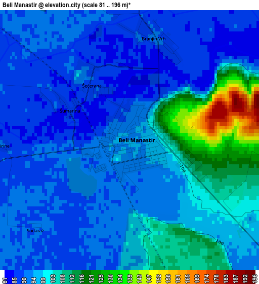
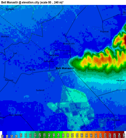
Below is the Elevation map of Beli Manastir, which displays elevation range with different colors. Scale of the first map is from 81 to 196 m (266 to 643 ft) with average elevation of 97.3 meters (=319 ft) [note 1]
These maps also provides idea of topography and contour of this city, they are displayed at different zoom levels. More info about maps, scale and edge coordinates you can find below images.
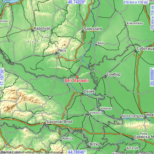
| \ | Map #1 | Map #2 | Topo.Map |
| Scale [m] | 81..196 m | 80..240 m | × |
| Scale [ft] | 266..643 ft | 262..787 ft | × |
| Average | 97.3 m = 319 ft | 96.8 m = 318 ft | × |
| Width | 6.82 km = 4.2 mi | 13.63 km = 8.5 mi | 218.1 km = 135.5 mi |
| Height | 6.82 km = 4.2 mi | 13.63 km = 8.5 mi | 218.1 km = 135.5 mi |
| ↑Max Latitude | 45.800645° | 45.831274° | 46.74229° |
| Latitude at center | 45.77° | 45.77° | 45.77° |
| ↓Min Latitude | 45.739338° | 45.708659° | 44.78046° |
| ← Min Longitude | 18.559665° | 18.515719° | 17.19736° |
| Longitude center | 18.60361° | 18.60361° | 18.60361° |
| →Max Longitude | 18.647555° | 18.691501° | 20.00986° |
Nearby cities:
Cities around Beli Manastir sort by population:
• Valpovo elevation 88 m
18.8 km,  229°
229°
• Belišće 89 m
18.3 km,  236°
236°
• Darda 86 m
17.5 km,  154°
154°
• Petrijevci 89 m
18.3 km,  196°
196°
• Bistrinci 93 m
18.1 km, 241°
• Jagodnjak 88 m
8.1 km,  194°
194°
• Čeminac 88 m
10.5 km, 151°
• Karanac 112 m
6.4 km,  99°
99°
• Petlovac 91 m
6 km,  257°
257°
• Kneževi Vinogradi 91 m
10.3 km, 102°
• Draž 85 m
16.4 km,  60°
60°
• Popovac 90 m
6.1 km,  44°
44°
Multilingual:
 En español:
Beli Manastir elevación 94 m.
 En France:
Beli Manastir élévation 94 m.
 Auf Deutsch:
Beli Manastir höhe über dem Meeresspiegel ist 94 m.

Sources and notes:
- [note 1] Map square and city borders are not equal. Map elevation data is calculated only from area inside that square.
- [src 1] Elevation data from geonames database provided with same terms of usage.
- [src 2] The elevation map of Beli Manastir is generated using elevation data from NASA's 3 arcsec (90m) resolution SRTM data.
- [src 3] Base (background) map © OpenStreetMap contributors tiles are generated by Geofabrik and OpenTopoMap.
Copyright & License:
This Beli Manastir Elevation Map is licensed under CC BY-SA. You may reuse any part from this page, if you give a proper credit by linking to this URL:
 More info on terms of use page.