Belišće elevation
Belišće (Osječko-Baranjska), Croatia elevation is 89 meters and Belišće elevation in feet is 292 ft above sea level [src 1]. Belišće is a seat of a second-order administrative division (feature code) with elevation that is 65 meters (213 ft) smaller than average city elevation in Croatia.
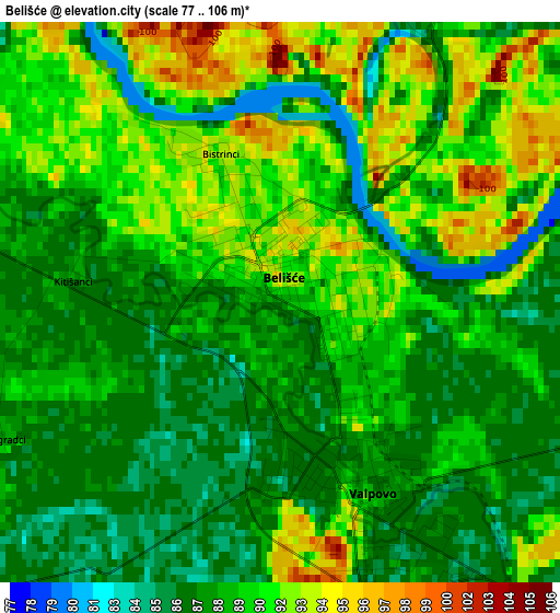
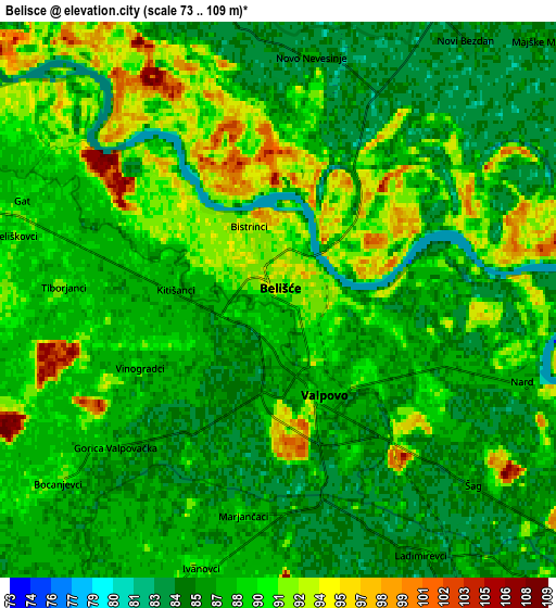
Below is the Elevation map of Belišće, which displays elevation range with different colors. Scale of the first map is from 77 to 106 m (253 to 348 ft) with average elevation of 89.2 meters (=293 ft) [note 1]
These maps also provides idea of topography and contour of this city, they are displayed at different zoom levels. More info about maps, scale and edge coordinates you can find below images.
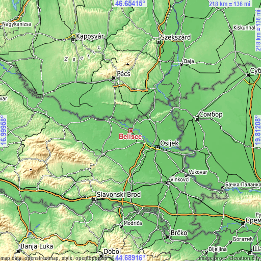
| \ | Map #1 | Map #2 | Topo.Map |
| Scale [m] | 77..106 m | 73..109 m | × |
| Scale [ft] | 253..348 ft | 240..358 ft | × |
| Average | 89.2 m = 293 ft | 88.3 m = 290 ft | × |
| Width | 6.83 km = 4.2 mi | 13.66 km = 8.5 mi | 218.5 km = 135.8 mi |
| Height | 6.83 km = 4.2 mi | 13.66 km = 8.5 mi | 218.5 km = 135.8 mi |
| ↑Max Latitude | 45.710974° | 45.741652° | 46.65415° |
| Latitude at center | 45.68028° | 45.68028° | 45.68028° |
| ↓Min Latitude | 45.649569° | 45.618841° | 44.68916° |
| ← Min Longitude | 18.361885° | 18.317939° | 16.99958° |
| Longitude center | 18.40583° | 18.40583° | 18.40583° |
| →Max Longitude | 18.449775° | 18.493721° | 19.81208° |
Nearby cities:
Cities around Belišće sort by population:
• Beli Manastir elevation 94 m
18.3 km,  56°
56°
• Valpovo 88 m
2.4 km,  155°
155°
• Josipovac 87 m
17.4 km,  128°
128°
• Petrijevci 89 m
12.6 km, 126°
• Bizovac 88 m
10.6 km, 157°
• Koška 95 m
17.7 km,  211°
211°
• Bistrinci 93 m
1.4 km,  336°
336°
• Ladimirevci 86 m
6.9 km,  151°
151°
• Jagodnjak 88 m
13.5 km,  81°
81°
• Čeminac 88 m
20.3 km,  88°
88°
• Marjanci 95 m
9 km,  260°
260°
• Petlovac 91 m
12.9 km,  47°
47°
Multilingual:
 En español:
Belišće elevación 89 m.
 En France:
Belišće élévation 89 m.


Sources and notes:
- [note 1] Map square and city borders are not equal. Map elevation data is calculated only from area inside that square.
- [src 1] Elevation data from geonames database provided with same terms of usage.
- [src 2] The elevation map of Belišće is generated using elevation data from NASA's 3 arcsec (90m) resolution SRTM data.
- [src 3] Base (background) map © OpenStreetMap contributors tiles are generated by Geofabrik and OpenTopoMap.
Copyright & License:
This Belišće Elevation Map is licensed under CC BY-SA. You may reuse any part from this page, if you give a proper credit by linking to this URL:
 More info on terms of use page.