Arizona elevation
Arizona (Atlántida), Honduras elevation is 72 meters and Arizona elevation in feet is 236 ft above sea level [src 1]. Arizona is a populated place (feature code) with elevation that is 471 meters (1545 ft) smaller than average city elevation in Honduras.
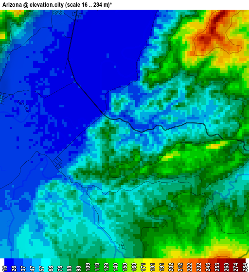
Below is the Elevation map of Arizona, which displays elevation range with different colors. Scale of the first map is from 16 to 284 m (52 to 932 ft) with average elevation of 74.6 meters (=245 ft) [note 1]
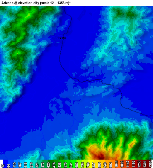
These maps also provides idea of topography and contour of this city, they are displayed at different zoom levels. More info about maps, scale and edge coordinates you can find below images.
| \ | Map #1 | Map #2 | Topo.Map |
| Scale [m] | 16..284 m | 12..1353 m | × |
| Scale [ft] | 52..932 ft | 39..4439 ft | × |
| Average | 74.6 m = 245 ft | 181.5 m = 595 ft | × |
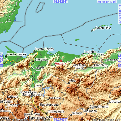
| Width | 9.41 km = 5.8 mi | 18.82 km = 11.7 mi | 301.1 km = 187.1 mi |
| Height | 9.41 km = 5.8 mi | 18.82 km = 11.7 mi | 301.1 km = 187.1 mi |
| ↑Max Latitude | 15.675645° | 15.717952° | 16.98296° |
| Latitude at center | 15.63333° | 15.63333° | 15.63333° |
| ↓Min Latitude | 15.591006° | 15.548673° | 14.27474° |
| ← Min Longitude | -87.360615° | -87.404561° | -88.72292° |
| Longitude center | -87.31667° | -87.31667° | -87.31667° |
| →Max Longitude | -87.272725° | -87.228779° | -85.91042° |
Nearby cities:
Cities around Arizona sort by population:
• Tela elevation 9 m
22.5 km,  314°
314°
• Mezapa 154 m
36.1 km,  261°
261°
• San Juan Pueblo 171 m
10.5 km,  121°
121°
• La Masica 28 m
21.5 km,  94°
94°
• Santa Ana 25 m
26.8 km, 86°
• San Francisco 27 m
28.6 km, 86°
• Toyós 61 m
36.9 km, 255°
• La Unión 3 m
35.1 km,  74°
74°
• El Triunfo de la Cruz 144 m
19.4 km,  319°
319°
• Atenas de San Cristóbal 21 m
5.6 km,  0°
0°
• Tornabé 6 m
28.1 km,  297°
297°
• San Antonio 98 m
18.2 km,  101°
101°
Multilingual:
 En español:
Arizona elevación 72 m.
 En France:
Arizona élévation 72 m.


Sources and notes:
- [note 1] Map square and city borders are not equal. Map elevation data is calculated only from area inside that square.
- [src 1] Elevation data from geonames database provided with same terms of usage.
- [src 2] The elevation map of Arizona is generated using elevation data from NASA's 3 arcsec (90m) resolution SRTM data.
- [src 3] Base (background) map © OpenStreetMap contributors tiles are generated by Geofabrik and OpenTopoMap.
Copyright & License:
This Arizona Elevation Map is licensed under CC BY-SA. You may reuse any part from this page, if you give a proper credit by linking to this URL:
 More info on terms of use page.