Tornabé elevation
Tornabé (Atlántida), Honduras elevation is 6 meters and Tornabé elevation in feet is 20 ft above sea level [src 1]. Tornabé is a populated place (feature code) with elevation that is 537 meters (1762 ft) smaller than average city elevation in Honduras.
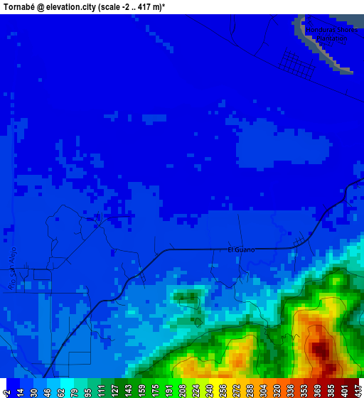
Below is the Elevation map of Tornabé, which displays elevation range with different colors. Scale of the first map is from -2 to 417 m (-7 to 1368 ft) with average elevation of 39.5 meters (=130 ft) [note 1]
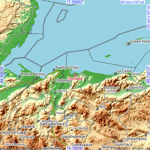
These maps also provides idea of topography and contour of this city, they are displayed at different zoom levels. More info about maps, scale and edge coordinates you can find below images.
| \ | Map #1 | Topo.Map |
| Scale [m] | -2..417 m | × |
| Scale [ft] | -7..1368 ft | × |
| Average | 39.5 m = 130 ft | × |
| Width | 9.41 km = 5.8 mi | 301 km = 187 mi |
| Height | 9.41 km = 5.8 mi | 301 km = 187 mi |
| ↑Max Latitude | 15.792291° | 17.09883° |
| Latitude at center | 15.75° | 15.75° |
| ↓Min Latitude | 15.7077° | 14.39216° |
| ← Min Longitude | -87.593945° | -88.95625° |
| Longitude center | -87.55° | -87.55° |
| →Max Longitude | -87.506055° | -86.14375° |
Nearby cities:
Cities around Tornabé sort by population:
• Tela elevation 9 m
9.3 km,  73°
73°
• Baracoa 9 m
32.2 km,  273°
273°
• Mezapa 154 m
21.4 km,  210°
210°
• Arizona 72 m
28.1 km,  117°
117°
• Toyós 61 m
24.7 km, 205°
• Río Blanquito 77 m
37.5 km, 267°
• Guaimitas 47 m
33 km, 212°
• El Triunfo de la Cruz 144 m
12.6 km,  81°
81°
• Atenas de San Cristóbal 21 m
26.1 km,  106°
106°
• Ocote Paulino 683 m
37.4 km,  188°
188°
• Puerto Alto 11 m
34.3 km,  260°
260°
• Baja Mar 3 m
36.1 km,  295°
295°
Multilingual:
 En español:
Tornabé elevación 6 m.
 En France:
Tornabé élévation 6 m.


Sources and notes:
- [note 1] Map square and city borders are not equal. Map elevation data is calculated only from area inside that square.
- [src 1] Elevation data from geonames database provided with same terms of usage.
- [src 2] The elevation map of Tornabé is generated using elevation data from NASA's 3 arcsec (90m) resolution SRTM data.
- [src 3] Base (background) map © OpenStreetMap contributors tiles are generated by Geofabrik and OpenTopoMap.
Copyright & License:
This Tornabé Elevation Map is licensed under CC BY-SA. You may reuse any part from this page, if you give a proper credit by linking to this URL:
 More info on terms of use page.