El Triunfo elevation
El Triunfo (Choluteca), Honduras elevation is 89 meters and El Triunfo elevation in feet is 292 ft above sea level [src 1]. El Triunfo is a populated place (feature code) with elevation that is 454 meters (1490 ft) smaller than average city elevation in Honduras.
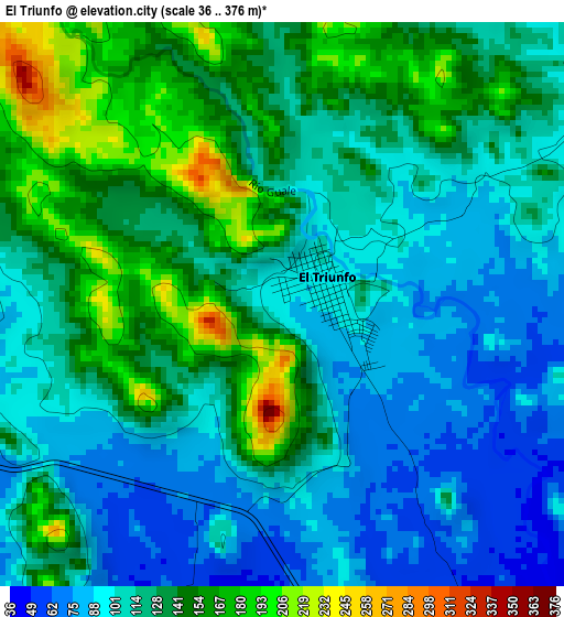
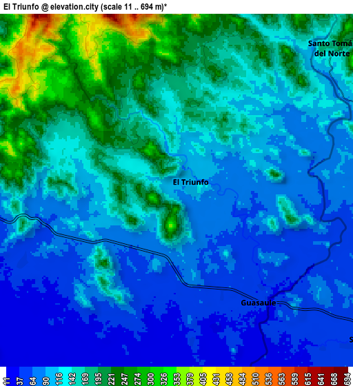
Below is the Elevation map of El Triunfo, which displays elevation range with different colors. Scale of the first map is from 36 to 376 m (118 to 1234 ft) with average elevation of 122.1 meters (=401 ft) [note 1]
These maps also provides idea of topography and contour of this city, they are displayed at different zoom levels. More info about maps, scale and edge coordinates you can find below images.
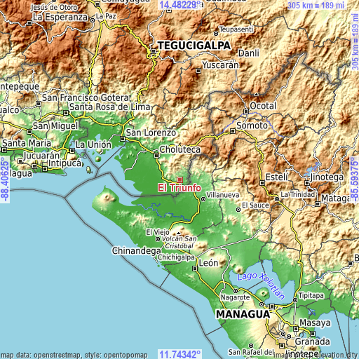
| \ | Map #1 | Map #2 | Topo.Map |
| Scale [m] | 36..376 m | 11..694 m | × |
| Scale [ft] | 118..1234 ft | 36..2277 ft | × |
| Average | 122.1 m = 401 ft | 131.9 m = 433 ft | × |
| Width | 9.52 km = 5.9 mi | 19.04 km = 11.8 mi | 304.5 km = 189.2 mi |
| Height | 9.52 km = 5.9 mi | 19.04 km = 11.8 mi | 304.6 km = 189.3 mi |
| ↑Max Latitude | 13.159465° | 13.202253° | 14.48229° |
| Latitude at center | 13.11667° | 13.11667° | 13.11667° |
| ↓Min Latitude | 13.073868° | 13.031058° | 11.74342° |
| ← Min Longitude | -87.043945° | -87.087891° | -88.40625° |
| Longitude center | -87° | -87° | -87° |
| →Max Longitude | -86.956055° | -86.912109° | -85.59375° |
Nearby cities:
Cities around El Triunfo sort by population:
• Ciudad Choluteca elevation 53 m
29 km,  314°
314°
• San Marcos de Colón 997 m
41.3 km,  31°
31°
• Monjarás 14 m
41.6 km,  282°
282°
• San Jerónimo 39 m
16.2 km,  294°
294°
• Marcovia 23 m
38.6 km,  299°
299°
• Santa Ana de Yusguare 69 m
23.9 km,  328°
328°
• Namasigüe 54 m
17.9 km, 303°
• El Puente 243 m
22.4 km, 325°
• Corpus 378 m
19.5 km,  348°
348°
• Santa Cruz 21 m
40.9 km, 292°
• El Obraje 51 m
14.8 km, 286°
• Los Llanitos 25 m
40.9 km, 297°
Multilingual:
 En español:
El Triunfo elevación 89 m.
 En France:
El Triunfo élévation 89 m.
 Auf Deutsch:
El Triunfo höhe über dem Meeresspiegel ist 89 m.

Sources and notes:
- [note 1] Map square and city borders are not equal. Map elevation data is calculated only from area inside that square.
- [src 1] Elevation data from geonames database provided with same terms of usage.
- [src 2] The elevation map of El Triunfo is generated using elevation data from NASA's 3 arcsec (90m) resolution SRTM data.
- [src 3] Base (background) map © OpenStreetMap contributors tiles are generated by Geofabrik and OpenTopoMap.
Copyright & License:
This El Triunfo Elevation Map is licensed under CC BY-SA. You may reuse any part from this page, if you give a proper credit by linking to this URL:
 More info on terms of use page.